
West Dean in Wiltshire, England, United Kingdom — Northwestern Europe (the British Isles)
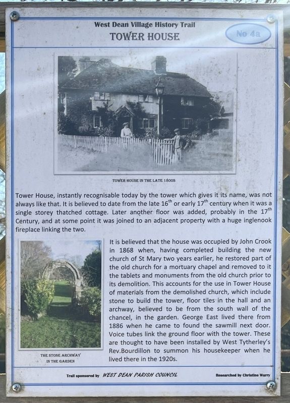
Tower House
| — | West Dean Village History Trail | — |
Photographed by Ray Gurganus, April 1, 2025
1. Tower House Marker
It is believed that the house was occupied by John Crook in 1868 when, having completed building the new church of St Mary two years earlier, he restored part of the old church for a mortuary chapel and removed to it the tablets and monuments from the old church prior to its demolition. This accounts for the use in Tower House of materials from the demolished church, which include stone to build the tower, floor tiles in the hall and an archway, believed to be from the south wall of the chancel, in the garden. George East lived there from 1886 when he came to found the sawmill next door. Voice tubes link the ground floor with the tower. These are thought to have been installed by West Tytherley's Rev. Bourdillon to summon his housekeeper when
this page online
Erected by West Dean Parish Council. (Marker Number 4a.)
Topics. This historical marker is listed in this topic list: Architecture. A significant historical year for this entry is 1868.
Location. 51° 2.553′ N, 1° 38.113′ W. Marker is in West Dean, England, in Wiltshire. It is on Rectory Hill, on the left when traveling north. Touch for map. Marker is at or near this postal address: Rectory Hill, West Dean, England SP5 1JQ, United Kingdom. Touch for directions.

Regionally, this marker is in South West England. Globally, it is on the Atlantic Ocean, in the North Atlantic Region, in Europe, in Atlantic Europe, on one of the British Isles, in the Western World, and in the Anglosphere. Historically, it finds itself in what was once the Roman Empire.
Other nearby markers. At least 8 other markers are within walking distance of this marker: West Dean Farm (here, next to this marker); The Village Shop (here, next to this marker); West Dean School (here, next to this marker); Dean House (here, next to this marker); The Post Office (here, next to this marker); The Wheelwright's and Blacksmith's Shop (here, next to this marker); Royal Naval Armaments Depot (here, next to this marker); Bridge Cottage (here, next to this marker). Touch for a list and map of all markers in West Dean.
Credits. This page was last revised on May 21, 2025. It was originally submitted on May 16, 2025, by Ray Gurganus of Washington, District of Columbia. This page has been viewed 77 times since then and 5 times this year. Photo 1. submitted on May 16, 2025, by Ray Gurganus of Washington, District of Columbia. • Andrew Ruppenstein was the editor who published this page.
Editor’s want-list for this marker. Photo of the marker within its surroundings • Can you help?
