Grafton in Washington County, Utah — The American Mountains (Southwest)
Grafton, Utah
Photographed by James Hulse, April 7, 2025
1. Grafton, Utah Marker
Inscription.
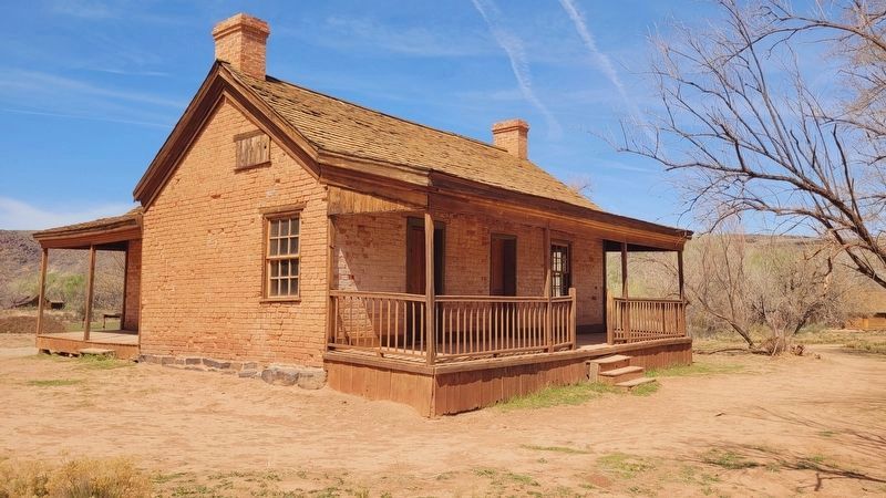
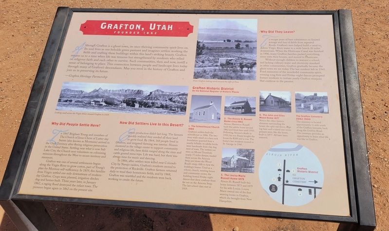
Grafton, Utah. . Although Grafton is a ghost town, its once-thriving community spirit lives on. Its soul lives as one beholds green pastures and imagines settlers working the fields and crafting these buildings within this land's striking beauty. Grafton returns us to a time when life was tenuous but strengthened by residents who relied on religious faith and each other to survive. Such communities, then and now, instill a sense of belonging to place. This connection between people and landscape lives today through many of Grafton's descendants. May you revel in the history of Grafton and join us in preserving its future. , -Grafton Heritage Partnership, Why Did People Settle Here? , In 1847 Brigham Young and members of The Church of Jesus Christ of Latter-day Saints (also known as Mormons) arrived in the Utah Territory after fleeing religious persecution in the United States. Settling near what is now Salt Lake City, the Church sent volunteers on colonizing missions throughout the West to secure territory and resources., Grafton was one of several settlements begun along the Virgin River to grow cotton, part of Young's plan for Mormon self-sufficiency. In 1859, five families from Virgin settled one mile downstream of modern-day Grafton. Crops were planted, irrigation ditches dug and homes built. Three years later, in January 1862, a raging flood destroyed the infant town. The pioneers began again in 1862 on the present site., How Did Settlers Live In this Desert? , Cotton production didn't last long. The farmers quickly realized they needed all their land to grow food. By 1864, 168 people lived in Grafton, and irrigated-farming was intense. Homes clustered in the village center to support community and religious life, farm fields ranged along the river a cattle grazed mesa tops. Life was hard, but there was always time for music and dancing., In 1866, after settlers were killed near Colorado City by Navajo raiders, Grafton's residents moved to the protection of Rockville. Grafton farmers return daily to tend their hometown fields, and by 1868, Grafton was resettled and the residents were back, working to create the future., Why Did They Leave? , To escape years of bare subsistence on limited acreage and loss of fields from repeated floods, Grafton's men helped build a canal to deliver Virgin River water to a wide bench 20 miles downstream. When the Hurricane Canal was finished in 1906, many Grafton families packed everything, some even their houses, and moved to Hurricane., Without enough children to warrant a school, and lacking culinary water and electricity standard in other communities, Grafton gradually became the ghost town we see today. The last resident left in 1945. Fond memories of the wonderful community spirit, evening song fests and Friday-night dances prompted former residents to initiate yearly Grafton reunions that continue to the present., Grafton Historic District , On the National Register of Historic Places , 1. The Schoolhouse/Church 1886 , Grafton's settlers built the schoolhouse in 1886. The two-story walls stand on a lava rock foundation quarried from a nearby hillside; its adobe bricks were handmade from clay dug west of town. The settlers cut trees on Mount Trumbull, nearly 75 miles distant, hauled them across the Arizona Strip and down the Wood Road's steep cliffs to hew the building's beams. Used as a school, church, meeting house and community center, the building hosted Friday night dances that drew cowboys from far out on the Arizona Strip. The last school class met in 1919., 2. The Alonzo H. Russell Home circa 1862 , Alonzo Haventon Russell built this adobe home around 1862 and lived here until 1910. Following Alonzo's death in 1910, his son Frank bought the house for $200 and a cow. The home's last residents moved to St. George in 1945., 3. The Louisa Marie Russell Home 1879 , Alonzo H. Russell built this home between 1873 and 1879 for his wife Louisa. Louisa Marie owned one of the first weaving looms in Grafton, which she brought from New Hampshire., 4. The John and Ellen Wood Home , Notice the other historic elements surrounding the house: the split-rail fence, large log barn and a raised one-room granary were, like the home, built in 1877. All have been restored., The Grafton Cemetery (1862-1924) , The cemetery is located approximately ½ mile south of the Grafton townsite, back along the Grafton Road. The cemetary provides an opportunity to learn what life was like in Grafton. , Captions , (Photo #1) Looking south across the Virgin River toward Grafton in 1929. , (Photo #2) From Grafton looking north toward the cliffs of Zion.
Although Grafton is a ghost town, its once-thriving community spirit lives on. Its soul lives as one beholds green pastures and imagines settlers working the fields and crafting these buildings within this land's striking beauty. Grafton returns us to a time when life was tenuous but strengthened by residents who relied on religious faith and each other to survive. Such communities, then and now, instill a sense of belonging to place. This connection between people and landscape lives today through many of Grafton's descendants. May you revel in the history of Grafton and join us in preserving its future.
-Grafton Heritage Partnership
Why Did People Settle Here?
In 1847 Brigham Young and members of The Church of Jesus Christ of Latter-day Saints (also known as Mormons) arrived in the Utah Territory after fleeing religious persecution in the United States. Settling near what is now Salt Lake City, the Church sent volunteers on colonizing missions throughout the West to secure territory and resources.
Grafton was one of several settlements begun along the Virgin River to grow cotton, part of Young's plan for Mormon
Click or scan to see this page online
self-sufficiency. In 1859, five families from Virgin settled one mile downstream of modern-day Grafton. Crops were planted, irrigation ditches dug and homes built. Three years later, in January 1862, a raging flood destroyed the infant town. The pioneers began again in 1862 on the present site.
How Did Settlers Live In this Desert?
Cotton production didn't last long. The farmers quickly realized they needed all their land to grow food. By 1864, 168 people lived in Grafton, and irrigated-farming was intense. Homes clustered in the village center to support community and religious life, farm fields ranged along the river a cattle grazed mesa tops. Life was hard, but there was always time for music and dancing.
In 1866, after settlers were killed near Colorado City by Navajo raiders, Grafton's residents moved to the protection of Rockville. Grafton farmers return daily to tend their hometown fields, and by 1868, Grafton was resettled and the residents were back, working to create the future.
Why Did They Leave?
To escape years of bare subsistence on limited acreage and loss of fields from repeated floods, Grafton's men helped
Photographed by James Hulse, April 7, 2025
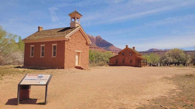
2. The view of the Schoolhouse and the Marker
build a canal to deliver Virgin River water to a wide bench 20 miles downstream. When the Hurricane Canal was finished in 1906, many Grafton families packed everything, some even their houses, and moved to Hurricane.
Without enough children to warrant a school,
and lacking culinary water and electricity standard
in other communities, Grafton gradually became the
ghost town we see today. The last resident left in 1945.
Fond memories of the wonderful community spirit,
evening song fests and Friday-night dances prompted
former residents to initiate yearly Grafton reunions
that continue to the present.
Grafton Historic District
On the National Register of Historic Places 1. The Schoolhouse/Church 1886
Grafton's settlers built the schoolhouse in 1886. The two-story walls stand on a lava rock foundation quarried from a nearby hillside; its adobe bricks were handmade from clay dug west of town. The settlers cut trees on Mount Trumbull, nearly 75 miles distant, hauled them across the Arizona Strip and down the Wood Road's steep cliffs to hew the building's beams. Used as a school, church, meeting house and community center,
Photographed by James Hulse, April 7, 2025
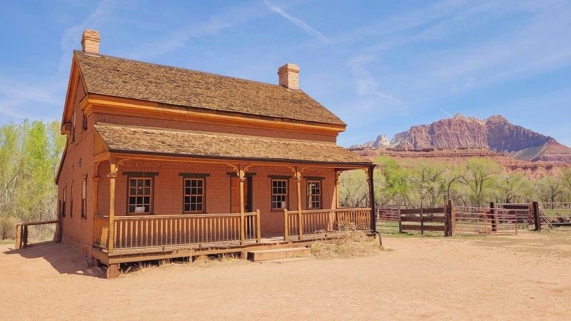
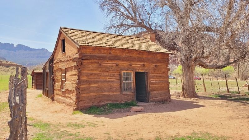
3. The Alonzo H. Russell Home circa 1862
the building hosted Friday night dances that drew cowboys from far out on the Arizona Strip. The last school class met in 1919.
2. The Alonzo H. Russell Home circa 1862
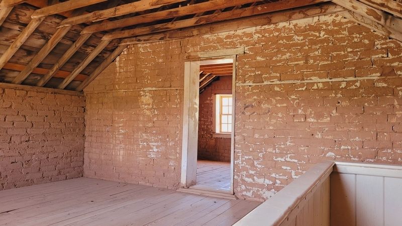
Alonzo Haventon Russell built this adobe home around 1862 and lived here until 1910. Following Alonzo's death in 1910, his son Frank bought the house for $200 and a cow. The home's last residents moved to St. George in 1945.
3. The Louisa Marie Russell Home 1879
Alonzo H. Russell built this home between 1873 and 1879 for his wife Louisa. Louisa Marie owned one of the first weaving looms in Grafton, which she brought from New Hampshire.
4. The John and Ellen Wood Home
Notice the other historic elements surrounding the house: the split-rail fence, large log barn and a raised one-room granary were, like the home, built in 1877. All have been restored.
The Grafton Cemetery (1862-1924)
The cemetery is located approximately ½ mile south of the Grafton townsite, back along the Grafton Road. The cemetary provides an opportunity to learn what life was like in Grafton.
Captions (Photo #1) Looking south across the Virgin River toward Grafton in 1929. (Photo #2) From Grafton looking north toward the cliffs of Zion.
Topics.
Photographed by James Hulse, April 7, 2025
4. The upstairs at the Alonzo H. Russell Home
This historical marker is listed in this topic list: Settlements & Settlers. A significant historical month for this entry is January 1862.
Location. 37° 10.037′ N, 113° 4.916′ W. Marker is in Grafton, Utah, in Washington County. It is on West Grafton Road (County Road W 230 S) 2 miles west of Smithsonian Butte Rd, on the right when traveling north. The marker is located at the entrance to the old ghost town. Touch for map. Marker is in this post office area: Springdale UT 84767, United States of America. Touch for directions.

Regionally, this marker is in Utah’s Color Country. It is also in the American Southwest, in the Mountain West, and in Colorado Plateau. Globally, it is in North America, the Rocky Mountains, the Western Hemisphere, the Western World, and the Anglosphere. Historically, it finds itself in what was once New Spain and also Mexicos Alta California.
Other nearby markers. At least 8 other markers are within 6 miles of this marker, measured as the crow flies: Grafton Cemetery (approx. 0.3 miles away); Rockville Bridge (approx. 2½ miles away); a different marker also named Rockville Bridge (approx. 2½ miles away);
Credits. This page was last revised on May 17, 2025. It was originally submitted on May 16, 2025, by James Hulse of Medina, Texas. This page has been viewed 163 times since then and 24 times this year. Photos:1, 2, 3, 4, 5, 6. submitted on May 17, 2025, by James Hulse of Medina, Texas.