Near La Verkin in Washington County, Utah — The American Mountains (Southwest)
CCC Corrals in Washington County

Photographed by James Hulse, April 7, 2025
1. CCC Corrals in Washington County Marker
Washington County was home for several of these CCC camps. One of their local projects was the construction of cedar-post-corrals to assist in the management of livestock, both cattle and sheep, which grazed the public lands. These corrals, built of closely spaced posts cut from juniper trees, were joined together with heavy wire twisted around the posts to make a solid fence. These cedar-post-corrals were called Unit Corrals.
At least five corrals were constructed in various locations in the County. They were used for handling and managing the livestock. There were three
this page online
This corral's design is unique in that it was built to accommodate both cattle and sheep. While all of the corrals were built with chutes for loading the livestock onto trucks, the SR-9 corral was built with two side-by-side crowding alleys. The first alley was built with tall posts for handling cattle, while the second adjoining alley was built with shorter posts to accommodate sheep. The shorter fence allowed the sheep herders to easily reach the animals and keep them moving through the alley to the loading chute. After loading, the trucks then transported the market livestock to railcars in Modena or Cedar City, Utah, or Lund, Nevada.
Kolob and Cedar Mountain were primarily sheep country when the corral was built. This corral was used to hold herds overnight as they were trailed
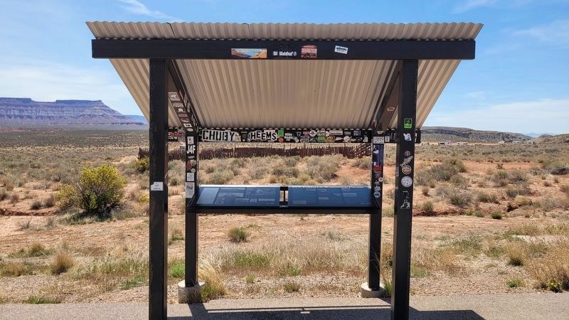
Photographed by James Hulse, April 7, 2025
2. CCC Corrals in Washington County Marker (right side)
The corals are located just behind the marker.
As sheep were replaced by cattle the focus of the corral changed. Since the location of the corral was actually a few miles west of the main trail, it wasn't used for this purpose as often as it might otherwise would have. Additional corrals were also built on the Arizona strip including Gould's, White Pockets, Clayholes, Short Creek, Fredonia, and Littlefield.
To the southeast of this corral lies Sheep Bridge on Sheep Bridge Road. The bridge spans a deep narrow canyon formed by the Virgin River as it cuts its way through thick layers of sedimentary rock. Both the bridge and road were aptly named after the thousands of sheep that trailed
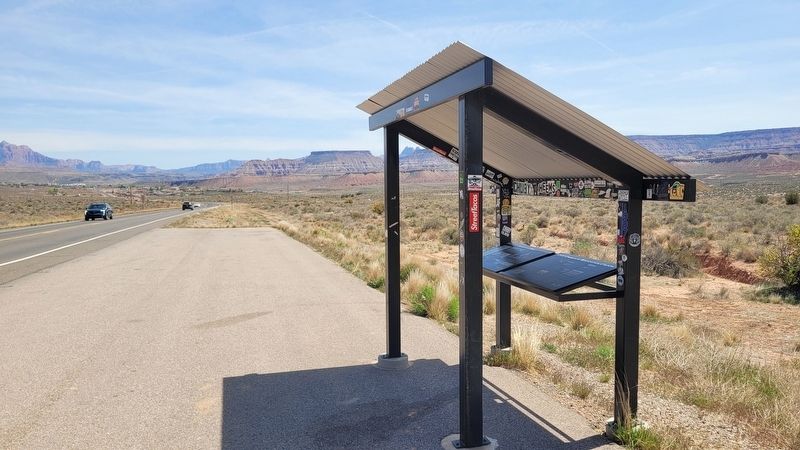
Photographed by James Hulse, April 7, 2025
3. The view of the marker along the street
The corrals, and especially the corral overseeing the Hurricane Cliffs on SR-9, represent a time slice of Americana and serves as a silent reminder of our great western livestock heritage. Many generations of ranchers who homesteaded and grazed the vast openness came to rely on these CCC improvements, as did residents in the more populous areas of the County who benefited from other infrastructure improvements.
The CCC program was phased out with the onset of World War II. The discipline of camp life helped ease the transition of thousands of these young men into the nation's swelling armed forces. Washington County salutes, honors, and wishes to forever recognize the sacrifices of the CCC members by preserving the memory of the Unit Corral on SR-9 and recognizing it as a Washington County historical site.
Dedicated to the heritage and hardworking cowboy spirit of Washington County, exemplified by former County Commissioner Alan Gardner 1996-2016.
Captions
(Photo #1) A Civilian Conservation Corp (CCC) camp near Zion National Park.
(Photo #2) The narrow sheep alley with shorter posts on the one side and taller posts on the inside to form a wall for the cattle alley.
(Photo #3) Large gate leads to cattle alley. Small Gate leads to sheep alley.
(Photo #4) Sheep shearing crew
(Photo #5) Loading chute, where cattle and sheep were moved up the ramp to the platform and onto trucks.
(Photo #6) First sheep bridge
Erected by Washington County Utah and Zion Scenic Byways.
Topics. This historical marker is listed in these topic lists: Animals • Charity & Public Work. A significant historical date for this entry is April 5, 1933.
Location. 37° 12.544′ N, 113° 14.221′ W. Marker is near La Verkin, Utah, in Washington County. It is on State Road 9 3½ miles east of State Road 17, on the right when traveling east. The marker is located along the highway. Touch for map. Marker is in this post office area: La Verkin UT 84745, United States of America. Touch for directions.

Regionally, this marker is in Color Country. It is also in the American Southwest, in the Mountain West, and on the Colorado Plateau. Globally, it is in North America, the Rocky Mountains, the Western Hemisphere, the Western World, and the Anglosphere. Historically, it finds itself in what was once New Spain and also Mexico’s Alta California.
Other nearby markers. At least 8 other markers are within 3 miles of this marker, measured as the crow flies: Hurricane Mesa (here, next to this marker); La Verkin Canal (approx. 1.9 miles away); La Verkin (approx. 1.9 miles away); Hurricane/LaVerkin Bridge (approx. 2.4 miles away); Southern Exploring Company – 1849 (approx. 2.6 miles away); Hurricane Canal (approx. 2.7 miles away); The Historic Hurricane Canal (approx. 2.9 miles away); The Historic Dixie-Long Valley, Utah Pioneer Trail (approx. 2.9 miles away). Touch for a list and map of all markers in La Verkin.
Also see . . . Civilian Conservation Corps. Wikipedia
The Civilian Conservation Corps (CCC) was a voluntary government work relief program that ran from 1933 to 1942 in the United States for unemployed, unmarried men ages 18–25 and eventually expanded to ages 17–28. The CCC was a major part of President Franklin D. Roosevelt's New Deal that supplied manual labor jobs related to the conservation and development of natural resources in rural lands owned by federal, state, and local governments. The CCC was designed to supply jobs for young men and to relieve families who had difficulty finding jobs during the Great Depression in the United States. There was eventually a smaller counterpart program for unemployed women called the She-She-She Camps, which were championed by Eleanor Roosevelt.(Submitted on May 17, 2025, by James Hulse of Medina, Texas.)
Credits. This page was last revised on May 17, 2025. It was originally submitted on May 17, 2025, by James Hulse of Medina, Texas. This page has been viewed 287 times since then and 73 times this year. Photos: 1, 2, 3. submitted on May 17, 2025, by James Hulse of Medina, Texas.
