Sarnia in Lambton County, Ontario — Central Canada (North America)
The Founding of Sarnia
⎯⎯⎯
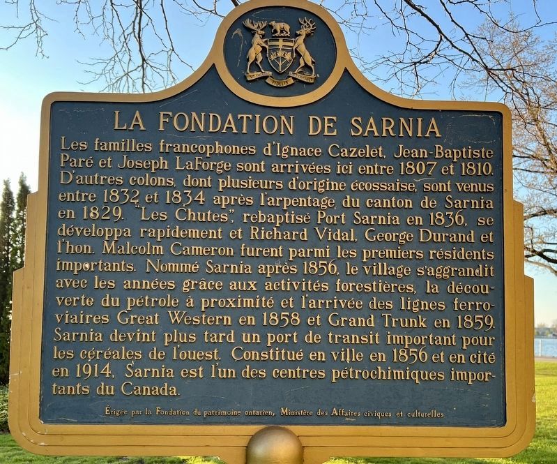
La Fondation de Sarnia

Photographed by Tim Boyd, May 11, 2025
1. The Founding of Sarnia Marker

The Founding of Sarnia. The French-speaking families of Ignace Cazelet, Jean-Baptiste Pare and Joseph LaForge arrived here 1807-1810. Other settlers, many of Scottish descent, came in 1832-1834 folLowing the 1829 survey of Sarnia Township. A community called "The Rapids", renamed Port Sarnia in 1836, soon developed and among its prominent early residents were Richard Vidal, George Durand and the Hon. Malcolm Cameron. Called Sarnia after 1856, the village flourished, stimulated by regional lumbering activity, nearby oil discoveries and the arrival of the Great Western and Grand Trunk Railways in 1858 and 1859, respectively. Later, Sarnia became a significant trans-shipment port for western grain. Incorporated as a town in 1856 and as a city in 1914, Sarnia is one of Canada's important petro-chemical centres.
this page online
Erected by Ontario Heritage Foundation, Ministry of Citizenship and Culture.
Topics and series. This historical marker is listed in these topic lists: Industry & Commerce • Railroads & Streetcars • Settlements & Settlers. In addition, it is included in the Canada, Ontario Heritage Trust series list. A significant historical year for this entry is 1807.
Location. 42° 58.53′ N, 82° 24.498′ W. Marker is in Sarnia, Ontario, in Lambton County. It can be reached from Front Street North north of George Street, on the left when traveling north. The Marker is in Mackenzie Park, visible
Photographed by Tim Boyd, May 11, 2026
2. The Founding of Sarnia Marker (français)

Regionally, this marker is in the Southwest Ontario Area and in Southwestern Ontario. It is also in Central Canada. Globally, it is in North America, on the Great Lakes, in the Western Hemisphere, in the Western World, and in the Anglosphere. Historically, it finds itself in what was once a British colony, the Viceroyalty of New France, the Haudenosaunee (Iroquois) Confederacy, and Rupert’s Land.
Other nearby markers. At least 8 other markers are within walking distance of this marker: The Honourable Alexander Mackenzie (within shouting distance of this marker); Indigenous Community Flag Plaza (about 120 meters away, measured in a direct line); Mackenzie House and Family (approx. 0.3 kilometers away); Pauline McGibbon 1910-2001 (approx. 0.6 kilometers away); Admiralty Anchor (approx. 1.1 kilometers away in the U.S.); The St. Clair River (approx. 1.2 kilometers away in the U.S.); Commerce & Catastrophe

Photographed by Tim Boyd, May 11, 2025
3. The Founding of Sarnia Marker
Looking southeast
Also see . . . From Hunting ground to County Seat (Sarnia Historical Society).
Sarnia, with most of the surrounding area which later became the modern County of Lambton,was ceded by the Chippewa Indians to the Crown in 1827. In the 20 years which preceded, the Indians had already permitted the friendly occupation of their lands by the first white settlers, probably for some private means of payment. Such arrangements were frowned upon by authority, yet were generally amicable in nature. Proceeding without the benefit of survey or deed, these early agreements later gave the “squatters” as the settlers were termed, a de facto recognition of title for their farms and homesteads.(Submitted on May 17, 2025, by Tim Boyd of Hamilton, Ontario.)
Earliest white settlers at Sarnia were French Canadians from the Windsor border region in Michigan. Of 20 families recorded in the year 1811, between Sarnia and the south end of the St. Clair River, all but two bore French names. Three families can bewell-documented early in the 19 century on the original Sarnia townsite: those of Aeneus Cazelet, Jean-Baptiste Pare, and Joseph LaForge. The descendants of, Cazelet, later spelled Causley, have lived continuously in Sarnia since the year 1807, making them by perhaps 30 years the longest-running local dynasty. Pare, located at least by 1808, left intriguing details of his purchase from an earlier settler. LaForge is thought to have come in 1809.May 17, 20254. Post Card of Front Street, Sarnia, ca 1900


May 17, 2025
5. Part of the Town of Sarnia, 1883

Photographed by Tim Boyd, May 11, 2025
6. The Founding of Sarnia Marker
Credits. This page was last revised on May 29, 2025. It was originally submitted on May 17, 2025, by Tim Boyd of Hamilton, Ontario. This page has been viewed 243 times since then and 91 times this year. Photos: 1, 2, 3, 4, 5, 6. submitted on May 17, 2025, by Tim Boyd of Hamilton, Ontario. • Devry Becker Jones was the editor who published this page.
