Southampton City Centre , England, United Kingdom — Northwestern Europe (the British Isles)
Town Walls

Photographed by Ray Gurganus, April 1, 2025
1. Town Walls Marker
Large numbers of masons were employed to build the wall using stone shipped from the Isle of Wight. The sound of hammers and chisels would have been heard for many years.
Once the wall was complete its upkeep was divided amongst the town's people. House owners were allocated a stretch of wall to maintain while the trade guilds looked after the towers. The shoemakers and saddlers were responsible for Arundel Tower.
Erected by Southampton City Council.
Topics. This historical marker is listed in this topic list: Forts and Castles. A significant historical year for this entry is 1338.
Location. 50° 54.157′ N, 1° 24.294′ W. Marker is in Southampton, England. It is in Southampton City Centre. It is on West Bargate. The marker is attached to the south side of the wall and is not visible from West Bargate. Touch for map. Marker is at or near this postal address: 182-184 W Bargate,
this page online

Regionally, this marker is in the Hampshire Ports. Globally, it is on the Atlantic Ocean, in the North Atlantic Region, in Europe, in Atlantic Europe, on one of the British Isles, in the Western World, and in the Anglosphere. Historically, it finds itself in what was once the Roman Empire.
Other nearby markers. At least 8 other markers are within walking distance of this marker: Bargate and Guildhall (within shouting distance of this marker); Southampton in the Second World War 1939-1945 (within shouting distance of this marker); Defence of the Town (within shouting distance of this marker); Jane Austen (within shouting distance of this marker); A Fashionable Resort (within shouting distance of this marker); Arundel Tower (within shouting distance of this marker); All Saints Church (about 120 meters away, measured in a direct line); Castle Gate (about 150 meters away). Touch for a list and map of all markers in Southampton.

2. A View of Southampton, c. 1790
Photographed by Raphael Tuck & Sons, circa 1907
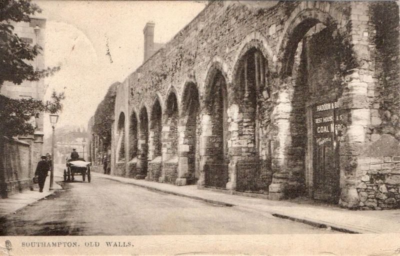
3. Old Walls
Credits. This page was last revised on May 19, 2025. It was originally submitted on May 18, 2025, by Ray Gurganus of Washington, District of Columbia. This page has been viewed 131 times since then and 13 times this year. Photos: 1, 2. submitted on May 18, 2025, by Ray Gurganus of Washington, District of Columbia. 3. submitted on May 19, 2025. • Andrew Ruppenstein was the editor who published this page.
