
Renfrew in Renfrew County, Ontario — Central Canada (North America)
Daniel McLachlin
1810-72
Photographed by William Fischer, Jr., May 13, 2025
1. Daniel McLachlin Marker
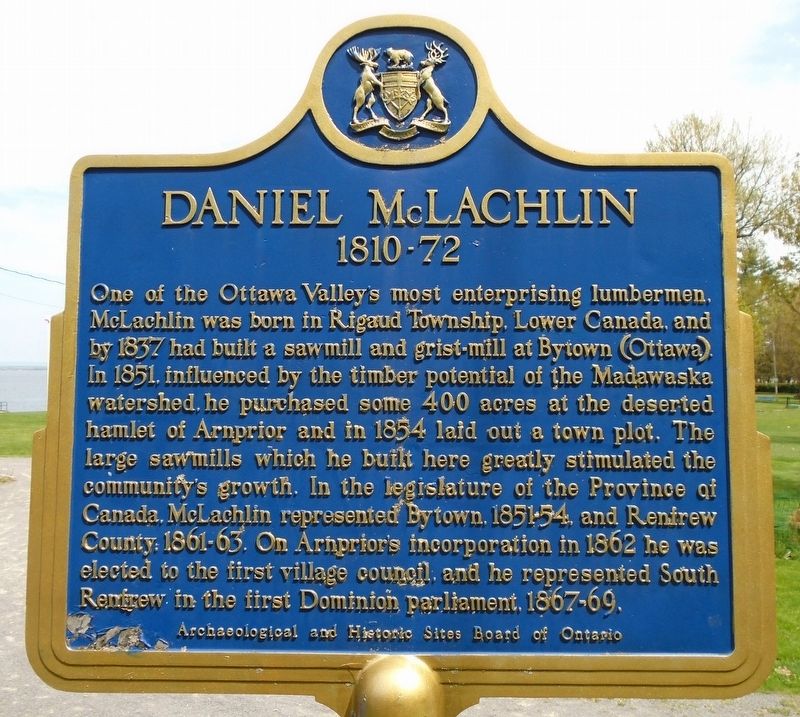
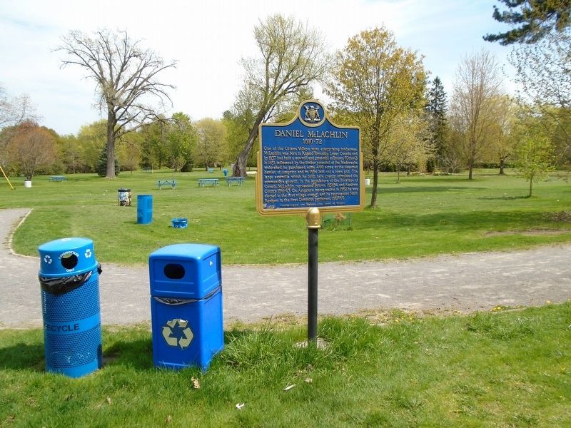
One of the Ottawa Valley's most enterprising lumbermen, McLachlin was born in Rigaud Township, Lower Canada, and by 1837 had built a sawmill and grist-mill at Bytown (Ottawa). In 1851, influenced by the timber potential of the Madawaska watershed, he purchased some 400 acres at the deserted hamlet of Arnprior and in 1854 laid out a town plot. The large sawmills which he built here greatly stimulated the community's growth. In the legislature of the Province of Canada. McLachlin represented Bytown, 1851-54, and Renfrew County, 1861-63. On Arnprior's incorporation in 1862 he was elected to the first village council, and he represented South Renfrew in the first Dominion parliament, 1867-69.
Erected by Archaelogical and Historic Sites Board of Ontario.
Topics and series. This historical marker is listed in these topic lists: Industry & Commerce • Settlements & Settlers. In addition, it is included in the Canada, Ontario Heritage Trust series list. A significant historical year for this entry is 1854.
Location. 45° 26.589′ N, 76° 21.118′ W. Marker is in Renfrew, Ontario, in Renfrew County. It is on John
this page online

Regionally, this marker is in the Haliburton Highlands to Ottawa Valley and in Eastern Ontario. It is also in Central Canada. Globally, it is in North America, the Western Hemisphere, the Western World, and the Anglosphere. Historically, it finds itself in what was once a British colony, the Viceroyalty of New France, the Haudenosaunee (Iroquois) Confederacy, and Rupert’s Land.
Other nearby markers. At least 8 other markers are within 13 kilometers of this marker, measured as the crow flies: War Memorial (about 240 meters away); Grace-St. Andrew's United Church Cornerstone Laying (approx. 0.6 kilometers away); David A. Gillies Building (approx. 0.9 kilometers away); The Arnprior Post Office and Customs House (approx. 0.9 kilometers away); McLachin Grist Mill (approx. 0.9 kilometers away); Pakenham's Early Growth (approx. 12.9 kilometers away); Pakenham 5 Arched Stone Bridge (approx. 13 kilometers away);
Photographed by William Fischer, Jr., May 13, 2025
2. Daniel McLachlin Marker
Another marker is no longer nearby. Timber Rafting on the Ottawa (was about 90 meters away, measured in a direct line but has been confirmed missing).
Also see . . . Daniel (Donhuil) McLachlin in Dictionary of Canadian Biography. (Submitted on May 19, 2025, by William Fischer, Jr. of Reynoldsburg, Ohio.)
Credits. This page was last revised on May 19, 2025. It was originally submitted on May 19, 2025, by William Fischer, Jr. of Reynoldsburg, Ohio. This page has been viewed 85 times since then and 9 times this year. Photos: 1, 2. submitted on May 19, 2025, by William Fischer, Jr. of Reynoldsburg, Ohio.
