Angeles National Forest in Los Angeles County, California — The American West (Pacific Coastal)
One Man & Mule Railway
Inspiration Point
| — | Mount Lowe Railway | — |
Photographed by Craig Baker
1. One Man & Mule Railway Marker
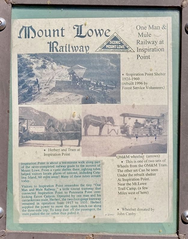
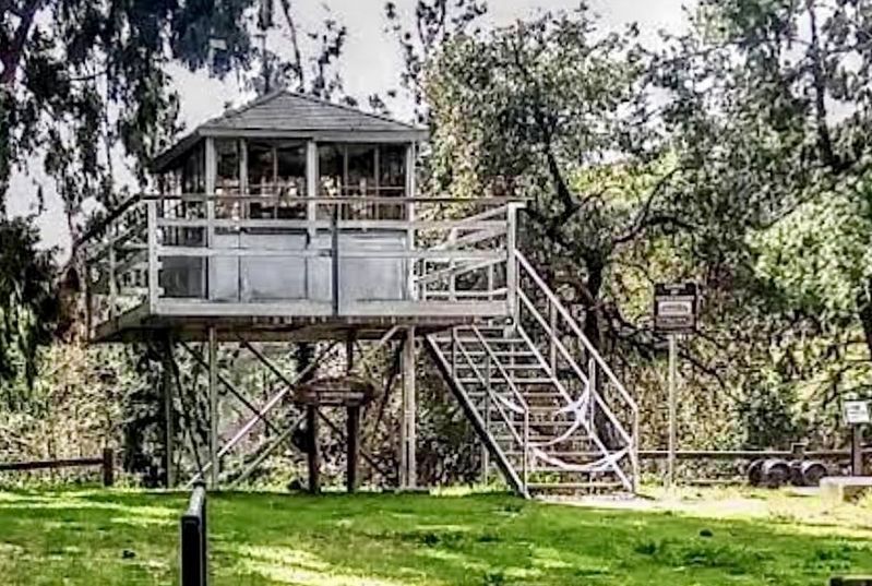
Inspiration Point is about a ten-minute walk along part of the never-completed railway grade to the summit of Mount Lowe. From a rustic shelter there, sighting tubes helped visitors locate places of interest, including Catalina Island, 60 miles away! Many of these tubes remain today.
Visitors to Inspiration Point remember the tiny "One Man and Mule Railway," a little tourist tramway that connected Inspiration Point to Panorama Point overlooking Eaton Canyon. Operated by one man and his cantankerous mule, Herbert, the two-foot-gauge tramway remained in operation from 1917 to 1935. Herbert supplied the power to move the open bench car along the three-mile trip. To keep dust off the passengers, the mule pushed the car rather than pulled it.
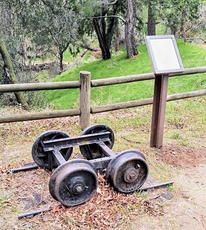
This is one of two sets of wheels from the OM&M Tram. The other set can be seen under the rebuilt shelter at Inspiration Point near the Mt.Lowe Trail Camp (a few Miles west of here).
Topics. This historical marker is listed in this topic list: Railroads & Streetcars. A significant historical year for this entry is 1917.
Location. 34° 11.618′ N, 118° 5.458′ W.
this page online

Regionally, this marker is in Greater Los Angeles and in the Transverse Ranges. It is also on the American Pacific Coast. Globally, it is in North America, on the Ring of Fire, on the Pacific Rim, in the Western Hemisphere, in the Western World, and in the Anglosphere. Historically, it finds itself in what was once New Spain and also Mexico’s Alta California.
Other nearby markers. At least 8 other markers are within 2 miles of this marker, measured as the crow flies: Castro Peak Fire Lookout Tower (a few steps from this marker); Henninger Flats (about 300 feet away, measured in a direct line); Many People of Eaton Canyon (approx. 1.2 miles away); Eaton Canyon (approx. 1.3 miles away); MacPherson Parkway (approx. 2 miles away); Echo Phone (approx. 2.1 miles away); Stairway To The Sky (approx. 2.1 miles away); Echo Mountain House (approx. 2.1 miles away).
Photographed by Craig Baker, circa 2017
2. Marker and Wheelset
More about this marker. L.A. County Fire Dept has closed Henninger Flats. This marker has been relocated and is now displayed at the Pomona Fairgrounds, at the America’s Great Outdoors exhibit area. The wheel set was moved to Inspiration Point, where there are now two.
Related marker. Click here for another marker that is related to this marker. - The other wheelset and marker, at Inspiration Point.
Additional keywords. Eaton Fire
Photographed by Craig Baker, circa 2017
3. One Man & Mule Railway Marker
The marker and wheelset are to the right of the lookout. Everything here has since been relocated.
Credits. This page was last revised on May 20, 2026. It was originally submitted on May 20, 2025. This page has been viewed 160 times since then and 25 times this year. Photos: 1, 2, 3. submitted on May 20, 2025, by Craig Baker of Sylmar, California.
