Hoover in Jefferson County, Alabama — The American South (East South Central)
Ross Bridge
Photographed by Tim Carr, February 6, 2009
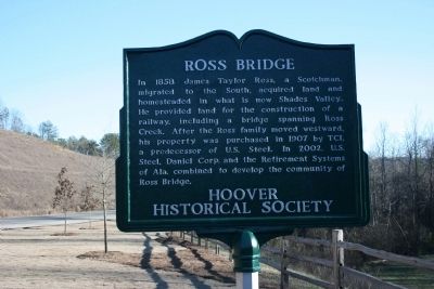
1. Ross Bridge Marker
Erected by Hoover Historical Society.
Topics. This historical marker is listed in these topic lists: Bridges & Viaducts • Industry & Commerce • Railroads & Streetcars • Settlements & Settlers. A significant historical year for this entry is 1858.
Location. 33° 23.148′ N, 86° 52.014′ W. Marker is in Hoover, Alabama, in Jefferson County. It is on Ross Bridge Parkway 2.7 miles north of State Highway 150, on the left when traveling north. Touch for map. Marker is in this post office area: Bessemer AL 35022, United States of America. Touch for directions.

Regionally, this marker is in the Birmingham Metropolitan Area. It is also in the American South and specifically
this page online
Other nearby markers. At least 8 other markers are within 4 miles of this marker, measured as the crow flies: Overseer’s House (approx. one mile away); The Park Avenue Historical District (approx. 1.3 miles away); Bluff Park Art Association/ Bluff Park Art Show (approx. 1.7 miles away); Bluff Park Elementary School / Hoover Community Education (approx. 1.8 miles away); Lover’s Leap (approx. 1.9 miles away); Hale - Joseph Home (approx. 1.9 miles away); Shades Crest Road Historical District (approx. 2 miles away); a different marker also named Shades Crest Road Historical District (approx. 3.2 miles away). Touch for a list and map of all markers in Hoover.
Photographed by Tim Carr, February 6, 2009
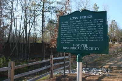
2. Ross Bridge Marker
Photographed by Tim Carr, February 6, 2009
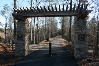
3. Former railroad bed converted into a walking trail at Ross Bridge.
Photographed by Tim Carr, February 6, 2009
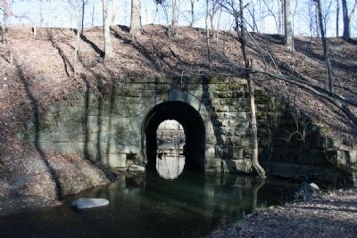
4. The Stone Structure of Ross Bridge, West Side
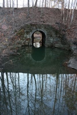
Photographed by Tim Carr, February 6, 2009
5. Stone Structure of Ross Bridge, East Side
Credits. This page was last revised on June 16, 2016. It was originally submitted on February 8, 2010, by Timothy Carr of Birmingham, Alabama. This page has been viewed 3,591 times since then and 89 times this year. Photos: 1, 2, 3, 4, 5. submitted on February 8, 2010, by Timothy Carr of Birmingham, Alabama. • Craig Swain was the editor who published this page.
