Speyer, Rhineland-Palatinate, Germany — Central Europe
Rathhof

Photographed by James Hulse, May 20, 2025
1. Pfaffhof Marker

Hier stand der Rathhof seit 1340, das Rathaus der Freien Reichsstadt Speyer. Zugleich Quartier der die freie Stadt besuchenden Kaiser und Könige, sowie seit 1530 Sitz des Reichskammergerichts. Hier war die statte der Protestation auf dem Reichstag zu Speyer 1529. Das alte Gebäude wurde zusammen mit der ganzen Stadt im Kriege 1689 zerstört.
The Rathhof, the town hall of the Free Imperial City of Speyer, stood here from 1340. It was also the quarters of emperors and kings visiting the free city, and since 1530, the seat of the Imperial Chamber Court. This was the site of the protest at the Imperial Diet of Speyer in 1529. The old building, along with the entire city, was destroyed in the war of 1689.
Topics. This historical marker is listed in this topic list: Notable Buildings. A significant historical year for this entry is 1340.
Location. 49° 19.056′ N, 8° 26.437′ E. Marker is in Speyer, Rheinland-Pfalz (Rhineland-Palatinate). It is at the intersection of Große Himmelsgasse and Bauhof, on the right when traveling west on Große Himmelsgasse. The marker is located at the corner of the
this page online

Regionally, it is in Europe, the European Union, Atlantic Europe, Central Europe, the Schengen Area, Western Europe, and the Western World. Historically, it finds itself in what was once the Roman Empire and specifically also the Holy Roman Empire.
Other nearby markers. At least 8 other markers are within walking distance of this marker: Domnapf / Cathedral Bowl (within shouting distance of this marker); Domnapf (within shouting distance of this marker); Kaiserdom / Imperial Cathedral (within shouting distance of this marker); Hohenfeldtischer Hof / Court of Hohenfeldt (within shouting distance of this marker); Der Speyerer Jakobspilger / The Speyer St. James Pilgrim (about 90 meters away, measured in a direct line); Dreifaltigkeitskirche / Trinity Church (about 90 meters away); Ölberg / Mount of Olives (about 150 meters away); Ehemalige Domherrenkurie / Former Canon’s Residence (about 150 meters away). Touch for a list and map of all markers in Speyer.
Also see . . .
1. History of Speyer.
Photographed by James Hulse, May 20, 2025
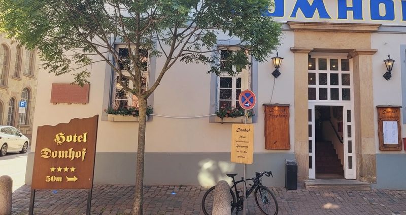
2. The Rathhof Marker is located on the corner of the hotel
The history of Speyer begins with the establishment of a Roman camp in 10 BCE, making it one of Germany's oldest cities. Its name evolved from Spira, first mentioned in 614. As of 1294 a Free Imperial City, the town became renowned for its Romanesque cathedral, its vibrant Jewish community, its seat of the Imperial Chamber Court, for 50 diets that took place within its walls, most notably 1526 and 1529, and last but not least, for the Protestation at Speyer. For several centuries from the Middle Ages into the early modern period, Speyer was one of the main centres of gravity of the Holy Roman Empire.(Submitted on May 23, 2025, by James Hulse of Medina, Texas.)
2. Free imperial city. Wikipedia
In the Holy Roman Empire, the collective term free and imperial cities (German: Freie und Reichsstädte), briefly worded free imperial city (Freie Reichsstadt, Latin: urbs imperialis libera), was used from the 15th century to denote a self-ruling city that had a certain amount of autonomy and was represented in the Imperial Diet.(Submitted on May 23, 2025, by James Hulse of Medina, Texas.)
Photographed by James Hulse, May 20, 2025
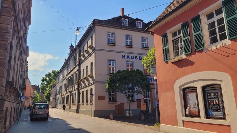
3. The view of the Rathhof Marker along the street
Credits. This page was last revised on May 23, 2025. It was originally submitted on May 21, 2025, by James Hulse of Medina, Texas. This page has been viewed 92 times since then and 14 times this year. Photos: 1, 2, 3. submitted on May 23, 2025, by James Hulse of Medina, Texas.
