Battle in East Sussex, England, United Kingdom — Northwestern Europe (the British Isles)
Battle Abbey Becomes a Country Estate
Photographed by Ray Gurganus, March 28, 2025
1. Battle Abbey Becomes a Country Estate Marker
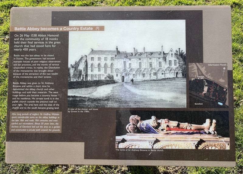
On 26 May 1538 Abbot Hamond and the community of 18 monks held their final services in the great church that had stood here for nearly 450 years.
Battle was the last abbey to be closed in Sussex. The government had accused monastic houses of poor religious observances and lax practices, and the monks of various unspecified crimes. In reality, the Dissolution of the monasteries was brought about because of the attraction of the vast wealth of the monasteries and their estates.
Battle Abbey was given to Sir Anthony Browne and within a short time he demolished the abbey church and other buildings and sold their materials. The west range before you became a country house and his residence. His ornate tomb is in the parish church outside the precinct wall on your right. The area here and the sites of the church and to the south became grazing land.
After long periods of neglect, Sir Godfrey Webster spent considerable sums on the abbey buildings in the late 18th and early 19th centuries and even carried out excavations. About 50 years later, the duchess of Cleveland laid out the area as a garden and constructed a circular
this page online
Topics. This historical marker is listed in this topic list: Religion & Religious Structures. A significant historical date for this entry is May 26, 1538.
Location. 50° 54.868′ N, 0° 29.344′ E. Marker is in Battle, England, in East Sussex. It can be reached from Upper Lake. Touch for map. Marker is at or near this postal address: 22 Upper Lake, Battle, England TN33 0AN, United Kingdom. Touch for directions.

Regionally, this marker is in the Greater South East. Globally, it is on the Atlantic Ocean, in the North Atlantic Region, in Europe, in Atlantic Europe, on one of the British Isles, in the Western World, and in the Anglosphere. Historically, it finds itself in what was once the Roman Empire.
Other nearby markers. At least 8 other markers are within walking distance of this marker: The Duchess of Cleveland’s Walled Garden (within shouting distance of this marker); Rebuilding the Abbey Church (within shouting distance of this marker); The East Range (within shouting distance of this marker); Beehives in the Walled Garden (within shouting distance of this marker); Dairy and Icehouse (within shouting

Photographed by Ray Gurganus, March 28, 2025
2. Battle Abbey Estate Building
Credits. This page was last revised on May 23, 2025. It was originally submitted on May 21, 2025, by Ray Gurganus of Washington, District of Columbia. This page has been viewed 88 times since then and 14 times this year. Photos: 1, 2. submitted on May 21, 2025, by Ray Gurganus of Washington, District of Columbia. • Andrew Ruppenstein was the editor who published this page.
