Uptown Oklahoma City in Oklahoma County, Oklahoma — The American South (West South Central)
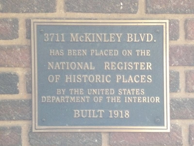
3711 McKinley Blvd.
Built 1918
Photographed by Duane and Tracy Marsteller, April 9, 2025
1. 3711 McKinley Blvd. Marker
National Register
of Historic Places
by the United States
Department of the Interior
Topics and series. This historical marker is listed in this topic list: Architecture. In addition, it is included in the National Register of Historic Places (NRHP) series list. A significant historical year for this entry is 1918.
Location. 35° 30.498′ N, 97° 32.225′ W. Marker is in Oklahoma City, Oklahoma, in Oklahoma County. It is in Uptown Oklahoma City. It is on North McKinley Avenue south of Northwest 37th Street, on the right when traveling south. Touch for map. Marker is at or near this postal address: 3711 N McKinley Ave, Oklahoma City OK 73118, United States of America. Touch for directions.

Regionally, this marker is in Central Oklahoma — Frontier Country. It is also in the American South, specifically on the prairies, and on the Southern Plains. Globally, it is in North America, the Western Hemisphere, the Western World, and the Anglosphere. Historically, it finds itself in what was once the territory of the Mississippian Culture and also the Louisiana Purchase.
Other nearby markers. At
this page online
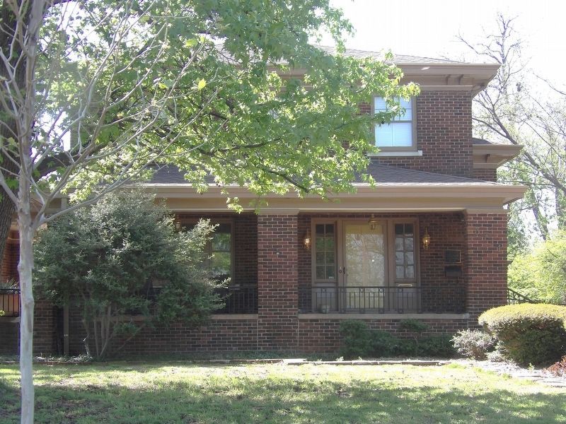
Regarding 3711 McKinley Blvd.. Excerpts from the National Register nomination for the Putnam Heights Historic Preservation District, which includes this property:
Putnam Heights land was originally granted by President McKinley to the Oklahoma Military Institute. After the structure burned the land was sold. It was developed by Isaac (sic) [Israel] Putnam. The area was a roster of early OKC bankers, merchants, architects, physicians and civic leaders. The names have changed but the occupations and community interest remains thesame today.…Photographed by Duane and Tracy Marsteller, April 10, 20252. 3711 McKinley Blvd. MarkerPlaque is mounted on the wall at the right corner of the porch.
Development of this area began in 1908 when the Putnam Heights Addition, with twenty-two others, was included within the city limits of the 19-year-old city. Oklahoma City then – a year after statehood and two years before it became the state capitol – had a population of approximately 3,000. That it was growing Israel Putnam recognized when, as a lawyer, he came to the city in 1901. He abandoned his practice the following year for real estate and organized the Putnam Company. By 1907, statehood year, he was developing a 320-acre area northwest of the city of which this historic district and present Memorial Park, immediately to the east, were a part.
Also see . . . Putnam Heights Historic Preservation District (PDF). National Register nomination for the district, which was listed in 1982. (Prepared by Sandra S. Stratton and Kent Ruth, State Historic Preservation Office of Oklahoma (1981); via the Historic Preservation Office) (Submitted on May 22, 2025, by Duane and Tracy Marsteller of Murfreesboro, Tennessee.)
Credits. This page was last revised on May 22, 2025. It was originally submitted on May 22, 2025, by Duane and Tracy Marsteller of Murfreesboro, Tennessee. This page has been viewed 105 times since then and 13 times this year. Photos: 1, 2. submitted on May 22, 2025, by Duane and Tracy Marsteller of Murfreesboro, Tennessee.
