Stirling in Stirling-Rawdon in Hastings County, Ontario — Central Canada (North America)
The Stirling Community Service Building
Photographed by William Fischer, Jr., May 12, 2025
1. The Stirling Community Service Building Marker
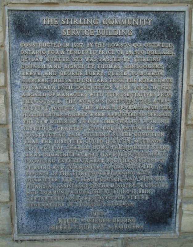
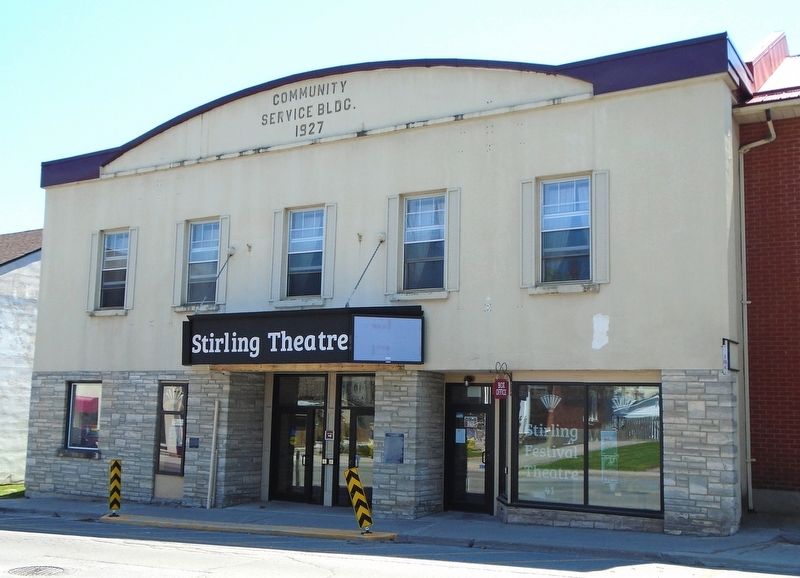
Constructed in 1927, by the Howson Co. of Tweed, Ontario for a tendered price of 25,500 dollars. By-law Number 373 was passed by Stirling Council and signed by Thomas Montgomery, Reeve, and George Luery, Clerk, to borrow nineteen thousand dollars from the Royal Bank of Canada until debentures were sold. In 1927 a Board of Managers with representatives from the Council, the Women's Institute, the Agriculture Society, the Board of Trade and the Horticulture Society were appointed to operate the new buildings. In 1928, the Stirling Women's Institute, granted 2,000 dollars toward constructing this building on the condition that the Institute could hold it meetings here free of charge. Down through the years many community events have been held here, providing entertainment for the citizens of Stirling and community. To-day with the efforts of the Stirling Performing Arts Committee, the Village Council and with the financial assistance of the Ministry of Culture and Communications, the building is being refurbished and preserved for future generations of Stirling citizens.
1988
Reeve Wieger Dejong
Clerk Murray A. Rodgers
Erected by Stirling
this page online
Topics. This historical marker is listed in this topic list: Notable Buildings. A significant historical year for this entry is 1927.
Location. 44° 17.742′ N, 77° 32.932′ W. Marker is in Stirling-Rawdon, Ontario, in Hastings County. It is in Stirling. It is on Front Street (County Highway 8) just east of Emma Street, on the right when traveling east. Touch for map. Marker is at or near this postal address: 41 West Front Street, Stirling-Rawdon ON K0K 3E0, Canada. Touch for directions.

Regionally, this marker is in Eastern Ontario and specifically in Southeastern Ontario. It is also in Central Canada. Globally, it is in North America, on the Great Lakes, in the Western Hemisphere, in the Western World, and in the Anglosphere. Historically, it finds itself in what was once a British colony, the Viceroyalty of New France, the Haudenosaunee (Iroquois) Confederacy, and Rupert’s Land.
Other nearby markers. At least 8 other markers are within 3 kilometers of this marker, measured as the crow flies: Stirling Theatre (here, next to this marker); Empire Block (within shouting distance of this marker); Bank of Montreal
Photographed by William Fischer, Jr., May 12, 2025
2. The Stirling Community Service Building Marker
Credits. This page was last revised on May 22, 2025. It was originally submitted on May 22, 2025, by William Fischer, Jr. of Reynoldsburg, Ohio. This page has been viewed 102 times since then and 14 times this year. Photos: 1, 2. submitted on May 22, 2025, by William Fischer, Jr. of Reynoldsburg, Ohio.
