Layton in Davis County, Utah — The American Mountains (Southwest)
West Layton Meeting House
Photographed by Jeremy Snow, May 20, 2025
1. West Layton Meeting House Marker
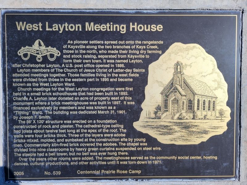
As pioneer settlers spread out onto the rangelands of Kaysville along the two branches of Kays Creek, those in the north, who made their living dry farming and stock raising, separated from Kaysville to form their own town. It was named Layton, after Christopher Layton. A U.S. post office opened in 1886.
Layton members of The Church of Jesus Christ of Latter-day Saints attended meetings together. Those families living in the west fields were divided from those in the eastern part in 1895 and became known as the West Layton Ward.
Church meetings for the West Layton congregation were first held in a small brick schoolhouse that had been built in 1892. Charles A. Layton later donated an acre of property east of this monument where a brick meetinghouse was built in 1897. It was financed exclusively by members and was known as a "Tithing" Ward. The building was dedicated March 31, 1901, by Joseph F. Smith.
The 56' X 120' structure was erected on a foundation constructed of rock and plaster. The cathedral-type ceiling had joists about twelve feet long at the apex of the roof. The walls were four bricks thick. Three
this page online
Over the years other rooms were added. The meetinghouse served as the community social center, hosting dances, cultural productions, and other activities until it was torn down in 1971.
Erected 2005 by Daughters of Utah Pioneers. (Marker Number 539.)
Topics and series. This historical marker is listed in these topic lists: Religion & Religious Structures • Settlements & Settlers. In addition, it is included in the Daughters of Utah Pioneers series list. A significant historical date for this entry is March 31, 1901.
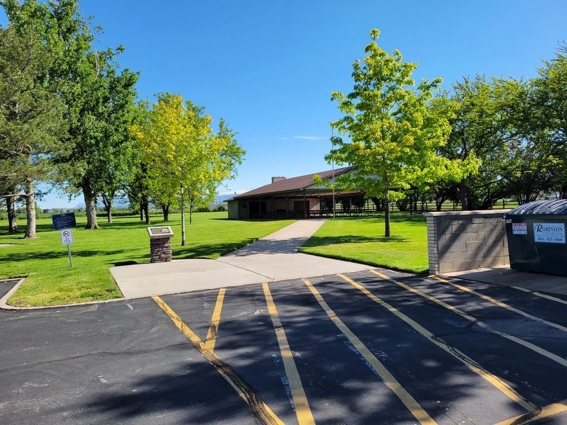
Location. 41° 3.67′ N, 112° 0.307′ W. Marker is in Layton, Utah, in Davis County. It can be reached from West Gentile Street. Marker located at the back of the LDS Church parking lot. Touch for map. Marker is at or near this postal address: 2120 W Gentile St, Layton UT 84041, United States of America. Touch for directions.

Regionally,
Photographed by Jeremy Snow, May 20, 2025
2. West Layton Meeting House Marker
Other nearby markers. At least 8 other markers are within 3 miles of this marker, measured as the crow flies: Early Education in Layton (approx. 1.6 miles away); Veterans Park Layton Utah (approx. 1.9 miles away); In Honor of All Who Served (approx. 1.9 miles away); First National Bank of Layton Utah (approx. 2 miles away); Layton's First Post Office (approx. 2 miles away); Stage Coach Station (approx. 2.1 miles away); Verdeland Park (approx. 2.2 miles away); Joseph "Cap" Hill Cabin (approx. 2.2 miles away). Touch for a list and map of all markers in Layton.
Credits. This page was last revised on May 24, 2025. It was originally submitted on May 23, 2025, by Jeremy Snow of Cedar City, Utah. This page has been viewed 269 times since then and 91 times this year. Photos: 1, 2. submitted on May 23, 2025, by Jeremy Snow of Cedar City, Utah. • Andrew Ruppenstein was the editor who published this page.
