Clinton in Davis County, Utah — The American Mountains (Southwest)
Clinton
Photographed by Jeremy Snow, May 20, 2025
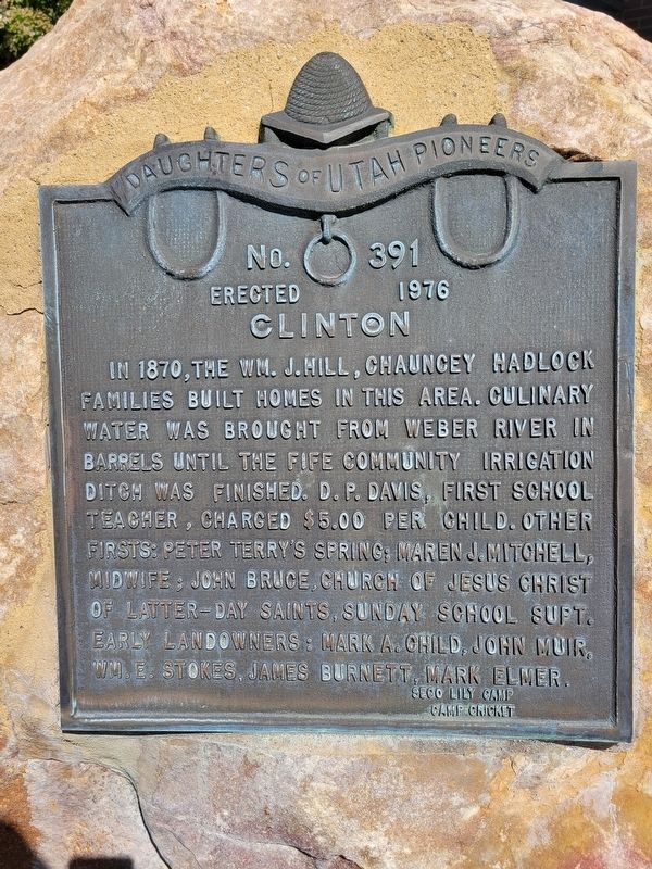
1. Clinton Marker
Erected 1976 by Daughters of Utah Pioneers. (Marker Number 391.)
Topics and series. This historical marker is listed in this topic list: Settlements & Settlers. In addition, it is included in the Daughters of Utah Pioneers series list. A significant historical year for this entry is 1870.
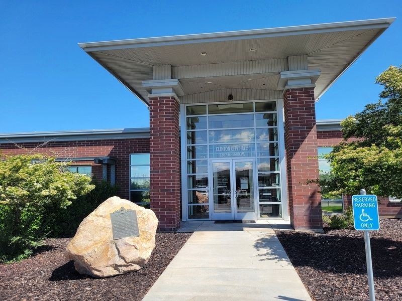
Location. 41° 8.787′ N, 112° 3.324′ W. Marker is in Clinton, Utah, in Davis County. It can be reached from North 1500 West. Marker located next to the entrance of the Clinton City Offices. Touch for map. Marker is at or near this postal address: 2267 N 1500 W, Clearfield UT 84015, United States of America. Touch for directions.

Regionally, this marker is in the Wasatch
this page online
Other nearby markers. At least 8 other markers are within 4 miles of this marker, measured as the crow flies: First Settlers of Roy (approx. ¾ mile away); First Post Office in Roy (approx. 0.8 miles away); a different marker also named The First Post Office in Roy (approx. 0.8 miles away); Hensley/Salt Lake Cutoff Ruts (approx. 2.7 miles away); Settlement of Clearfield (approx. 2.8 miles away); Hensley / Salt Lake Cutoff-Bluff Road (approx. 3.3 miles away); Muskrat Springs-Hooper (approx. 3.4 miles away); Historical Wilcox Cabin (approx. 4 miles away).
Photographed by Jeremy Snow, May 20, 2025
2. Clinton Marker
Credits. This page was last revised on May 23, 2025. It was originally submitted on May 23, 2025, by Jeremy Snow of Cedar City, Utah. This page has been viewed 175 times since then and 29 times this year. Photos: 1, 2. submitted on May 23, 2025, by Jeremy Snow of Cedar City, Utah. • Andrew Ruppenstein was the editor who published this page.
