
Near Murrells Inlet in Horry County, South Carolina — The American South (South Atlantic)
St. James Rosenwald School
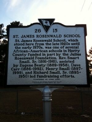
Photographed by Cindy Bullard, January 14, 2010
1. St. James Rosenwald School Marker (front)
Marker Reverse:
The school, built in 1928 or 1929, was a five-room frame schoolhouse typical of the larger rural schools built by the Rosenwald Foundation between 1917 and 1932. It educated about 150 students a year in grades 1-10, with five or six teachers. St. James Rosenwald School had two principals: Eula G. Owens (d. 1971), succeeded by her husband, Boyd Williams Owens (d. 1981). It closed in 1970 after desegregation.
Erected 2005 by the Burgess Organization for the Advancement of Young People, Inc. (Marker Number 26-15.)
Topics and series. This historical marker is listed in these topic lists: African Americans • Education. In addition, it is included in the Rosenwald Schools series list. A significant historical year for this entry is 1928.
Location. 33° 37.273′ N,
this page online

Regionally, this marker is on South Carolina’s Grand Strand and in the Pee Dee. It is also in the American South, specifically in the Deep South, and on the Eastern Seaboard. Globally, it is in the North Atlantic Region, North America, the Western Hemisphere, the Western World, and the Anglosphere. Historically, it finds itself in what was once the territory of the Mississippian Culture, one of the original Thirteen Colonies, one of the Confederate States of America, and the Antebellum South.
Other nearby markers. At least 8 other markers are within 5 miles of this marker, measured as the crow flies: Ark Cemetery (approx. 3.8 miles away); Ark Agriculture (approx. 3.9 miles away); The
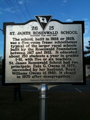
Photographed by Cindy Bullard, January 14, 2010
2. St. James Rosenwald School Marker (reverse)
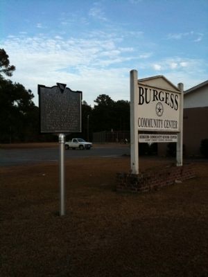
Photographed by Cindy Bullard, January 14, 2010
3. Present location
Credits. This page was last revised on June 16, 2016. It was originally submitted on February 9, 2010, by David Bullard of Seneca, South Carolina. This page has been viewed 1,579 times since then and 72 times this year. Photos: 1, 2, 3. submitted on February 9, 2010, by David Bullard of Seneca, South Carolina. • Kevin W. was the editor who published this page.
