Barrie in Simcoe County, Ontario — Central Canada (North America)
Early Businesses
| — | Barrie Waterfront Heritage Trail | — |
Photographed by Cosmos Mariner, June 5, 2024
1. Early Businesses Marker
Essa Road Level Crossing
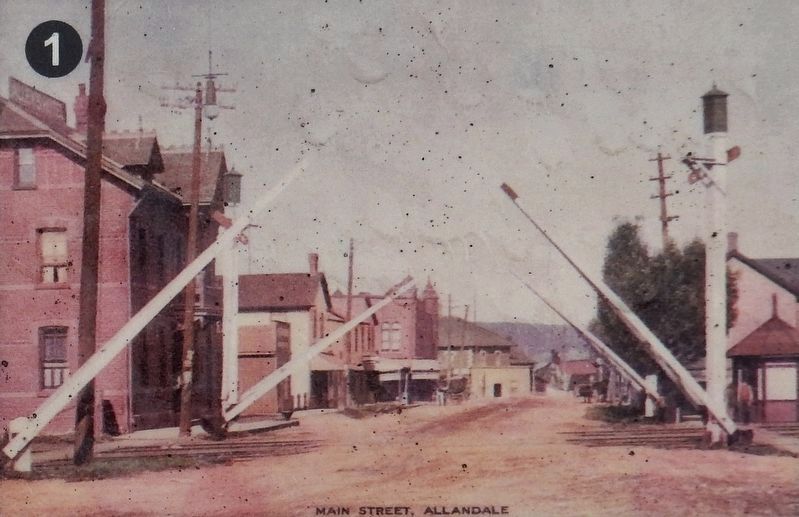
Downtown Allandale was a bustling hub of activity. Road traffic was regularly interrupted by rail traffic shunting over several tracks which crossed Essa Road just north of Gowan Street. The crossing guard (standing just right of the right hand gates shown below) kept watch from the adjacent octagonal hut and regulated traffic by raising and lowering the crossing gates by hand.
First Businesses
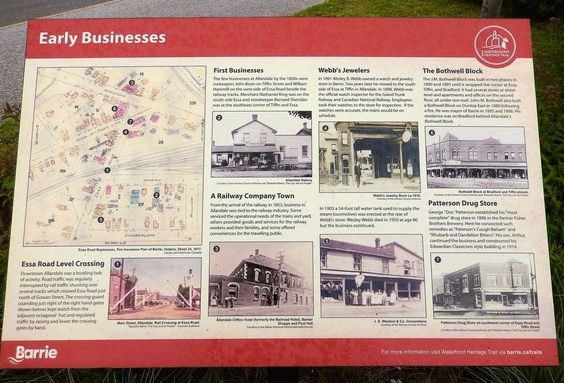
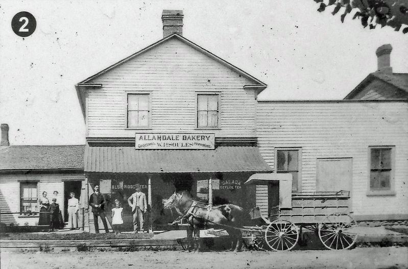
The few businesses at Allandale by the 1850s were innkeepers John Boon on Tiffin Street and William Hammill on the west side of Essa Road beside the railway tracks. Merchant Nathaniel King was on the south side of Essa and storekeeper Bernard Sheridan was at the southeast corner of Tiffin and Essa.
A Railway Company Town
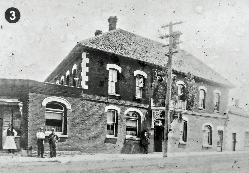
From the arrival of the railway in 1853, business in Allandale was tied to the railway industry. Some serviced the operational needs of the trains and yard, others provided goods and services for the railway workers and their families, and some offered conveniences for the travelling public.
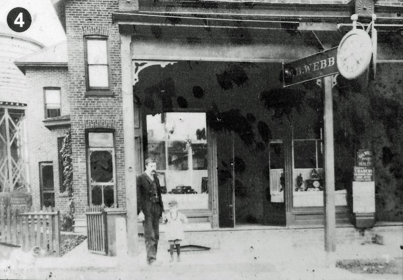
Webb's Jewelers
In 1891 Wesley B. Webb owned a watch and jewelry store in Barrie. Two years later he moved
this page online
In 1903 a 54-foot tall water tank used to supply the steam locomotives was erected at the rear of Webb's store. Wesley Webb died in 1950 at age 80 but the business continued.
The Bothwell Block
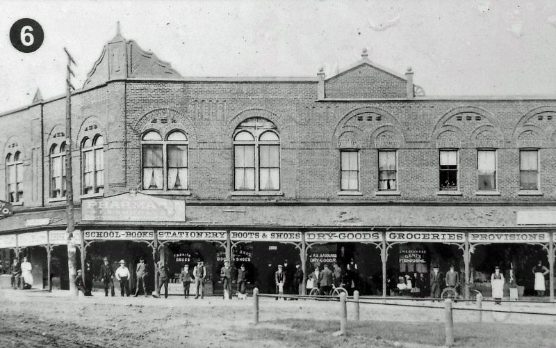
The J.M. Bothwell Block was built in two phases in 1890 and 1891 until it wrapped the corner at Essa, Tiffin, and Bradford. It had several stores at street level and apartments and offices on the second floor, all under one roof. John M. Bothwell also built a Bothwell Block on Dunlop East in 1880 following a fire. He was mayor of Barrie in 1895 and 1896. His residence was on Bradford behind Allandale's Bothwell Block.
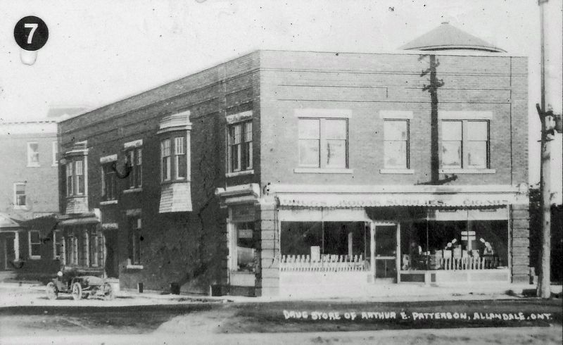
Patterson Drug Store
George “Doc” Patterson established his “most complete” drug store in 1896 in the former Fisher Brothers Brewery. Here he concocted such remedies as “Paterson's Cough Balsam” and “Rhubarb and Dandelion Bitters.” His son, Arthur, continued
Courtesy “Beautiful Barrie; The City and Its People”
2. Marker detail: Rail Crossing at Essa Road
Main Street, Allendale.
Erected by Barrie Waterfront Heritage Trail.
Topics. This historical marker is listed in these topic lists: Architecture • Industry & Commerce • Railroads & Streetcars. A significant historical year for this entry is 1853.
Location. 44° 22.449′ N, 79° 41.106′ W. Marker is in Barrie, Ontario, in Simcoe County. It is on Lakeshore Drive 0.3 kilometers east of Tiffin Street, on the left when traveling east. The marker is on the Barrie Waterfront Heritage Trail at Station #4 (Allandale Village), in South Shore Park. Touch for map. Marker is at or near this postal address: 155 Lakeshore Drive, Barrie ON L4N 7Y9, Canada. Touch for directions.

Regionally, this marker is in Central Ontario Cottage Country and specifically in Georgian Bay Country. It is also in Central Canada. Globally, it is in North America, on the Great Lakes, in the Western Hemisphere, in the Western World, and in the Anglosphere. Historically, it finds itself in what was once a British colony, the Viceroyalty of New France, the Haudenosaunee (Iroquois) Confederacy,
Courtesy “Beautiful Barrie; The City and Its People”
3. Marker detail: Allandale Bakery
Other nearby markers. At least 8 other markers are within walking distance of this marker: Housing Shortages (here, next to this marker); Allandale Railroad YMCA (here, next to this marker); Living in a Company Town (here, next to this marker); Train Town Kids (here, next to this marker); An Independent Village (here, next to this marker); Allandale Railway Station (about 90 meters away, measured in a direct line); In Recognition of the Rotary Club of Barrie Tree Planting Program (approx. 0.3 kilometers away); Steamboating on Lake Simcoe / La navigation à vapeur sur le lac Simcoe (approx. 0.3 kilometers away). Touch for a list and map of all markers in Barrie.
Related markers. Click here for a list of markers that are related to this marker. Barrie Waterfront Heritage Trail Station #4 — Allandale Village
Courtesy “Beautiful Barrie; The City and Its People”
4. Marker detail: Allandale Clifton Hotel, Barber Shoppe and Pool Hall
Formerly the Railroad Hotel.
Simcoe County Archives
5. Marker detail: Webb's Jewelry Store, circa 1910
Simcoe County Archives
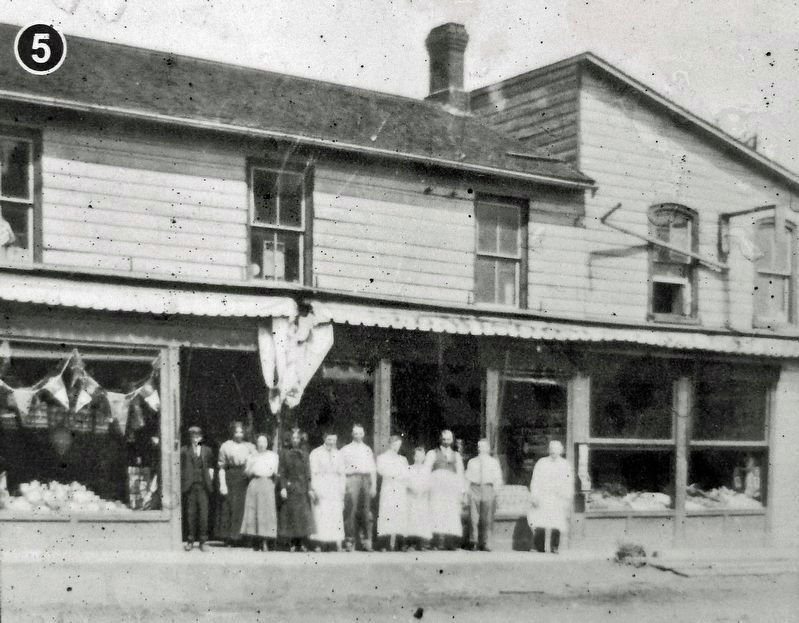
6. Marker detail: J. D. Wisdom & Co. Grocereteria
Simcoe County Archives & “Beautiful Barrie; The City and Its People”
7. Marker detail: Bothwell Block at Bradford and Tiffin Streets
Simcoe County Archives & “Beautiful Barrie; The City and Its People”
8. Marker detail: Patterson Drug Store
On southwest corner of Essa Road and Tiffin Street
Photographed by Cosmos Mariner, June 5, 2024
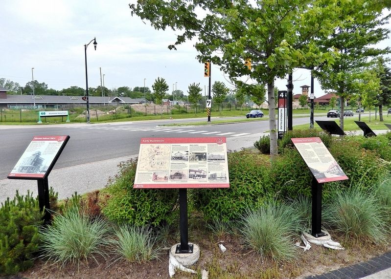
9. Early Businesses Marker
Looking west along Lakeshore Drive. This is one of six related interpretive panels at this location.
Credits. This page was last revised on May 27, 2025. It was originally submitted on May 24, 2025, by Cosmos Mariner of Cape Canaveral, Florida. This page has been viewed 103 times since then and 12 times this year. Photos: 1, 2, 3, 4, 5, 6, 7, 8, 9. submitted on May 26, 2025, by Cosmos Mariner of Cape Canaveral, Florida.
