Barrie in Simcoe County, Ontario — Central Canada (North America)
Housing Shortages
| — | Barrie Waterfront Heritage Trail | — |
Photographed by Cosmos Mariner, June 5, 2024
1. Housing Shortages Marker
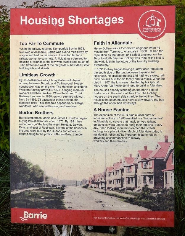
Too Far To Commute
When the railway reached Kempenfelt Bay in 1853, few lived at Allandale. Barrie was over a mile away by wagon and had no rail service. It was too far for a railway worker to commute. Anticipating a demand for housing at Allandale, the few who owned land south of Tiffin Street and west of the rail yards subdivided it into building lots and streets.
Limitless Growth
By 1855 Allandale was a busy station with trains arriving between Toronto and Collingwood. House construction was on the rise. The Hamilton and North Western Railway arrived in 1877, bringing more rail workers and their families. When the Grand Trunk Railway took over in 1888, growth seemed without limit. By 1892, 23 passenger trains arrived and departed daily. This schedule depended on a large workforce, who needed housing and services.
Burton Brothers
Barrie lumbermen Martin and James L. Burton began buying lots at Allandale about 1873. By 1891 they owned most of the land between Holgate, Gowan, Essa, and east of Robinson. Several of the houses in the area were built by the Burtons and others, no doubt adding to the profits of Burton Bros. Lumber.
this page online
Faith in Allandale
Henry Dollery was a locomotive engineer when he moved from Toronto to Allandale in 1880. He had the reputation as the fastest and safest engineer on the Toronto-North Bay run. Dollery was “one of the first to show his faith in the future of the town by building extensively.”
In 1891 Dollery began buying quarter acre lots along the south side of Burton, between Bayview and Robinson. He divided the lots and had two storey, red brick houses built for his family and to resell. When he died in 1907, the lots were inherited by his spouse Mary Anne (Vair) who continued to build in Allandale.
The houses already standing on the north side of Burton are in the centre of their lots. The Dollery houses on the south side straddle the lot lines. The result is the south houses have a view toward the bay through the north side driveways.
A House Famine
The expansion of the GTR plus a local burst of industrial activity in 1903 resulted in a “house famine” in Allandale so severe that newly arrived railway employees were unable to bring their families. Every day, “tired looking inquirers” roamed the streets looking for a place to live.
Photographed by Cosmos Mariner, June 5, 2024
2. Housing Shortages Marker
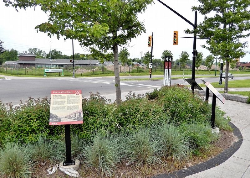
Looking southwest across Lakeshore Drive. This is one of six related interpretive panels at this location.
[background image caption] Burton Avenue, circa 1987
Erected by Barrie Waterfront Heritage Trail.
Topics. This historical marker is listed in these topic lists: Architecture • Industry & Commerce • Railroads & Streetcars. A significant historical year for this entry is 1853.
Location. 44° 22.45′ N, 79° 41.107′ W. Marker is in Barrie, Ontario, in Simcoe County. It is on Lakeshore Drive 0.3 kilometers east of Tiffin Street, on the left when traveling east. The marker is on the Barrie Waterfront Heritage Trail at Station #4 (Allandale Village), in South Shore Park. Touch for map. Marker is at or near this postal address: 155 Lakeshore Drive, Barrie ON L4N 7Y9, Canada. Touch for directions.

Regionally, this marker is in Central Ontario Cottage Country and specifically in Georgian Bay Country. It is also in Central Canada. Globally, it is in North America, on the Great Lakes, in the Western Hemisphere, in the Western World, and in the Anglosphere. Historically, it finds itself in what was once a British colony, the Viceroyalty of New France, the Haudenosaunee (Iroquois) Confederacy, and Rupert’s Land.
Other nearby markers. At least 8 other markers are within walking distance of this marker: Early Businesses (here, next to this marker); Allandale Railroad YMCA (here, next to this marker); Living in a Company Town (here, next to this marker); Train Town Kids (here, next to this marker); An Independent Village (here, next to this marker); Allandale Railway Station (within shouting distance of this marker); In Recognition of the Rotary Club of Barrie Tree Planting Program (approx. 0.3 kilometers away); Steamboating on Lake Simcoe / La navigation à vapeur sur le lac Simcoe (approx. 0.3 kilometers away). Touch for a list and map of all markers in Barrie.
Related markers. Click here for a list of markers that are related to this marker. Barrie Waterfront Heritage Trail Station #4 — Allandale Village
Credits. This page was last revised on May 27, 2025. It was originally submitted on May 24, 2025, by Cosmos Mariner of Cape Canaveral, Florida. This page has been viewed 112 times since then and 17 times this year. Photos: 1, 2. submitted on May 27, 2025, by Cosmos Mariner of Cape Canaveral, Florida.
