Bowmanville in Durham Region, Ontario — Central Canada (North America)
Bowmanville Cenotaph

Photographed by Tim Boyd, April 7, 2024
1. Bowmanville Cenotaph
They gave
their today
1914-1918
1939-1945
1950-1953.
In loving remembrance of all who served
Erected by the citizens of Bowmanville
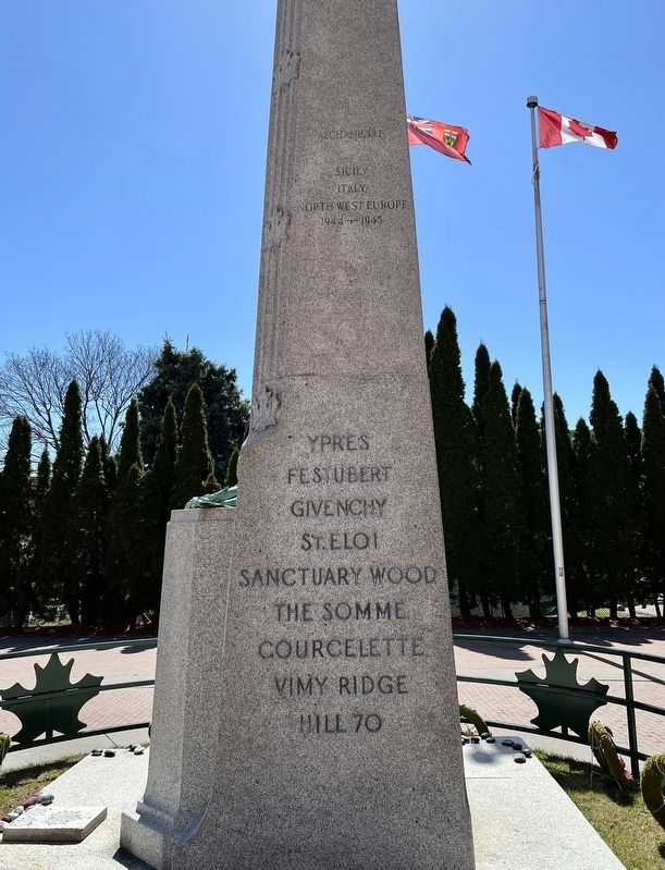
(battles and names of the fallen not transcribed)
Topics. This memorial is listed in these topic lists: War, Afghanistan • War, Korean • War, World I • War, World II.
Location. 43° 54.77′ N, 78° 41.352′ W. Memorial is in Bowmanville, Ontario, in Durham Region. It is on Temperance Street 0.1 kilometers north of King Street West, on the left when traveling north. Touch for map. Memorial is at or near this postal address: 40 Temperance Street, Bowmanville ON L1C 4V7, Canada. Touch for directions.

Regionally, this memorial is in Greater Toronto, specifically on the Golden Horseshoe, in the York, Durham and Headwaters Area, and in the Toronto Metropolitan Area. It is also in Central Canada. Globally, it is in North America, on the Great Lakes, in the Western Hemisphere, in the Western World, and in the Anglosphere. Historically, it finds itself in what was once a British colony, the Viceroyalty
this page online
Other nearby markers. At least 8 other markers are within walking distance of this marker: Bowmanville's First Volunteers, W.W. I (a few steps from this marker); Lt.-Col. Charles Robert McCullough (a few steps from this marker); Market Square, Town Hall & Horsey Block, 1880. (within shouting distance of this marker); Church and Temperance Street, circa 1880 (within shouting distance of this marker); Clarington Municipal Administration Centre (within shouting distance of this marker); Rathskamory Estate. Circa 1843 (within shouting distance of this marker); St. Andrew's Presbyterian Church (about 90 meters away, measured in a direct line); King Street, Circa 1900 (about 150 meters away).
Also see . . . Ontario War Memorials: Bowmanville. Includes a transcription of the names (on the east side of the cenotaph) of the individuals who were killed in action (Submitted on May 24, 2025, by Tim Boyd of Hamilton, Ontario.)
Photographed by Tim Boyd, April 7, 2024
2. Bowmanville Cenotaph, north side

Photographed by Tim Boyd, April 7, 2025
3. Bowmanville Cenotaph, south side

Photographed by Tim Boyd, April 7, 2024
4. Bowmanville Cenotaph, in Veterans’ Square
Credits. This page was last revised on May 30, 2025. It was originally submitted on May 24, 2025, by Tim Boyd of Hamilton, Ontario. This page has been viewed 142 times since then and 38 times this year. Photos: 1, 2, 3, 4. submitted on May 24, 2025, by Tim Boyd of Hamilton, Ontario. • Andrew Ruppenstein was the editor who published this page.
