Newcastle in Durham Region, Ontario — Central Canada (North America)
Newcastle Cenotaph
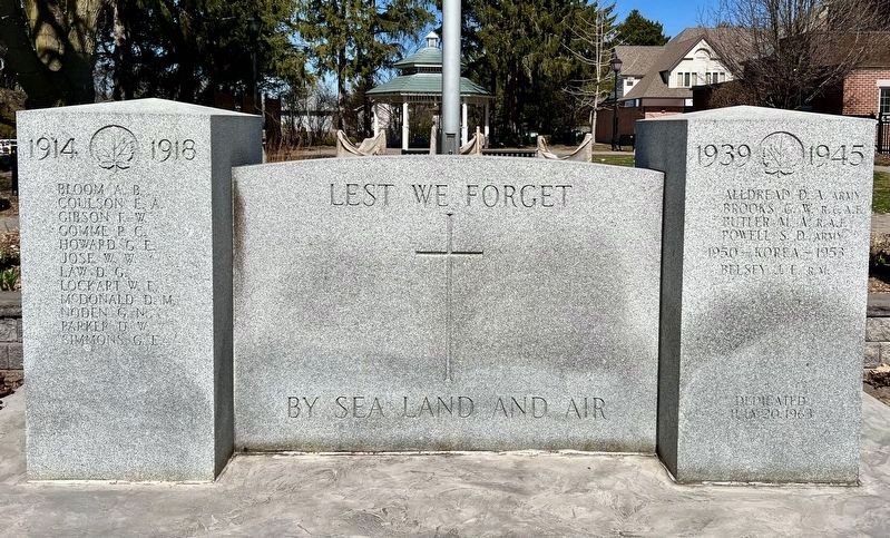
Photographed by Tim Boyd, April 7, 2024
1. Newcastle Cenotaph
Lest We Forget
By Sea Land and Air
1914 1918
Bloom A.B. · Coulson E.A. · Gibson F.W. · Gomme P.C. · Howard G.E. · Jose W.W. · Law D.G. · Lockart W.E. · McDonald D.M. · Noden G.M. · Parker D.W. · Simmons G.E.
1939 1945
Alldread D.A. Army
Brooks G.W. R.C.A.F.
Butler M.A. R.A.F.
Powell S.D. Army
1950 - Korea - 1953
Belsey J.E.
Erected 1963.
Topics. This memorial is listed in these topic lists: War, World I • War, World II.
Location. 43° 55.044′ N, 78° 35.382′ W. Memorial is in Newcastle, Ontario, in Durham Region. It is on King Avenue West 0.1 kilometers west of Mill Street North, on the right when traveling west. Touch for map. Memorial is at or near this postal address: 72 King Ave W, Newcastle ON L1B 1H7, Canada. Touch for directions.

Regionally, this memorial is in Greater Toronto, specifically on the Golden Horseshoe, in the York, Durham and Headwaters Area, and in the Toronto Metropolitan Area. It is also in Central Canada. Globally, it is in North America, on the Great Lakes, in the Western Hemisphere,
this page online
Other nearby markers. At least 8 other markers are within 8 kilometers of this marker, measured as the crow flies: The Masseys at Newcastle / Les Massey à Newcastle (about 210 meters away, measured in a direct line); Joseph E. Atkinson 1865-1948 (approx. 0.3 kilometers away); Bishop Charles Henry Brent 1862-1929 (approx. 0.4 kilometers away); Newcastle Fish Hatchery 1868 (approx. 1.6 kilometers away); Clarke Township Bicentennial Plaque (approx. 2.5 kilometers away); King Street, Circa 1900 (approx. 7.9 kilometers away); St. Andrew's Presbyterian Church (approx. 7.9 kilometers away); Church and Temperance Street, circa 1880 (approx. 8 kilometers away).
Also see . . . Ontario War Memorials: Newcastle. (Submitted on May 24, 2025, by Tim Boyd of Hamilton, Ontario.)

Photographed by Tim Boyd, April 7, 2024
2. Newcastle Cenotaph
Credits. This page was last revised on May 30, 2025. It was originally submitted on May 24, 2025, by Tim Boyd of Hamilton, Ontario. This page has been viewed 94 times since then and 21 times this year. Photos: 1, 2. submitted on May 24, 2025, by Tim Boyd of Hamilton, Ontario. • Andrew Ruppenstein was the editor who published this page.
