
Appalachia in Wise County, Virginia — The American South (Mid-Atlantic)
Appalachia: A Legacy of Railroading
Town of Appalachia
| — | Powell River Trail | — |
Photographed by J. J. Prats, May 16, 2025
1. Appalachia Marker
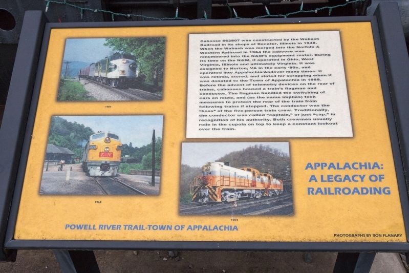
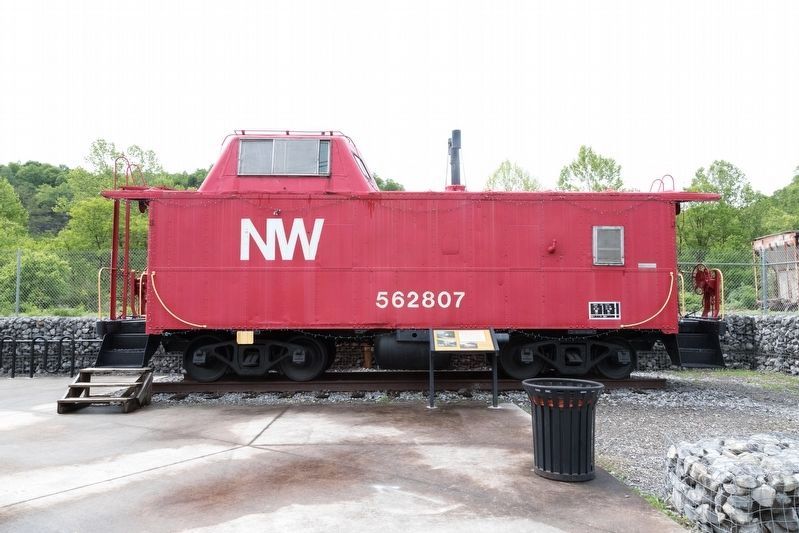
Before the advent of telemetry devices on the rear of trains, cabooses housed a train’s flagman and conductor. The flagman handled the switching of cars en route, and (as the name implies) took measures to protect the rear of the train from following trains if stopped. The conductor was the “boss” of the five-person train crew. Traditionally, the conductor was called “captain,” or just “cap,” in recognition of his authority. Both crewmen usually rode in the cupola on top to keep a constant lookout over the train.
Topics. This historical marker is listed in this topic list:
this page online
Location. 36° 53.995′ N, 82° 47.318′ W. Marker is in Appalachia, Virginia, in Wise County. It is on West Main Street (Business U.S. 23) 0.2 miles west of Inman Street (Route 68), on the right when traveling south. It is at the Powell River Trailhead parking lot. Touch for map. Marker is at or near this postal address: 751 W Main St, Appalachia VA 24216, United States of America. Touch for directions.

Regionally, this marker is in Southwest Virginia. It is also in the American South, specifically in the Upper South, in Appalachia, and specifically in Southern Appalachia. Globally, it is in the North Atlantic Region, North America, the Western Hemisphere, the Western World, and the Anglosphere. Historically, it finds itself in what was once the original Cherokee Nation, the territory of the Mississippian Culture, one of the original Thirteen Colonies, one of the Confederate States of America, and the Antebellum South.
Other nearby markers. At least 8 other markers are within 3 miles of this marker, measured as the crow flies: In Memory of Johnny Cubine
Photographed by J. J. Prats, May 16, 2025
2. N&W Caboose 562807 and its Historical Marker
More about this marker. The marker is illustrated with three locomotive photographs by Ron Flanary. Southern Railway locomotive 3499 is captioned 1984, L&N locomotive 1828 is captioned 1965, and Interstate locomotive 34 is captioned 1964. Click on photo No. 1 to zoom in to examine the photos.
Credits. This page was last revised on May 26, 2025. It was originally submitted on May 26, 2025, by J. J. Prats of Powell, Ohio. This page has been viewed 145 times since then and 16 times this year. Photos: 1, 2. submitted on May 26, 2025, by J. J. Prats of Powell, Ohio.
