Erie in Erie County, Pennsylvania — The American Northeast (Mid-Atlantic)
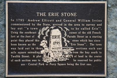
The Erie Stone
Photographed by Dale K. Benington, August 1, 2009
1. The Erie Stone Marker
Topics. This historical marker is listed in this topic list: Settlements & Settlers. A significant historical year for this entry is 1795.
Location. 42° 8.246′ N, 80° 4.804′ W. Marker is in Erie, Pennsylvania, in Erie County. It is at the intersection of East Front Street and Parade Street, on the right when traveling west on East Front Street. Touch for map. Marker is in this post office area: Erie PA 16507, United States of America. Touch for directions.

Regionally, this marker is in Northwestern Pennsylvania. It is also in the American Northeast, in the Mid-Atlantic,
this page online
Other nearby markers. At least 8 other markers are within walking distance of this marker: American Fort (here, next to this marker); Erie Heritage (here, next to this marker); Erie Area Native Americans (here, next to this marker); Fort Presque Isle (here, next to this marker); Fort de la Presqu'ile (here, next to this marker); French Fort de la Presqu'isle - 1753 (here, next to this marker); Russian Town / Pycckое Cоседство (approx. 0.2 miles away); Hero of Gettysburg (approx. 0.3 miles away). Touch for a list and map of all markers in Erie.
Photographed by Dale K. Benington, August 1, 2009
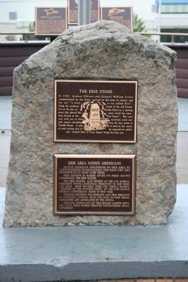
2. The Erie Stone Marker
View of both the historical marker and of the actual "Erie Stone."
Photographed by Dale K. Benington, August 1, 2009
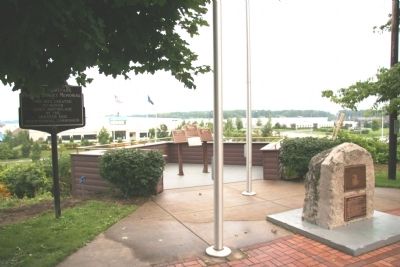
3. The Erie Stone Marker
View of Heritage Park that marked the location of not only the French and British forts, but also of the "Erie Stone" which can be seen in the right foreground of the picture.
Credits. This page was last revised on June 16, 2016. It was originally submitted on February 10, 2010, by Dale K. Benington of Toledo, Ohio. This page has been viewed 2,099 times since then and 92 times this year. Photos: 1, 2, 3. submitted on February 10, 2010, by Dale K. Benington of Toledo, Ohio.
