
West Dean in Wiltshire, England, United Kingdom — Northwestern Europe (the British Isles)
West Dean School
| — | West Dean Village History Trail | — |
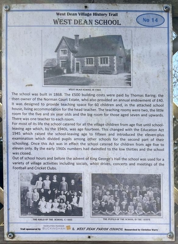
Photographed by Ray Gurganus, April 1, 2025
1. West Dean School Marker
For most of its life the school catered for all the village children from age five until school-leaving age which, by the 1940s, was age fourteen. This changed with the Education Act 1945 which raised the school-leaving age to fifteen and introduced the eleven-plus examination which divided pupils among other schools for the second part of their schooling. Once this Act was in effect the school catered for children from age five to eleven only. By the early 1960s numbers had dwindled to the low thirties and the school was closed.
Out of school hours and before the advent of King George's Hall the school was used for a variety of village activities including
this page online
Erected by West Dean Parish Council. (Marker Number 14.)
Topics. This historical marker is listed in this topic list: Education. A significant historical year for this entry is 1868.
Location. 51° 2.554′ N, 1° 38.114′ W. Marker is in West Dean, England, in Wiltshire. It is on Rectory Hill. Touch for map. Marker is at or near this postal address: Rectory Hill, West Dean, England SP5 1JQ, United Kingdom. Touch for directions.

Regionally, this marker is in South West England. Globally, it is on the Atlantic Ocean, in the North Atlantic Region, in Europe, in Atlantic Europe, on one of the British Isles, in the Western World, and in the Anglosphere. Historically, it finds itself in what was once the Roman Empire.
Other nearby markers. At least 8 other markers are within walking distance of this marker: Dean House (here, next to this marker); The Post Office (here, next to this marker); The Wheelwright's and Blacksmith's Shop (here, next to this marker); Royal Naval Armaments Depot (here, next to this marker); Bridge Cottage (here, next to this marker); King George's Hall (here, next to this marker); Garage and Petrol Station (here, next to this marker); Henrietta Crook House (here, next to this marker). Touch for a list and map of all markers in West Dean.
Credits. This page was last revised on June 3, 2025. It was originally submitted on May 27, 2025, by Ray Gurganus of Washington, District of Columbia. This page has been viewed 70 times since then and 9 times this year. Photo 1. submitted on May 27, 2025, by Ray Gurganus of Washington, District of Columbia. • Andrew Ruppenstein was the editor who published this page.
