Totnes in Devon, England, United Kingdom — Northwestern Europe (the British Isles)
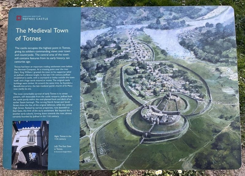
The Medieval Town of Totnes
Totnes Castle
Photographed by Ray Gurganus, April 6, 2025
1. The Medieval Town of Totnes Marker
Totnes had been an important trading settlement even before the Norman Conquest. At a crossing point over the river Dart, King William I granted the town to his supporter Juhel or Judhael a Breton knight. In the late 11th century, Judhael established a castle, with a courtyard or bailey outside the town itself, and a huge earth mound or motte. The original castle buildings were timber. At around the same time, he founded a Benedictine priory, the late medieval parish church of St Mary now marks its site.
The most remarkable survival of early Totnes is its street pattern, still detectable from the castle ramparts. Judhael built the castle partly within the oval-planned bank and ditch of an earlier Saxon borough. The curving North Street and South Street show the line of the original defences, while the central High Street, flanked by narrow properties, runs downhill to East Gate, the limit of the early settlement.
this page online
Erected by English Heritage.
Topics. This historical marker is listed in this topic list: Forts and Castles.
Location. 50° 25.941′ N, 3° 41.447′ W. Marker is in Totnes, England, in Devon. It can be reached from Castle Street. On the grounds of Totnes Castle. Touch for map. Marker is at or near this postal address: 11A Castle Street, Totnes, England TQ9 5NU, United Kingdom. Touch for directions.

Regionally, this marker is in South West England. Globally, it is on the Atlantic Ocean, in the North Atlantic Region, in Europe, in Atlantic Europe, on one of the British Isles, in the Western World, and in the Anglosphere. Historically, it finds itself in what was once the Roman Empire.
Other nearby markers. At least 8 other markers are within 10 kilometers of this marker, measured as the crow flies: The Shell Keep (a few steps from this marker); The Castle Bailey (within shouting distance of this marker); Welcome to The Market Square (about
Photographed by Ray Gurganus, April 6, 2025
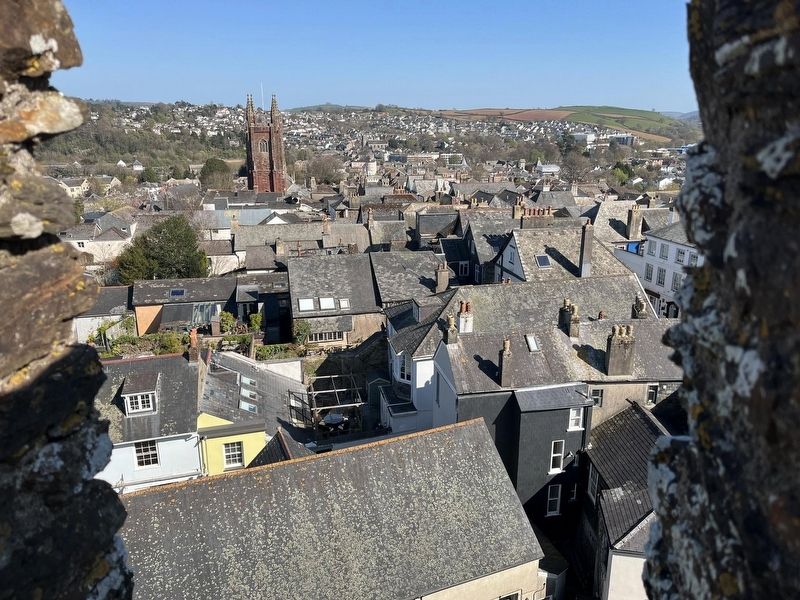
2. Looking down at Totnes from the top of the castle
Credits. This page was last revised on May 28, 2025. It was originally submitted on May 28, 2025, by Ray Gurganus of Washington, District of Columbia. This page has been viewed 93 times since then and 11 times this year. Photos: 1, 2. submitted on May 28, 2025, by Ray Gurganus of Washington, District of Columbia. • Andrew Ruppenstein was the editor who published this page.
