Totnes in Devon, England, United Kingdom — Northwestern Europe (the British Isles)
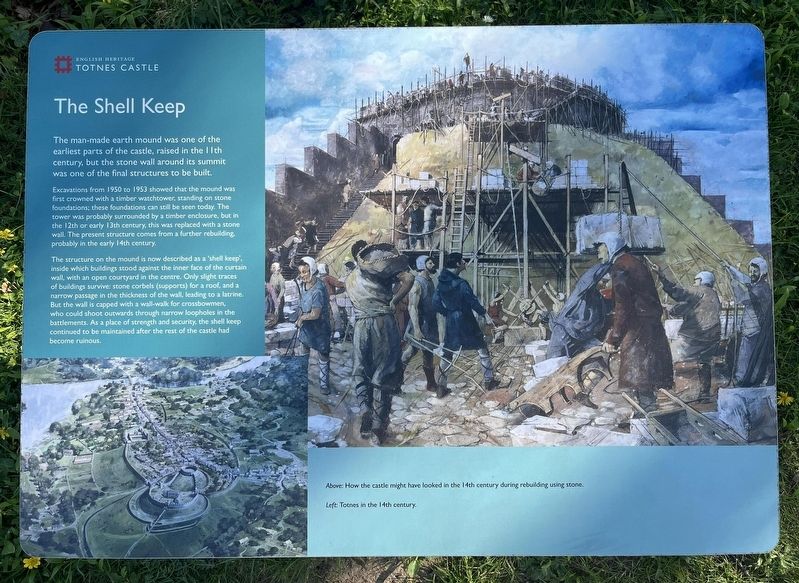
The Shell Keep
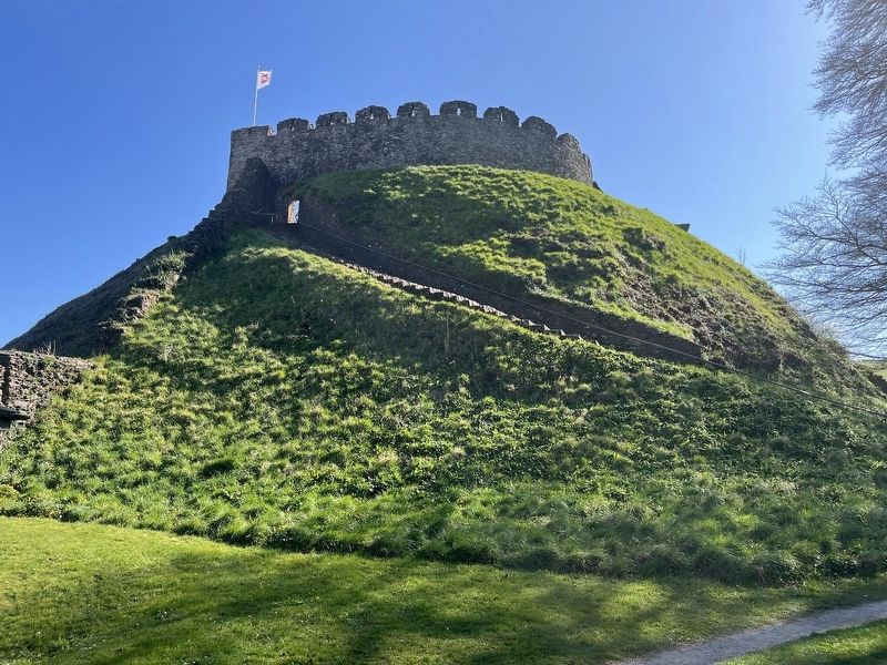
Totnes Castle
Photographed by Ray Gurganus, April 6, 2025
1. The Shell Keep Marker
Excavations from 1950 to 1953 showed that the mound was first crowned with a timber watchtower, standing on stone foundations; these foundations can still be seen today. The tower was probably surrounded by a timber enclosure, but in the 12th or early 13th century, this was replaced with a stone wall. The present structure comes from a further rebuilding probably in the early 14th century.
The structure on the mound is now described as a 'shell keep', inside which buildings stood against the inner face of the curtain wall, with an open courtyard in the centre. Only slight traces of buildings survive: stone corbels (supports) for a roof, and a narrow passage in the thickness of the wall, leading to a latrine. But the wall is capped with a wall-walk for crossbowmen who could shoot outwards through narrow loopholes in the battlements. As a place of strength and security, the shell keep continued to be maintained after the rest of the castle
this page online
Erected by English Heritage.
Topics. This historical marker is listed in this topic list: Forts and Castles.
Location. 50° 25.939′ N, 3° 41.454′ W. Marker is in Totnes, England, in Devon. It can be reached from Castle Street. On the grounds of Totnes Castle. Touch for map. Marker is at or near this postal address: 11A Castle St, Totnes, England TQ9 5NU, United Kingdom. Touch for directions.

Regionally, this marker is in South West England. Globally, it is on the Atlantic Ocean, in the North Atlantic Region, in Europe, in Atlantic Europe, on one of the British Isles, in the Western World, and in the Anglosphere. Historically, it finds itself in what was once the Roman Empire.
Other nearby markers. At least 8 other markers are within 10 kilometers of this marker, measured as the crow flies: The Medieval Town of Totnes (a few steps from this marker); The Castle Bailey (within shouting distance of this marker); Welcome to The Market Square (about 150 meters away, measured in a direct line); Ann Ball (about 210 meters away); The Shady Garden (approx.
Photographed by Ray Gurganus, April 6, 2025
2. Totnes Castle
Credits. This page was last revised on May 29, 2025. It was originally submitted on May 28, 2025, by Ray Gurganus of Washington, District of Columbia. This page has been viewed 97 times since then and 9 times this year. Photos: 1, 2. submitted on May 28, 2025, by Ray Gurganus of Washington, District of Columbia. • Andrew Ruppenstein was the editor who published this page.
