Sharbot Lake in Central Frontenac in Frontenac County, Ontario — Central Canada (North America)
Mile Board
Photographed by William Fischer, Jr., May 12, 2025
1. Mile Board Marker
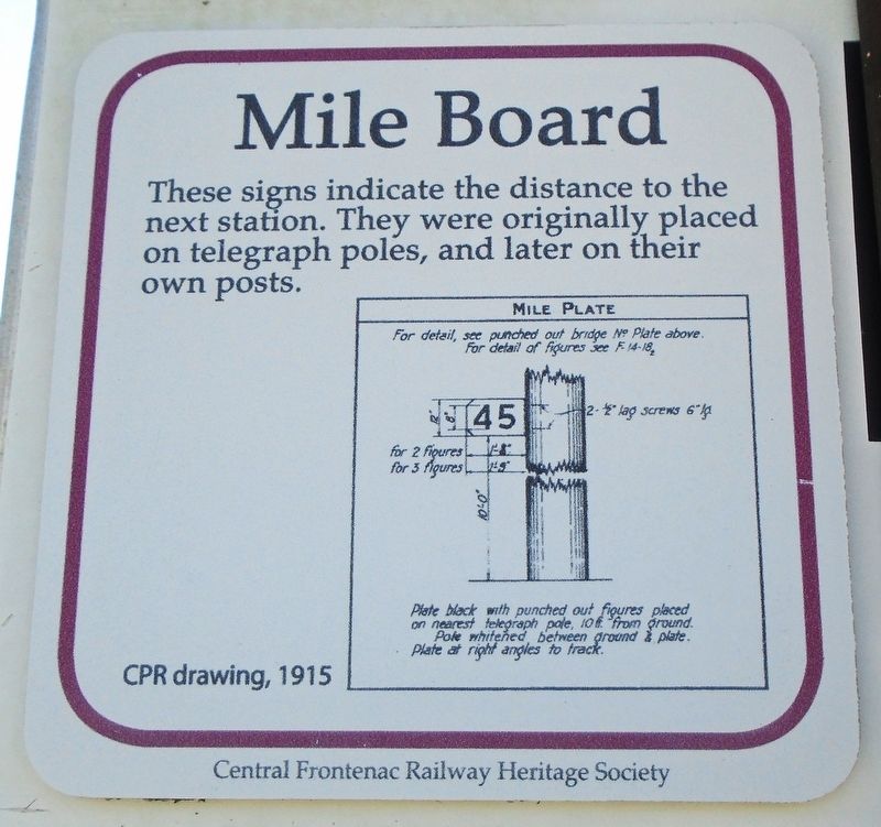
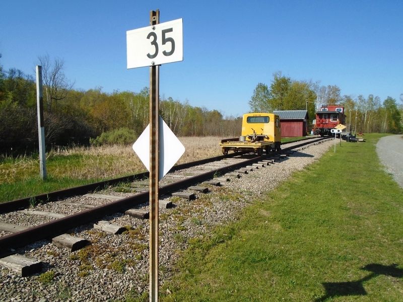
These signs indicate the distance to the next station. They were originally placed on telegraph poles, and later on their own posts.
CPR drawing, 1915 [reads]
MILE PLATE
For detail, see punched out bridge No Plate above.
For detail of figures see F-14-182
for 2 figures 1'-8"
for 3 figures 1'-9"
2-lag screws 6" lg.
10'-0" [height from sign to ground]
Plate black with punched out figures placed on nearest telegraph pole, 10 ft. from ground.
Pole whitened, between ground & plate.
Plate at right angles to track.
Erected 2017 by Central Frontenac Railway Heritage Society and Ontario Trillium Foundation.
Topics. This historical marker is listed in these topic lists: Communications • Railroads & Streetcars. A significant historical year for this entry is 1915.
Location. 44° 46.427′ N, 76° 41.337′ W. Marker is in Central Frontenac, Ontario, in Frontenac County. It is in Sharbot Lake. It is on Elizabeth Street just north of Robert Street, on the left when traveling north. Mile Board is in the Railway Heritage Park, adjacent to the former Canadian Pacific Railway grade, now part of the Trans Canada Trail. Touch for map.
this page online

Regionally, this marker is in Eastern Ontario and specifically in Southeastern Ontario. It is also in Central Canada. Globally, it is in North America, on the Great Lakes, in the Western Hemisphere, in the Western World, and in the Anglosphere. Historically, it finds itself in what was once a British colony, the Viceroyalty of New France, the Haudenosaunee (Iroquois) Confederacy, and Rupert’s Land.
Other nearby markers. At least 8 other markers are within walking distance of this marker: Track Dolly (here, next to this marker); Section Gang Tools (a few steps from this marker); The Lining Bar (a few steps from this marker); Tie Plate (a few steps from this marker); Motor Car (a few steps from this marker); Section Car (a few steps from this marker); Flanger Sign (a few steps from this marker); Yard Limit (within shouting distance of this marker). Touch for a list and map of all markers in Central Frontenac.
Also see . . . Railway Heritage Park, Sharbot Lake ON. (Submitted on May 28, 2025, by William Fischer, Jr. of Reynoldsburg, Ohio.)
Photographed by William Fischer, Jr., May 12, 2025
2. Mile Board
Credits. This page was last revised on May 28, 2025. It was originally submitted on May 28, 2025, by William Fischer, Jr. of Reynoldsburg, Ohio. This page has been viewed 77 times since then and 12 times this year. Photos: 1, 2. submitted on May 28, 2025, by William Fischer, Jr. of Reynoldsburg, Ohio.
