
St Ives in Cornwall, England, United Kingdom — Northwestern Europe (the British Isles)
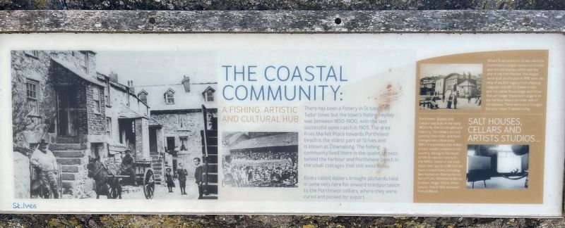
The Coastal Community
A Fishing, Artistic and Cultural Hub
Photographed by Ray Gurganus, April 7, 2025
1. The Coastal Community Marker
Boats called dippers brought pilchards held in seine nets here for onward transportation to the Porthmeor cellars where they were cured and packed for export.
Salt Houses, Cellars and Artists Studios...
Wharf Road and Fore Street, with the Fishermen's Lodges (unique to St Ives) and the old slipway which was the site of the Fish Market. The lodges were built on the plot in 1918, with the help of a £300 legacy from shipping magnate and MP Sir Edward Hain, and are called Rose Lodge and Shore Shelter Lodge. Shamrock Lodge is on the harbour beach on other side of the slipway. There were once 5 lodges but only these 3 remain today.
Porthrneor Studios and Cellars was built in the early 1800s for the St Ives pilchard industry.
this page online
Topics. This historical marker is listed in these topic lists: Arts, Letters, Music • Industry & Commerce. A significant historical year for this entry is 1905.
Location. 50° 12.926′ N, 5° 28.583′ W. Marker is in St Ives, England, in Cornwall. It is on Saint Eia Street. Touch for map. Marker is at or near this postal address: 14 St Eia Street, St Ives, England TR26 1PQ, United Kingdom. Touch for directions.

Regionally, this marker is in South West England. Globally, it is on the Atlantic Ocean, in the North Atlantic Region, on the Atlantic Arc, in Europe, on the Celtic Fringe, in Atlantic Europe, on one of the British Isles, in the Western World, and in the Anglosphere. Historically, it finds itself in what was once the Roman Empire.
Other nearby markers. At least 8 other markers are within 11 kilometers of this marker, measured as the crow flies: Shared Viewpoints (here, next to this marker); Pier & Now (here, next to this marker); The Island or St. Ives Head (about 210 meters away, measured in a direct line); St Nicholas Chapel (approx. 0.3 kilometers away); St Ives War Memorial (approx. 0.4 kilometers away); King Edward Landing (approx. 10.3 kilometers away); Victoria & Albert Visit (approx. 10.7 kilometers away); Footprints of HM the Queen (approx. 10.8 kilometers away). Touch for a list and map of all markers in St Ives.
Credits. This page was last revised on June 2, 2025. It was originally submitted on May 29, 2025, by Ray Gurganus of Washington, District of Columbia. This page has been viewed 76 times since then and 13 times this year. Photo 1. submitted on May 29, 2025, by Ray Gurganus of Washington, District of Columbia. • Andrew Ruppenstein was the editor who published this page.
Editor’s want-list for this marker. photo of the marker within its surroundings • Can you help?
