Mackinaw City in Emmet County, Michigan — The American Midwest (Great Lakes)
The modern history of this land
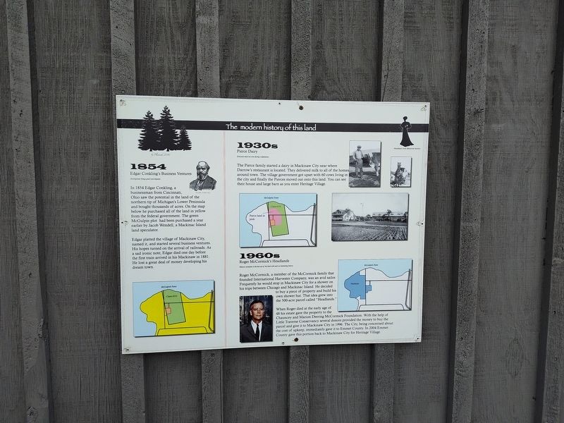
Photographed by Craig Doda, May 25, 2025
1. The modern history of this land Marker
1854
Edgar Conkling's Business Ventures
Development brings greed and disputes
In 1854 Edgar Conkling, a businessman from Cincinnati, Ohio saw the potential in the land of the northern tip of Michigan's Lower Peninsula and bought thousands of acres. On the map below he purchased all of the land in yellow from the federal government. The green McGulpin plot had been purchased a year earlier by Jacob Wendell, a Mackinac Island land speculator.
Edgar platted the village of Mackinaw City, named it, and started several business ventures. His hopes turned on the arrival of railroads. As a sad ironic note, Edgar died one day before the first train arrived in his Mackinaw in 1881. He lost a great deal of money developing his dream town.
1930s
Pierce Dairy
Everyone must out even during a depression.
The Pierce family started a dairy in Mackinaw City near where Darrow's restaurant is located. They delivered milk to all of the homes around town. The village government got upset with 60 cows living in the city and finally the Pierces moved out onto this land. You can see their house and large barn as you enter Heritage Village.
1960s
Roger
this page online
Historie recreation is the best use of the land with such an interesting history.
Roger McCormick, a member of the McCormick family that founded International Harvester Company, was an avid sailor. Frequently he would stop in Mackinaw City for a shower on his trips between Chicago and Mackinac Island. He decided to buy a piece of property and build his own shower hut. That idea grew into the 500-acre parcel called "Headlands."
When Roger died at the early age of 48 his estate gave the property to the Chauncey and Marion Deering McCormick Foundation. With the help of Little Traverse Conservancy several donors provided the money to buy the parcel and give it to Mackinaw City in 1996. The City, being concerned about the cost of upkeep, immediately gave it to Emmet County. In 2004 Emmet County gave this portion back to Mackinaw City for Heritage Village.
Topics. This historical marker is listed in these topic lists: Industry & Commerce • Settlements & Settlers. A significant historical year for this entry is 1854.
Location. 45° 46.624′ N, 84° 46.236′ W. Marker is in Mackinaw City, Michigan, in Emmet County.
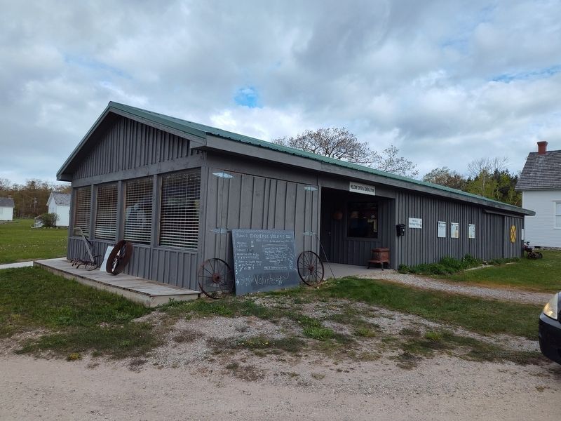
Photographed by Craig Doda, May 25, 2025
2. The modern history of this land Marker

Regionally, this marker is in Northern Michigan Lower Peninsula, on the Straits of Mackinac, and in one of the Lake Michigan Shore counties. It is also in the American Midwest. Globally, it is in North America, in the Great North Woods, on the Great Lakes, in the Western Hemisphere, in the Western World, and in the Anglosphere. Historically, it finds itself in what was once the Viceroyalty of New France and also the Northwest Territory.
Other nearby markers. At least 8 other markers are within walking distance of this marker: The early European history of this land (here, next to this marker); Mackinaw's General Store (a few steps from this marker); Sawmill (a few steps from this marker); Heritage Chapel (within shouting distance of this marker); Walk the Path to the Hidden Native Settlement (within shouting distance of this marker); Pest House (within shouting distance of this marker); Ice Harvesting (within shouting distance of this marker); The Cope Family Icehouse (within shouting distance of this marker). Touch for a list and map of all markers in Mackinaw City.
Credits. This page was last revised on June 2, 2025. It was originally submitted on May 30, 2025, by Craig Doda of Napoleon, Ohio. This page has been viewed 138 times since then and 36 times this year. Photos: 1, 2. submitted on May 30, 2025, by Craig Doda of Napoleon, Ohio. • Devry Becker Jones was the editor who published this page.
