City Center in Mankato in Blue Earth County, Minnesota — The American Midwest (Upper Plains)
First Presbyterian Church

Photographed by Koen Schneidawind, May 24, 2025
1. First Presbyterian Church Marker
The First Presbyterian Church of Mankato traces back to the very early days of the town's settlement. The first church meetings were held in 1855 in a log structure which served as a school and worship space for several congregations. The church outgrew the log structure and held services in several different locations in Mankato until the congregation built a brick church in 1863. The first service was held in 1864. The building, which was located on the corner diagonally across the street from the present-day structure, was dedicated the following year.
When the congregation outgrew their original building, they hired Minneapolis architect Warren H. Haynes and approved his design for a new building in 1890. The present-day location was purchased and work began on the current building in 1893. The first service was held here in December 1894 although the building was not finished until 1897. The congregation held its formal building dedication on September 2, 1896.
Builders used local stone in the church's construction. Haynes's design used the "Akron Plan" in which classrooms radiated out from the main sanctuary.
this page online
The building has changed internally and externally several times. An annex was built in 1927 and a chapel was added in 1959. Remodeling occurred in 1957, 1980, and 1993.
A bell was purchased by the congregation in 1857 for $300 using funds generated by the Ladies Sewing Sociable. Since there wasn't a church structure yet, the bell was placed on a wooden frame outside the schoolhouse. Each time the church moved, they took the bell along. Today, it is in the First Presbyterian Church's belfry.
This building was added to the National Register of Historic Places in 1980 and locally designated as a Heritage Preservation Landmark in 2010.
Erected by Blue Earth County Historical Society.
Topics. This historical marker is listed in this topic list: Religion & Religious Structures. A significant historical date for this entry is September 2, 1896.
Location. 44° 9.883′ N, 94° 0.117′ W. Marker is in Mankato, Minnesota, in Blue Earth County. It is in City Center. It is on East Hickory Street.

Photographed by Koen Schneidawind, May 24, 2025
2. First Presbyterian Church Marker Reverse

Regionally, this marker is in Southwest Minnesota and specifically in the Minnesota River Valley. It is also in the American Midwest and in the Corn Belt. Globally, it is in North America, the Western Hemisphere, the Western World, and the Anglosphere. Historically, it finds itself in what was once Rupert’s Land and also the territory of the Mississippian Culture.
Other nearby markers. At least 8 other markers are within walking distance of this marker: Sinclair Lewis House (about 300 feet away, measured in a direct line); Native Americans (about 400 feet away); Early European Explorers (about 600 feet away); Early Settlers (about 600 feet away); Navigating the River (about 700 feet away); Blue Earth County Courthouse (approx. 0.2 miles away); Korean War (approx. 0.2 miles away); Dakota (Sioux) Memorial – 1862 (approx. ¼ mile away). Touch for a list and map of all markers in Mankato.
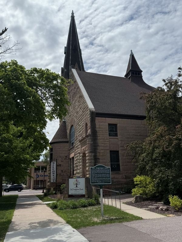
Photographed by Koen Schneidawind, May 29, 2025
3. First Presbyterian Church and Marker
Credits. This page was last revised on July 4, 2025. It was originally submitted on May 30, 2025, by Koen Schneidawind of Mankato, Minnesota. This page has been viewed 177 times since then and 35 times this year. Photos: 1, 2, 3. submitted on May 30, 2025, by Koen Schneidawind of Mankato, Minnesota. • J. Makali Bruton was the editor who published this page.
