Brandywine in Prince George's County, Maryland — The American Northeast (Mid-Atlantic)
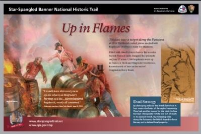
Up in Flames
Star-Spangled Banner National Historic Trail
| — | National Park Service, U.S. Department of the Interior | — |
Photographed by Anacostia Trails Heritage Area
1. Up in Flames Marker
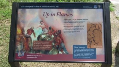
Tobacco was a target along the Patuxent in 1814. The British raided places stocked with hogsheads of tobacco ready for shipment. Filled with dried tobacco leaves, the wooden barrels burned easily. Imagine the spectacle on June 17 when 1,100 hogsheads went up in flames at Moil and Magruder warehouse, located north of here at the end of Magruders Ferry Road.
Dual Strategy
By destroying tobacco the British hit where it hurt most—the heart of the region’s economy. They had another reason for the raids. Joshua Barney’s Chesapeake Flotilla was out of reach in St. Leonard Creek. By increasing raids along the Patuxent, the British hoped to force Barney out to defend local property.
“It would have distressed you to see the tobacco at Magruder’s burning, as I did... Eleven hundred hogsheads, nearly all consumed.”
– Unknown merchant, New York Herald, June 25, 1814
Erected by National Park Service, U.S. Department of the Interior.
Topics and series. This historical marker is listed in this topic list: War of 1812. In addition, it is included in the Star-Spangled Banner National Historic Trail series list. A significant historical month for this entry is June 1861.
Location. 38° 38.399′ N,
this page online

Regionally, this marker is in the Washington Metropolitan Area. It is also in the American South, specifically in the Upper South, in the Mid-Atlantic, and on the Eastern Seaboard. Globally, it is in the North Atlantic Region, North America, the Western Hemisphere, the Western World, and the Anglosphere. Historically, it finds itself in what was once one of the original Thirteen Colonies and also the Antebellum South.
Other nearby markers. At least 8 other markers are within 5 miles of this marker, measured as the crow flies: Town Ravaged (approx. 1.3 miles away); Lower Marlboro Town (approx. 1.3 miles away); Warships and Raids
Photographed by F. Robby, August 20, 2013
2. Up in Flames Marker
Another marker is no longer nearby. Lower Marlboro (was approx. 1.3 miles away but has been confirmed missing).
Additional commentary.
1. Battle of Maguder's Ferry
"In reference to the warehouse at Magruder's Ferry, it appears that a considerable American force was stationed behind it. Being filled with tobacco, it afforded complete protection against the cannon of the enemy; and a battle was fought with the British vessels, which continued until the ammunition of our troops was exhausted, and they were consequently obliged to retreat. Upon the retreat of the American force, the British landed and burned the warehouse, with the tobacco of the petitioner R. Johnson, and others therein contained" – Senator James A. Bayard, Jr. In the Senate Feb. 17 1854.
— Submitted July 16, 2014, by Allen C. Browne of Silver Spring, Maryland.
Additional keywords. Star
Photographed by F. Robby, August 20, 2013
3. Up in Flames Marker
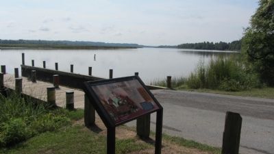
Looking south down the Patuxent River.
Photographed by F. Robby, August 20, 2013
4. Patuxent River
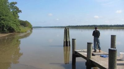
Looking north from the pier next to the marker.
Credits. This page was last revised on June 1, 2025. It was originally submitted on November 26, 2012, by Anacostia Trails Heritage Area of Hyattsville, Maryland. This page has been viewed 1,586 times since then and 108 times this year. Last updated on May 31, 2025, by Carl Gordon Moore Jr. of North East, Maryland. Photos: 1. submitted on November 26, 2012, by Anacostia Trails Heritage Area of Hyattsville, Maryland. 2, 3, 4. submitted on August 24, 2013, by F. Robby of Baltimore, Maryland. • Devry Becker Jones was the editor who published this page.
