Aquasco in Prince George's County, Maryland — The American Northeast (Mid-Atlantic)
Alarming Sight
Star-Spangled Banner Historic Trail
| — | National Park Service, U.S. Department of the Interior | — |
Photographed by Allen C. Browne, July 13, 2014
1. Alarming Sight Marker
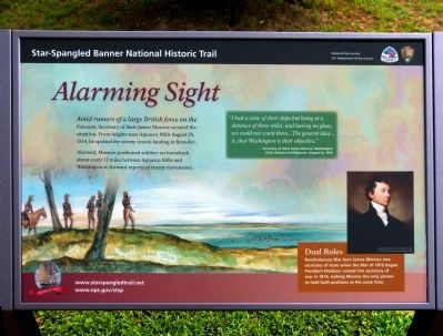
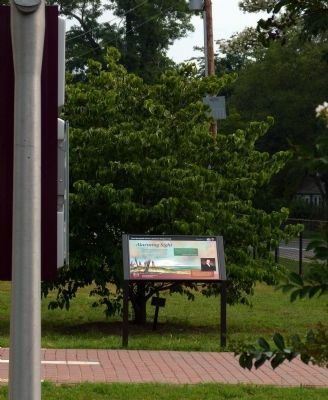
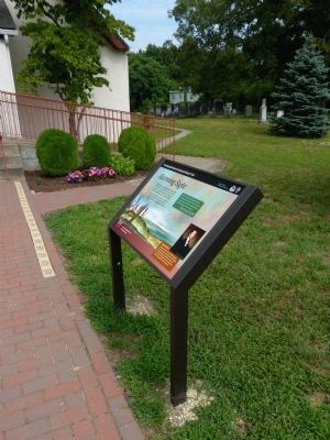
Amid rumors of a large British force on the Patuxent, Secretary of State James Monroe scouted the situation. From heights near Aquasco Mills August 20, 1814, he spotted the enemy vessels landing at Benedict.
Alarmed, Monroe positioned soldiers on horseback about every 12 miles between Aquasco Mills and Washington to forward reports of enemy movements.
"I had a view of their ships but being at a distance of three miles, and having no glass, we could not count them… The general idea… is, that Washington is their objective."- Secretary of State James Monroe, Washington Daily National Intelligencer, August 22, 1814
Erected 2014 by National Park Service, U.S. Department of the Interior.
Topics and series. This historical marker is listed in this topic list: War of 1812. In addition, it is included in the Former U.S. Presidents: #05 James Monroe series list. A significant historical year for this entry is 1814.
Location. 38° 35.094′ N, 76° 43.484′ W. Marker is in Aquasco, Maryland, in Prince George's County. It is on Aquasco Road south of Saint Mary's Church Road, on the right when traveling north. The marker stands
this page online

Regionally, this marker is in the Washington Metropolitan Area. It is also in the American South, specifically in the Upper South, in the Mid-Atlantic, and on the Eastern Seaboard. Globally, it is in the North Atlantic Region, North America, the Western Hemisphere, the Western World, and the Anglosphere. Historically, it finds itself in what was once one of the original Thirteen Colonies and also the Antebellum South.
Other nearby markers. At least 8 other markers are within 4 miles of this marker, measured as the crow flies: Brig Gen Leonard Covington (within shouting distance of this marker); Woodville School (approx. 0.7 miles away); Maxwell Hall (approx. 3.7 miles away); Test of a New Nation (approx. 3.7 miles away); Begin Your Adventure (approx. 3.7 miles away); a different marker also named Maxwell Hall (approx. 3.7 miles away); War of 1812 (approx. 3.7 miles away); Warships and Raids (approx. 3.9 miles away). Touch for a list and map
Photographed by Allen C. Browne, July 13, 2014
2. Alarming Sight Marker
Also see . . . Star-Spangled Banner National Historic Trail. Website homepage (Submitted on July 15, 2014, by Allen C. Browne of Silver Spring, Maryland.)
Photographed by Allen C. Browne, July 13, 2014
3. Alarming Sight Marker
Photographed by Allen C. Browne, July 13, 2014
4. St. Mary's Church
Photographed by Allen C. Browne, July 13, 2014
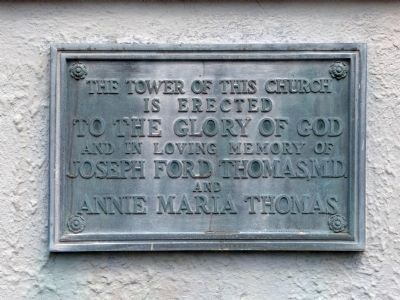
5. The Tower
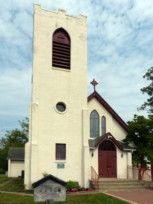
The Tower of this church is erected to the Glory of God and in loving memory of Joseph Ford Thomas, MD. and Annie Maria Thomas
Photographed by Allen C. Browne, July 13, 2014
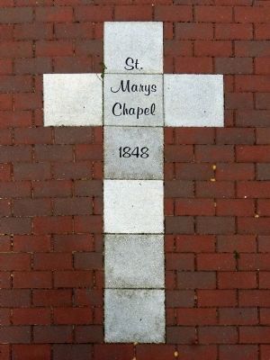
6. St. Mary's Chapel
1848
1848
Cross marked in the walkway in front of the church.
Credits. This page was last revised on June 1, 2025. It was originally submitted on July 15, 2014, by Allen C. Browne of Silver Spring, Maryland. This page has been viewed 889 times since then and 24 times this year. Last updated on May 31, 2025, by Carl Gordon Moore Jr. of North East, Maryland. Photos: 1, 2, 3, 4, 5, 6. submitted on July 15, 2014, by Allen C. Browne of Silver Spring, Maryland. • Devry Becker Jones was the editor who published this page.
