Thornhill in Vaughan in York Region, Ontario — Central Canada (North America)
Yonge Street Hill
Photographed by Cosmos Mariner, June 3, 2024
1. Yonge Street Hill Marker
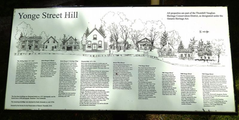
The Stirling Bank, 1917-1967
Prior to 1917, banking services, primarily to local farmers, were available at a smaller bank located just south of here in the centre store of the Francis block. In 1928 the Stirling Bank became the Standard Bank, which in turn became the Canadian Bank of Commerce in 1965. Throughout much of its history the upper rooms were used as a dentist's office. An earlier building at this location with quaint multi-paned corner windows, was occupied at various times by a general store, a saddlery, a crockery and china shop, and an undertaking establishment.
Herb Hooper's House
This house was built prior to 1870. Herb Hooper bought the carriage shop next door in 1898, and moved into this house in 1904, where he lived until 1929. In 1943 Alan Thorne, grandson of Benjamin Thorne had the house moved to 25 Thornbank Rd. It has since been demolished.
Herb Hooper's Carriage Shop
James Macdonald, a blacksmith built this house in 1883, possibly from brick acquired from Bishop's brickyard located just south of Thornhill Public school. This building was purchased by Herb Hooper, also a blacksmith, in 1898. He modified
this page online
The building was clad sometime before 1975 and remained a car dealership until 1990.
Victoria Hall, 1871-1961
Built of pine boards attached by wooden pegs and square nails, and covered with plaster and stucco, this elegant 30 ft. by 90 ft. building had a 25 ft. high ceiling and tall gothic windows. The corner stone was laid on July 1, 1871.
In July of 1874 Mlle Rosa D'Erina, the 'prima donna of Erin' or the 'Irish song bird' and an acclaimed singer in London and New York, performed here (admission: 35 cts.). Sir John A Macdonald, Prime Minister of Canada accompanied by Lady Macdonald attended another concert here in November, 1876, that featured at least six soloists, the Apollo Club choir and the Thornhill band. It is recorded that he was greeted with 'an enthusiastic outburst of applause' and
Photographed by Cosmos Mariner, June 3, 2024
2. Yonge Street Hill Marker
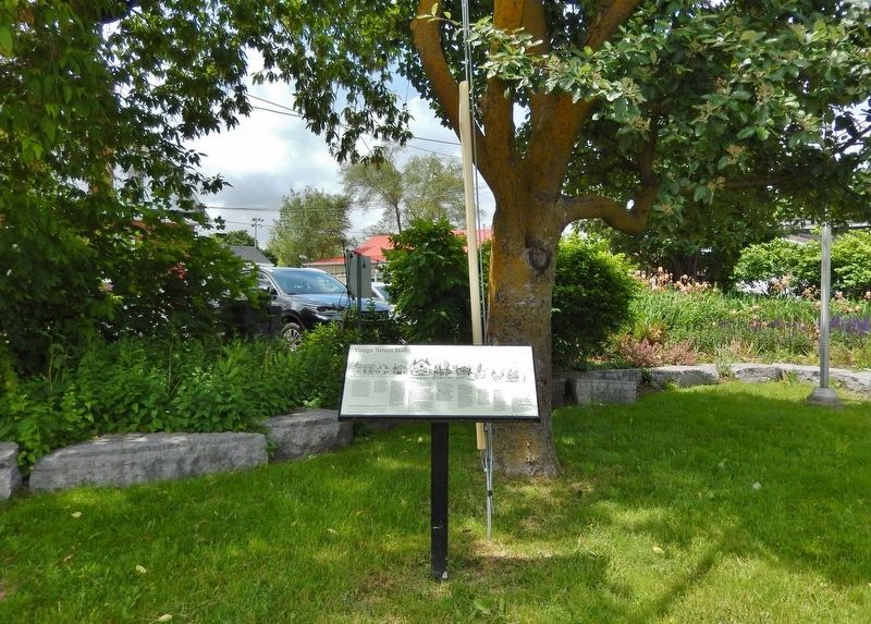
Looking north from Centre Street.
Over the years the building went through many changes. The Masons occupied a room here from 1875 to 1961. Interior and exterior renovations in 1901, 1912, and 1925, as well as later on, provided facilities for a library, a pool room, the Loyal Orange Lodge, horticultural shows, a restaurant, a barber shop, a drug store, a doughnut shop, a shoe repair shop, a hair salon, a gift shop and a jewelry store. In 1961, the Hall, much altered, was sold for $20,000 and subsequently demolished.
Robert West House
This Neo-classical frame house was built in 1843 by Robert West, a merchant, whose store, built in 1837, was located directly across the street. Mr. West's descendants have continuously owned this property, and his great granddaughter Louisa (Davie) Keith, who still resides here, has donated the property to the Thornhill Heritage Foundation, established on April 19, 2008. This house is listed on the Canadian Inventory of Historic Buildings, and the Ontario Inventory of Historic Buildings and is designated under
Photographed by Cosmos Mariner, June 3, 2024
3. Lion's Park
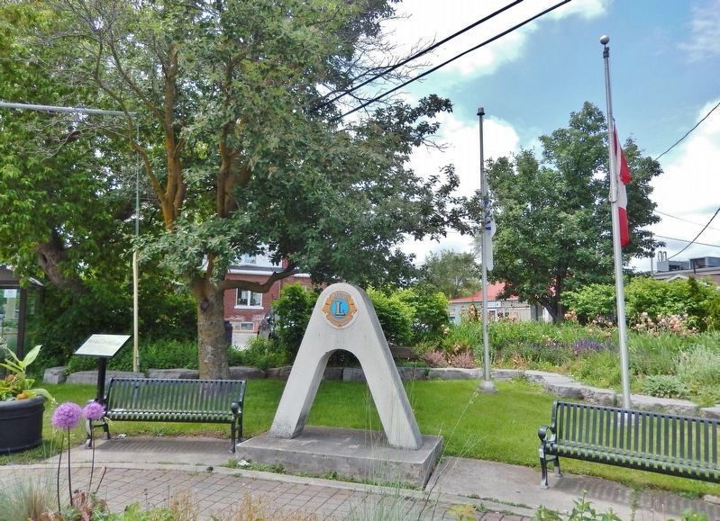
The marker is located in the Lion's Park at the northwest corner of the intersection. It is visible at the far left.
7794 Yonge Street
This Greek Revival frame church was built in 1846 by the British Methodist Congregation on Lot 31, Conc. 1 Vaughan, and was sold in 1850 to the Presbyterian church for 52 pounds, who then moved to its present location. They held their last service here on March 5, 1959.
This building was spared demolition in 1982 when it was lovingly restored by John and Kathleen Wilson. The building changed hands in 1992 and the current owners, the congregation of St. Michael's Memorial Chapel, under the direction of Anthony Wekerle have made further impressive improvements to the earlier restoration.
7802 Yonge Street
The empty lot directly north of the Presbyterian church was purchased in 1902 by local hardware store owner Robert Clark. Here he built a Planing mill which was sold to Charles Sinclair in 1928. The mill was closed in 1940 and Fred Ball built this house in 1941. It has been the home of the Trant family since 1958.
7808 Yonge Street
This Neo-classical stucco house was built by Edward Seager c. 1856. He, and his twin brother Edmund, sons of the Rev. John Seager of Bicknor, England, became interested in Canada after hearing the tales of a seafaring uncle. Unable to obtain parental permission to emigrate, they ran away at the age of 21 and came to Canada in 1832 on a schooner captained by their uncle. They prospered in Thornhill, developing a nearby farm and building a number of homes.
7822 Yonge Street
Edward Seager built this house in 1850 for his children. A 'back' road westward from this location led to the Seager farmstead on the north side of Centre Street near Bathurst. Mr. and Mrs. Harold Rowswell moved here in 1944. Mrs. Rowswell was a great granddaughter of John Hall Thompson, one of the Fathers of Confederation. She was also the sister of famed golfer Ada Mackenzie, who started the Ladies Golf Club of Toronto in Thornhill.
One of Mrs. Rowswell's daughters, Phyllis Ball, moved here in 1950 and lived here until her passing in 2005.
This house is listed on the Canadian Inventory of Historic Buildings and on the Ontario Inventory of Historic Buildings.
A house at 7830 Yonge Street was demolished in 1974.
All properties are part of the Thornhill Vaughn Heritage Conservation District, as designated under the Ontario Heritage Act.
[illustration legend]
• The first three buildings are illustrated based on a 1917 photograph, and the fourth from a 1900 photograph. Illustrator Tom Goldsmith
• The remaining buildings were sketched by Kathi Alexander ca. mid 1970s
Erected 2010 by Society for the Preservation of Historic Thornhill.
Topics. This historical marker is listed in these topic lists: Architecture • Arts, Letters, Music • Industry & Commerce • Settlements & Settlers.
Location. 43° 48.983′ N, 79° 25.491′ W. Marker is in Vaughan, Ontario, in York Region. It is in Thornhill. It is at the intersection of Centre Street and Yonge Street (Regional Road 1), on the right when traveling east on Centre Street. The marker is located in the Lion's Park at the northwest corner of the intersection. Touch for map. Marker is at or near this postal address: 7756 Yonge Street, Vaughan ON L4J 1W3, Canada. Touch for directions.

Regionally, this marker is in Greater Toronto, specifically on the Golden Horseshoe, in the York, Durham and Headwaters Area, and in the Toronto Metropolitan Area. It is also in Central Canada. Globally, it is in North America, the Western Hemisphere, the Western World, and the Anglosphere. Historically, it finds itself in what was once a British colony, the Viceroyalty of New France, the Haudenosaunee (Iroquois) Confederacy, and Rupert’s Land.
Other nearby markers. At least 8 other markers are within 8 kilometers of this marker, measured as the crow flies: Mason Cogswell's Wagon Yard (a few steps from this marker); The Founding of Thornhill (within shouting distance of this marker); J.E.H. MacDonald 1873-1932 (approx. 0.3 kilometers away); Holy Trinity Church (approx. 0.3 kilometers away); Unearthing Thoreau's Thornhill (approx. 0.3 kilometers away); Zion Evangelical Lutheran Church (approx. 6.6 kilometers away); The Founding of Richmond Hill (approx. 6.9 kilometers away); St. Andrew’s Church (approx. 8 kilometers away). Touch for a list and map of all markers in Vaughan.
Credits. This page was last revised on June 2, 2025. It was originally submitted on June 1, 2025, by Cosmos Mariner of Cape Canaveral, Florida. This page has been viewed 184 times since then and 73 times this year. Photos: 1, 2, 3. submitted on June 2, 2025, by Cosmos Mariner of Cape Canaveral, Florida.
