Cahaba in Dallas County, Alabama — The American South (East South Central)
What Happened to Cahaba
Photographed by Mark Hilton, June 1, 2025
1. What Happened to Cahaba Marker
Abandoned
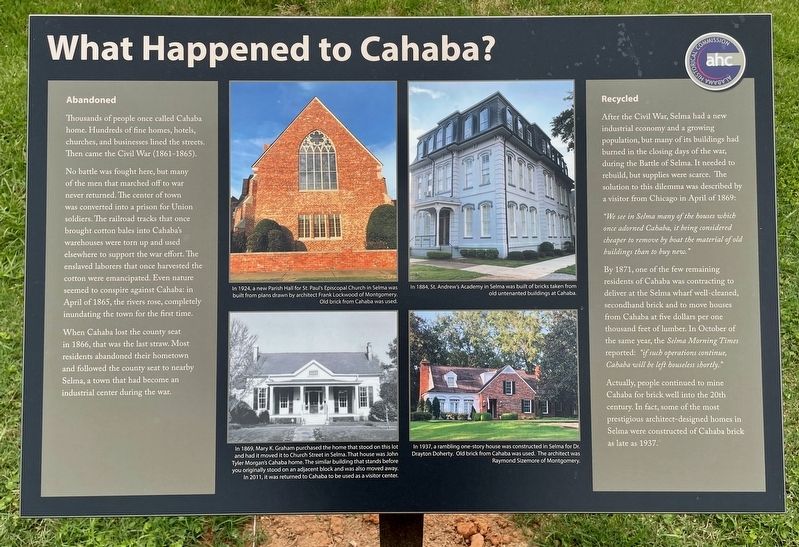
Thousands of people once called Cahaba home. Hundreds of fine homes, hotels, churches, and businesses lined the streets. Then came the Civil War (1861-1865).
No battle was fought here, but many of the men that marched off to war never returned. The center of town was converted into a prison for Union soldiers. The railroad tracks that once brought cotton bales into Cahaba's warehouses were torn up and used elsewhere to support the war effort. The enslaved laborers that once harvested the cotton were emancipated. Even nature seemed to conspire against Cahaba: in April of 1865, the rivers rose, completely inundating the town for the first time.
When Cahaba lost the county seat in 1866, that was the last straw. Most residents abandoned their hometown and followed the county seat to nearby Selma, a town that had become an industrial center during the war.
Recycled
After the Civil War, Selma had a new industrial economy and a growing population, but many of its buildings had burned in the closing days of the war, during the Battle of Selma. It needed to rebuild, but supplies
this page online
"We see in Selma many of the houses which once adorned Cahaba, it being considered cheaper to remove by boat the material of old buildings than to buy new."
By 1871, one of the few remaining residents of Cahaba was contracting to deliver at the Selma wharf well-cleaned, secondhand brick and to move houses from Cahaba at five dollars per one thousand feet of lumber. In October of the same year, the Selma Morning Times reported: "if such operations continue, Cahaba will be left houseless shortly."
Actually, people continued to mine Cahaba for brick well into the 20th century. In fact, some of the most prestigious architect-designed homes in Selma were constructed of Cahaba brick as late as 1937.
[Captions]
Middle left top: In 1924, a new Parish Hall for St. Paul's Episcopal Church in Selma was built from plans drawn by architect Frank Lockwood of Montgomery. Old brick from Cahaba was used.
Middle left bottom: In 1869, Mary K. Graham purchased the home that stood on this lot and had it moved it to Church Street in Selma. That house was John Tyler Morgan's Cahaba home. The similar building that stands before you originally stood on an adjacent block and was also moved away. In 2011, it was returned to Cahaba to be used as a visitor center.
Middle right top: In 1884, St. Andrew's Academy in Selma was built of bricks taken from old untenanted buildings at Cahaba.
Middle right bottom: In 1937, a rambling one-story house was constructed in Selma for Dr. Drayton Doherty. Old brick from Cahaba was used. The architect was Raymond Sizemore of Montgomery.
Erected 2024
Photographed by Mark Hilton, June 1, 2025
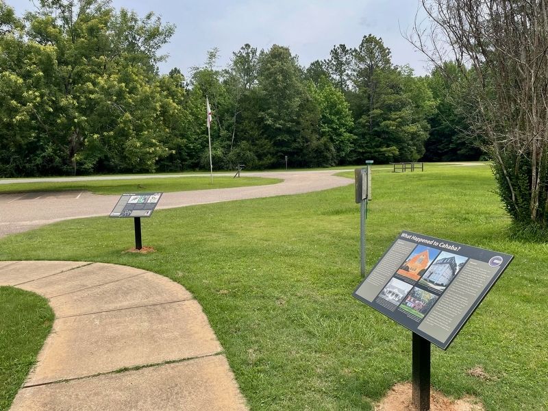
2. View from marker (foreground) towards Capitol Street.
Topics. This historical marker is listed in this topic list: Settlements & Settlers. A significant historical month for this entry is April 1865.
Location. 32° 19.163′ N, 87° 6.265′ W. Marker is in Cahaba, Alabama, in Dallas County. It is on Capitol Street east of Cahaba Road, on the right when traveling east. Located within the Old Cahawba Archaeological Park near the visitor center back door (nominal fee required). Touch for map. Marker is in this post office area: Orrville AL 36767, United States of America. Touch for directions.

Regionally, this marker is in the American South, specifically in the Deep South, and in the Black Belt. Globally, it is in North America, a Gulf of Mexico state, the Western Hemisphere, the Western World, and the Anglosphere. Historically, it finds itself in what was once New Spain, the territory of the Mississippian Culture, one of the Confederate States of America, and the Antebellum South.
Other nearby markers. At least 8 other markers are within walking distance of this marker: Black Belt Transformations (within shouting distance of this marker); Cahawba's Changing Landscape
Photographed by Mark Hilton, June 1, 2025
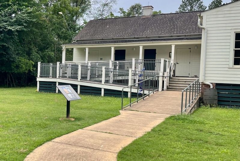
3. What Happened to Cahaba Marker near Visitor's Center.
Other markers no longer nearby. Missing Pieces (was a few steps from this marker but has been permanently removed); Alabama's Native Prairie (was within shouting distance of this marker but has been permanently removed).
Credits. This page was last revised on June 5, 2025. It was originally submitted on June 5, 2025, by Mark Hilton of Montgomery, Alabama. This page has been viewed 203 times since then and 37 times this year. Photos: 1, 2, 3. submitted on June 5, 2025, by Mark Hilton of Montgomery, Alabama.
