Thorold in Niagara Region, Ontario — Central Canada (North America)
Battle of Beaverdams
June 24, 1813
Photographed by Kevin Westell, April 26, 2025
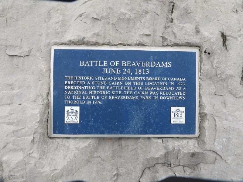
1. Battle Of Beaverdams June 24, 1813 Marker
The Historic Sites and Monuments Board Of Canada erected a stone cairn on this location in 1923, designating the Battlefield of Beaverdams as a National Historic Site. The cairn was relocated to The Battle Of Beaverdams Park in downtown Thorold in 1976.
Erected by City of Thorold.
Topics. This historical marker is listed in this topic list: War of 1812. A significant historical date for this entry is June 24, 1813.
Location. 43° 7.055′ N, 79° 11.124′ W. Marker is in Thorold, Ontario, in Niagara Region. It is at the intersection of Davis Road and Old Thorold Stone Road, on the right when traveling north on Davis Road. South-east corner of intersection, Davis Rd and Old Thorold Stone Rd. Touch for map. Marker is at or near this postal address: 3500 Davis Road, Thorold ON L2V 3Y5, Canada. Touch for directions.

Regionally, this marker is on the Golden Horseshoe and in Niagara Canada. It is also in Central Canada. Globally, it is in North America, on the Great Lakes, in the Western Hemisphere, in the Western World, and in the Anglosphere. Historically, it finds itself in what was once a British colony, the Viceroyalty
this page online
Other nearby markers. At least 8 other markers are within walking distance of this marker: Jack "JG" Walker 1907-1986 (approx. 0.9 kilometers away); Lynch House 1908 (approx. 0.9 kilometers away); The Ontario Paper Company Ltd. (approx. 0.9 kilometers away); Construction of the Welland Canals / La Construction des Canaux Welland (approx. 0.9 kilometers away); Bogardus House c.1875 (approx. 0.9 kilometers away); The Parsonage 1875 (approx. 0.9 kilometers away); Millar House c. 1876 (approx. one kilometer away); Stewart House c. 1860 (approx. one kilometer away). Touch for a list and map of all markers in Thorold.
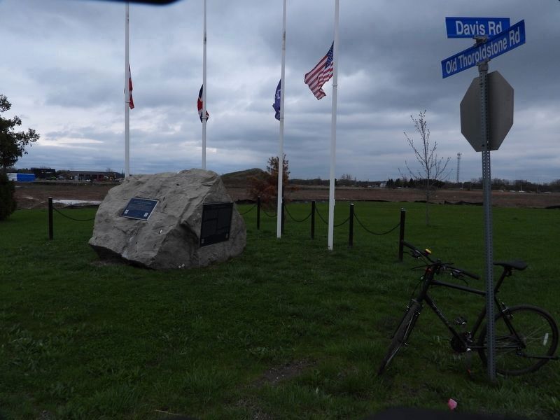
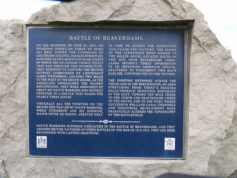
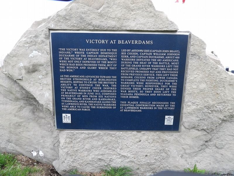
Regarding Battle of Beaverdams. The display is a boulder with 3 plaques, and 4 flagpoles with flags (Canada, Great Britain, Iroquois Confederacy, USA).
Photographed by Kevin Westell, April 26, 2025
2. View from road
Photographed by Kevin Westell, April 26, 2025
3. Plaque on left side
Photographed by Kevin Westell, April 26, 2025
4. Plaque on right side
Credits. This page was last revised on June 16, 2025. It was originally submitted on April 27, 2025, by Kevin Westell of St. Catharines, Ontario. This page has been viewed 123 times since then and 20 times this year. Last updated on June 7, 2025, by Kevin Westell of St. Catharines, Ontario. Photos: 1, 2, 3, 4. submitted on April 27, 2025, by Kevin Westell of St. Catharines, Ontario. • Devry Becker Jones was the editor who published this page.
