Springfield in Fairfax County, Virginia — The American South (Mid-Atlantic)
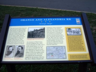
Orange and Alexandria RR
Strategic Target
The Lake Accotink access road here lies atop the original road bed of the Orange and Alexandria Railroad, chartered in 1849 to link the port city of Alexandria with Gordonsville in central Virginia. After the war began in 1861, railroads became strategically important for the transportation of troops and supplies. Since this part of the Orange and Alexandria fell under Union control early in the war, the Confederates targeted it to disrupt the movement of Federal forces. During Confederate General J.E.B. Stuart’s December 28, 1862, raid on nearby Burke Station, he tore up rails and cut telegraph lines. He also dispatched twelve men under Gen. Fitzhugh Lee (Robert E. Lee’s nephew) to burn the wooden trestle over Accotink Creek. The trestle was repaired and carried Union supplies for the duration of the war. Maj. John S. Mosby’s Rangers and Confederate civilians continued to make nighttime raids, however, tearing up tracks and attempting to derail trains. The raiders often concealed themselves in drainage culverts beneath the rail bed while waiting to sabotage passing trains. After a derailment attempt failed on July 26, 1863, Union Gen. George G. Meade ordered civilian saboteurs severely punished. To protect the railroad, the 155th New York and 4th Delaware Regiments camped along the tracks here.
(Sidebar)
The longest continuous stretch of surviving Orange and Alexandria Railroad bed in Fairfax County runs through Lake Accotink Park. The park occupies land that was originally part of the 22,000-acre Ravensworth tract that William Fitzhugh purchased in 1685. The Fitzhugh’s were related to the Lees, who often visited Ravensworth. In 1829, Robert E. Lee’s mother died there. Two years later, Robert E. Lee married Mary Randolph Custis, and the couple honeymooned at Ravensworth. Mary Custis Lee inherited Ravensworth after the war and moved there after Robert E. Lee died in 1870. The Lees’ second son, William Henry Fitzhugh “Rooney” Lee, inherited the tract on her death in 1874. The house, built about 1796, burned in 1926.
After his December 28, 1862, raid, Stuart and his men stopped at Sully Plantation in Western Fairfax County. To learn more about Sully’s role in the war, please visit the Sully Civil War Trails site.
Erected by Virginia Civil War Trails.
Topics and series. This historical marker is listed in these topic lists: Railroads & Streetcars • War, US Civil. In addition, it is included in the Orange and Alexandria Railroad, and the Virginia Civil War Trails series lists. A significant historical date for this entry is July 26, 1863.
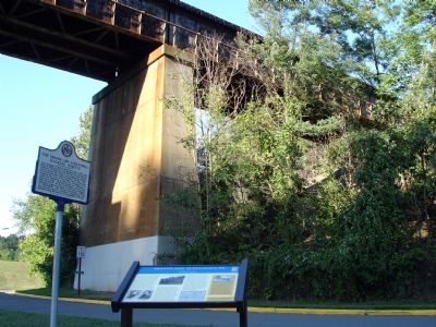
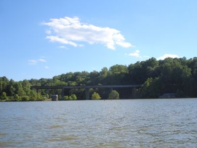
Location. Marker has been reported missing. It was located near 38° 47.553′ N, 77° 13.067′ W. Marker was in Springfield, Virginia, in Fairfax County. Marker was on Accotink Park Road, on the left when traveling east. It is in Accotink Park in the main parking lot that sits in front of the Lake Accotink dam and the current railroad bridge. Touch for map. Marker was in this post office area: Springfield VA 22150, United States of America. Touch for directions.
Other nearby markers. At least 8 other markers are within 3 miles of this location, measured as the crow flies. Orange and Alexandria Railroad (a few steps from this marker); Connecting Communities and Parks (within shouting distance of this marker); The Civilian Conservation Corps (approx. 0.4 miles away); a different marker also named Orange and Alexandria Railroad (approx. 0.6 miles away); Ravensworth (approx. 1.2 miles away); a different marker also named Ravensworth (approx. 1.2 miles away); Springfield Station (approx. 1.8 miles away); Keene’s Mill (approx. 2.1 miles away). Touch for a list and map of all markers in Springfield.
Credits. This page was last revised on March 18, 2023. It was originally submitted on September 28, 2007. This page has been viewed 2,906 times since then and 54 times this year. Photos: 1, 2, 3. submitted on September 28, 2007. • J. J. Prats was the editor who published this page.


