Novelty near Russell Township in Geauga County, Ohio — The American Midwest (Great Lakes)
Alaska Pipeline
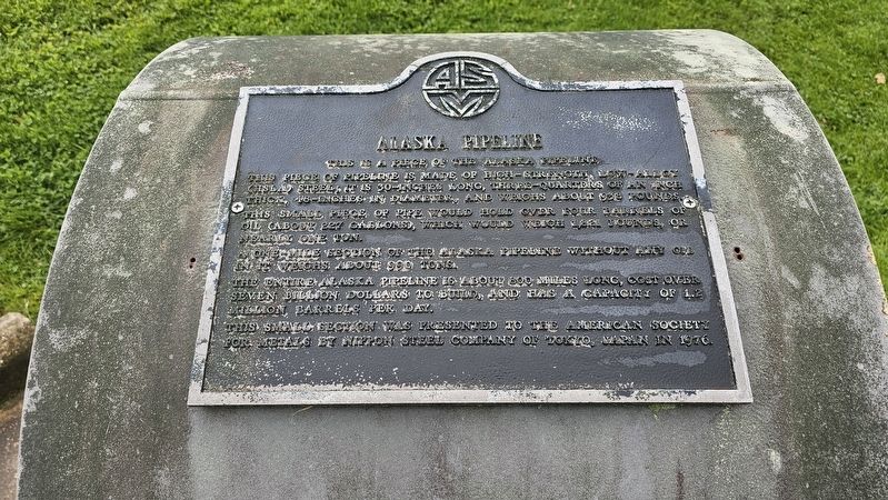
This is a piece of the Alaska pipeline.
Photographed by Ian Lefkowitz, May 23, 2025
1. Alaska Pipeline Marker
This piece of pipeline is made of high-strength, low-alloy (HSLA) steel; It is 30-inches long, three-quarters of an inch thick, 48-inches in diameter, and weighs about 938 pounds.
This small piece of pipe would hold over four barrels of oil (about 227 gallons), which would weigh 1,821 pounds, or nearly one ton.
A one-mile section of the Alaska pipeline without any oil in it weighs about 990 tons.
The entire Alaska pipeline is about 800 miles long, cost over seven billion dollars to build, and has a capacity of 1.2 million barrels per day.
This small section was presented to the American Society for Metals by Nippon Steel Company of Tokyo, Japan in 1976.
Erected 1976.
Topics. This historical marker is listed in these topic lists: Industry & Commerce • Natural Resources.
Location. 41° 27.621′ N, 81° 17.931′ W. Marker is near Russell Township, Ohio, in Geauga County. It is in Novelty. It can be reached from the intersection of Kinsman Road (Ohio Route 87) and Sleepy Hollow Drive (County Road 589), on the right when traveling east. Touch for map. Marker is
this page online

Regionally, this marker is in Greater Cleveland and in the Western Reserve. It is also in the American Midwest. Globally, it is in North America, on the Great Lakes, in the Western Hemisphere, in the Western World, and in the Anglosphere. Historically, it finds itself in what was once the Haudenosaunee (Iroquois) Confederacy, the territory of the Mississippian Culture, and the Northwest Territory.
Other nearby markers. At least 8 other markers are within 6 miles of this marker, measured as the crow flies: ASM International Headquarters and Geodesic Dome (within shouting distance of this marker); South Russell Veterans Memorial (approx. 2.9 miles away); Veterans Memorial (approx. 3.2 miles away); Chagrin Falls & Eastern Railway (approx. 4 miles away); This Tablet Marks the Site of Union Chapel (approx. 5 miles away); South Newbury Union Chapel (approx. 5 miles away); Centennial Oak / An Ohio Suffragist Legacy (approx. 5 miles away); Fowlers Mill Historic District / A.B. Carlson Building (approx. 5.2 miles
Photographed by Ian Lefkowitz, May 23, 2025
2. Alaska Pipeline
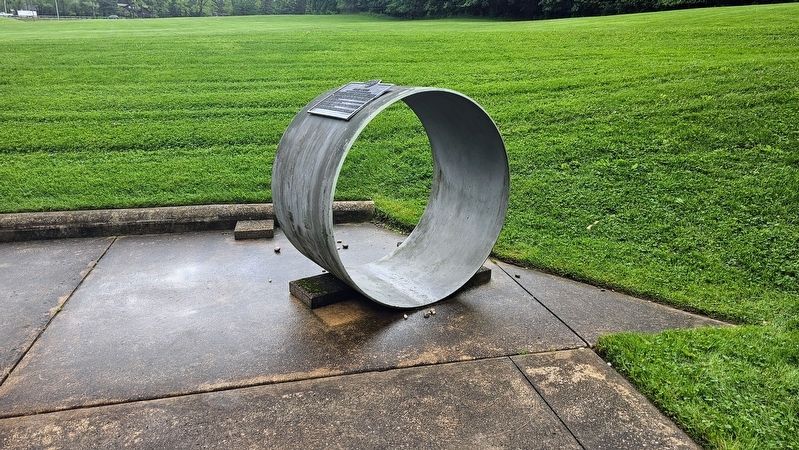
This piece of the Alaska Pipeline is found in ASM Materials Park, a historic park featuring ores and minerals, along with an outdoor geodesic dome.
Photographed by Ian Lefkowitz, May 23, 2025
3. ASM International Headquarters
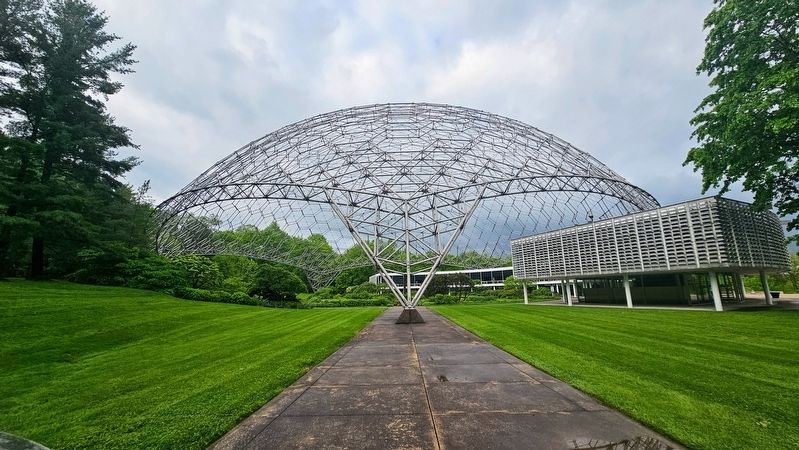
A view of ASM International Headquarters and the geodesic dome taken from the Alaska Pipeline marker.
Credits. This page was last revised on June 27, 2025. It was originally submitted on June 9, 2025, by Ian Lefkowitz of New York, New York. This page has been viewed 91 times since then and 22 times this year. Photos: 1, 2, 3. submitted on June 9, 2025, by Ian Lefkowitz of New York, New York. • Devry Becker Jones was the editor who published this page.
