Fort Snelling in Hennepin County, Minnesota — The American Midwest (Upper Plains)
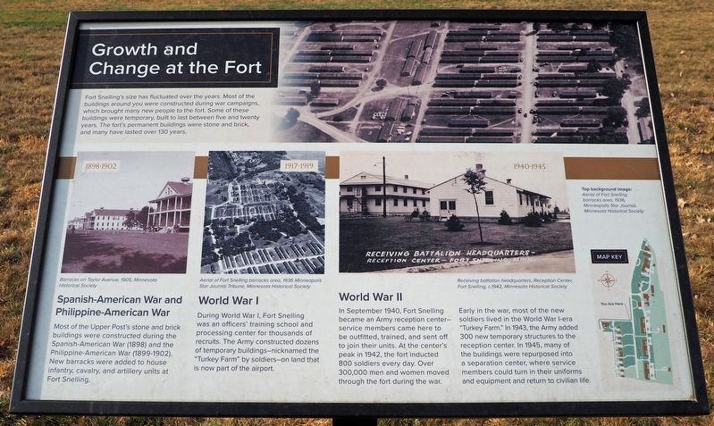
Growth and Change at the Fort
Photographed by McGhiever, October 21, 2024
1. Growth and Change at the Fort Marker
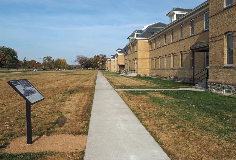
Fort Snelling's size has fluctuated over the years. Most of the buildings around you were constructed during war campaigns, which brought many new people to the fort. Some of these buildings were temporary, built to last between five and twenty years. The fort's permanent buildings were stone and brick, and many have lasted over 130 years.
1898-1902
Barracks on Taylor Avenue, 1905, Minnesota Historical Society
Spanish-American War and the Philippine-American War
Most of the Upper Post's stone and brick buildings were constructed during the Spanish-American War (1898) and the Philippine-American War (1899-1902). New barracks were added to house infantry, cavalry, and artillery units at Fort Snelling.
1917-1919
Aerial of Fort Snelling barracks area, 1936 Minneapolis Star Tribune Journal Tribune, Minnesota Historical Society
World War I
During World War I, Fort Snelling was an officers' training school and processing center for thousands of recruits. The Army constructed dozens of temporary buildings—nicknamed the "Turkey Farm" by soldiers—on land that is now part of the airport.
1940-1945
Receiving battalion headquarters, Reception Center, Fort Snelling, c. 1942, Minnesota Historical Society
World War II
In
this page online
Early in the war, most of the new soldiers lived in the World War I-era "Turkey Farm." In 1943, the Army added 300 new temporary structures to the reception center. In 1945, many of the buildings were repurposed into a separation center, where service members could turn in their uniforms and equipment and return to civilian life.
Top background image: Aerial of Fort Snelling barracks area, 1936, Minneapolis Star Journal, Minnesota Historical Society
Topics. This historical marker is listed in these topic lists: Forts and Castles • War, Spanish-American • War, World I • War, World II. A significant historical year for this entry is 1898.
Location. 44° 53.059′ N, 93° 11.517′ W. Marker is in Fort Snelling, Minnesota, in Hennepin County. It is on Taylor Avenue south of Leavenworth Avenue, on the left when traveling south. Touch for map.
Photographed by McGhiever, October 21, 2024
2. Growth and Change at the Fort Marker

Regionally, this marker is in the Twin Cities Metropolitan Area. It is also in the American Midwest, in the Corn Belt, and in the Great River Road Region. Globally, it is in North America, the Western Hemisphere, the Western World, and the Anglosphere. Historically, it finds itself in what was once Rupert’s Land, the territory of the Mississippian Culture, and the Louisiana Purchase.
Other nearby markers. At least 8 other markers are within walking distance of this marker: Fort Snelling's Later Uses (within shouting distance of this marker); Life Underfoot (about 300 feet away, measured in a direct line); Military Units of Fort Snelling (about 600 feet away); Fun at the Fort (about 700 feet away); Fort Snelling 1861–1946 (about 700 feet away); Military Training at Fort Snelling (approx. 0.2 miles away); Getting Around at the Fort (approx. 0.2 miles away); The Upper Post at Fort Snelling (approx. 0.2 miles away). Touch for a list and map of all markers in Fort Snelling.
Credits. This page was last revised on June 9, 2025. It was originally submitted on June 9, 2025, by McGhiever of Minneapolis, Minnesota. This page has been viewed 152 times since then and 31 times this year. Photos: 1, 2. submitted on June 9, 2025, by McGhiever of Minneapolis, Minnesota.
