Kent in Portage County, Ohio — The American Midwest (Great Lakes)
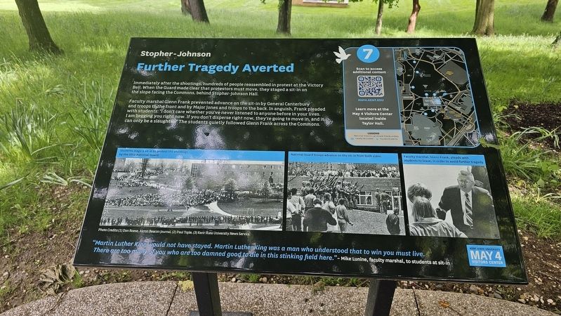
Further Tragedy Averted
Stopher-Johnson
| — | May 4 National Historic Landmark Site Tour | — |
Photographed by Ian Lefkowitz, May 23, 2025
1. Further Tragedy Averted Marker
Faculty marshal Glenn Frank prevented advance on the sit-in by General Canterbury and troops to the front and by Major Jones and troops to the back. In anguish, Frank pleaded with students: “I don't care whether you've never listened to anyone before in your lives. I am begging you right now. If you don't disperse right now, they're going to move in, and it can only be a slaughter.” The students quietly followed Glenn Frank across the Commons.
“Martin Luther King would not have stayed. Martin Luther King was a man who understood that to win you must live. There are too many of you who are too damned good to die in this stinking field here.” - Mike Lunine, faculty marshal, to students at sit-in
Erected 2024 by May 4 Visitors Center. (Marker Number 7.)
Topics. This historical marker is listed in these topic lists: Notable Buildings • Peace • War, Vietnam. A significant historical date for this entry is May 4, 1970.
Location. 41° 9.028′ N,
this page online

Regionally, this marker is in Greater Cleveland and in the Western Reserve. It is also in the American Midwest. Globally, it is in North America, the Western Hemisphere, the Western World, and the Anglosphere. Historically, it finds itself in what was once the Haudenosaunee (Iroquois) Confederacy, the territory of the Mississippian Culture, and the Northwest Territory.
Other nearby markers. At least 8 other markers are within walking distance of this marker: The Day the War Came Home (a few steps from this marker); May 4 National Historic Landmark Site (a few steps from this marker); Site of the Shooting of Kent State Students May 4, 1970 (within shouting distance of this marker); The May 4, 1970, Kent State Shootings Site (within shouting distance of this marker); Solar Totem #1 (within shouting distance of this marker); 4 Dead and 9 Wounded (within shouting distance of this marker);

Photographed by Ian Lefkowitz, May 23, 2025
2. The Slope Facing the Commons
The Commons was the site of the campus protest both before and after the shooting on May 4, 1970.
Also see . . . National Historic Landmark Site Tour Trail Markers.
Trace the steps of history through this documentary in the style of Ken Burns -- based on 500 archival photographs never before brought together and narrated by notable civil rights leader Julian Bond. The chapters of the documentary are keyed to the seven Walking Tour trail markers.(Submitted on June 10, 2025, by Ian Lefkowitz of New York, New York.)
Photographed by Ian Lefkowitz, May 23, 2025
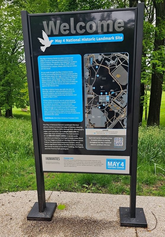
3. Welcome Marker
This marker contains a map of each of the locations on the May 4 National Historic Landmark Site Tour. This stop, stop 7, faces the Victory Bell and Johnson Hall.

Photographed by Ian Lefkowitz, May 23, 2025
4. The Victory Bell
Students reassembled at this bell on May 4, 1970, after being fired upon by the Ohio National Guard.
Credits. This page was last revised on June 26, 2025. It was originally submitted on June 9, 2025, by Ian Lefkowitz of New York, New York. This page has been viewed 113 times since then and 19 times this year. Photos: 1. submitted on June 9, 2025, by Ian Lefkowitz of New York, New York. 2, 3, 4. submitted on June 10, 2025, by Ian Lefkowitz of New York, New York. • Andrew Ruppenstein was the editor who published this page.
