Harwood in Northumberland County, Ontario — Central Canada (North America)
Harwood
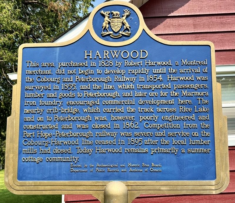
Photographed by Tim Boyd, June 7, 2025
1. Harwood Marker
Erected by Erected by the Archaeological and Historic Sites Board of Ontario.
Topics and series. This historical marker is listed in these topic lists: Railroads & Streetcars • Settlements & Settlers. In addition, it is included in the Canada, Ontario Heritage Trust series list. A significant historical year for this entry is 1828.
Location. 44° 8.44′ N, 78° 10.88′ W. Marker is in Harwood,
this page online

Regionally, this marker is in the Kawarthas Northumberland Area and in Eastern Ontario. It is also in Central Canada. Globally, it is in North America, on the Great Lakes, in the Western Hemisphere, in the Western World, and in the Anglosphere. Historically, it finds itself in what was once a British colony, the Viceroyalty of New France, the Haudenosaunee (Iroquois) Confederacy, and Rupert’s Land.
Other nearby markers. At least 8 other markers are within 11 kilometers of this marker, measured as the crow flies: Mount Ararat (approx. 1.8 kilometers away); Gravesite of German Workers (approx. 1.8 kilometers away); Gore’s Landing Dock (approx. 4.7 kilometers away); Gore’s Landing (approx. 4.8 kilometers away); Alderville First Nation Cenotaph (approx. 10.2 kilometers away); a different marker also named Alderville First Nation Cenotaph (approx. 10.2 kilometers

Photographed by Tim Boyd, 67/2025
2. Harwood Marker
Also see . . . The Cobourg - Peterborough Railway (Port Hope History).
The major obstacle in the route of the Cobourg & Peterborough Railway was Rice Lake, which lay athwart the path of this pioneer line; the C. & P. R. was incorporated in 1852, under the laws of the Province of Canada (16 Vic. Cap.40) to build between the towns mentioned in its title. Projected in 1852, the railway chose a path which involved a crossing of Rice Lake, the only appreciable body of water in the vicinity. The lake, about fifteen miles inland from Cobourg, on the shore of Lake Ontario, is about 18 miles long and less than three miles wide, at its widest point.(Submitted on June 12, 2025, by Tim Boyd of Hamilton, Ontario.)

June 12, 2025
3. The Cobourg and Peterborough Railroad, with Harwood and the Rice Lake Bridge
Tremaine’s Map of Upper Canada, 1862 (Source: University of Milwaukee, public domain)
Credits. This page was last revised on June 22, 2025. It was originally submitted on June 12, 2025, by Tim Boyd of Hamilton, Ontario. This page has been viewed 98 times since then and 30 times this year. Photos: 1, 2, 3. submitted on June 12, 2025, by Tim Boyd of Hamilton, Ontario. • Andrew Ruppenstein was the editor who published this page.
