Downtown in St. Catharines in Niagara Region, Ontario — Central Canada (North America)
1796 - 1935
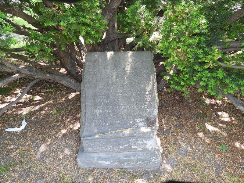
Photographed by Kevin Westell, June 11, 2025
1. 1796 - 1935 Marker
The hand of God unrolls the scroll of time. On this we read the story of a nation's birth of an old church in a new land of men and women living valiantly under the gracious symbol of our salvation.
This stone of remembrance is placed here by members of St. George's Church within the churchyard where their fathers in the faith erected the first Church of England in this community about the year 1796.
Dedicated by Wilmot, Lord Bishop of Niagara on Sunday November [...] 1935[, a] century after the laying of the [corner] stone of the present St. [George's Church] on July 20th 1835.
NOTE: Some letters are missing, denoted by [...] [sometimes with guessed letters]
Erected 1935 by Anglican Church of Canada.
Topics. This historical marker is listed in this topic list: Religion & Religious Structures. A significant historical year for this entry is 1796.
Location. 43° 9.253′ N, 79° 14.76′ W. Marker is in St. Catharines, Ontario, in Niagara Region. It is in Downtown. It can be reached from the intersection of St. Paul Street West and McGuire Street, on the right when traveling east. The marker is difficult to
this page online

Regionally, this marker is on the Golden Horseshoe and in Niagara Canada. It is also in Central Canada. Globally, it is in North America, on the Great Lakes, in the Western Hemisphere, in the Western World, and in the Anglosphere. Historically, it finds itself in what was once a British colony, the Viceroyalty of New France, the Haudenosaunee (Iroquois) Confederacy, and Rupert’s Land.
Other nearby markers. At least 8 other markers are within walking distance of this marker: Anglican Church, St. Catharines (here, next to this marker); William Hamilton Merritt 1793 - 1862 (here, next to this marker); This Statue of the Honorable William Hamilton Merritt (a few steps from this marker); The Battle of Vimy Ridge / The History of Vimy Oak Trees

Photographed by Kevin Westell, June 11, 2025
2. 1796 - 1935 - Marker in context
Photo is from St. Paul Street, facing north-west. McGuire runs away behind the statue. This marker is tucked in the evergreen bush, right of the bicycle and just left of and "below" the left-hand plaque-on-a-stick.
Regarding 1796 - 1935. The marker describes two churches at this site: the original, modest wooden church, built around 1796; and a replacement modest church, built around 1835.
Nearby, 1 km to the north, is the current St. George's Anglican Church.
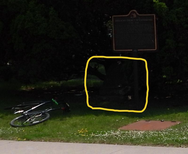
Photographed by Kevin Westell, June 11, 2025
3. Zoom-in detail from the context photo
The marker (circled) is lurking under the juniper, invisible just 2 metres from the plaque-on-a-post and 4 metres from the sidewalk.
Credits. This page was last revised on June 22, 2025. It was originally submitted on June 12, 2025, by Kevin Westell of St. Catharines, Ontario. This page has been viewed 111 times since then and 25 times this year. Photos: 1, 2, 3. submitted on June 12, 2025, by Kevin Westell of St. Catharines, Ontario. • Andrew Ruppenstein was the editor who published this page.
