Westerlo in Albany County, New York — The American Northeast (Mid-Atlantic)
Early Sawmill

Photographed by Gayle Hannay, June 12, 2025
1. Early Sawmill Marker
Originally water powered
by the Eight Mile Creek,
later converted to steam.
In operation 1860-1908
Erected 2024 by Westerlo Historical Society.
Topics. This historical marker is listed in this topic list: Industry & Commerce.
Location. 42° 28.661′ N, 74° 4.092′ W. Marker is in Westerlo, New York, in Albany County. It is on County Route 402 north of Bear Swamp Road (County Route 404), on the right when traveling north. Touch for map. Marker is at or near this postal address: 642 CR 402, Westerlo NY 12193, United States of America. Touch for directions.

Regionally, this marker is in Upstate New York, in the Capital District, and in the Albany Metropolitan Area. It is also in the American Northeast and in the Mid-Atlantic. Globally, it is in North America, the Western Hemisphere, the Western World, and the Anglosphere. Historically, it finds itself in what was once New Netherland and also one of the original Thirteen Colonies.
Other nearby markers. At least 8 other markers are within 3 miles of this marker, measured as the
this page online
Photographed by Patricia Britton, circa March 2026
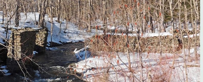
2. Snyder Sawmill showing dam to the right, to the left where the waterwheel stone stand still stands

Photographed by Patricia Britton, March 9, 2026
3. Snyder Sawmill sign with view towards mill base on Eight Mile Creek
Credits. This page was last revised on March 30, 2026. It was originally submitted on June 12, 2025, by Gayle Hannay of Westerlo, New York. This page has been viewed 132 times since then and 30 times this year. Photos: 1. submitted on June 12, 2025, by Gayle Hannay of Westerlo, New York. 2, 3. submitted on March 21, 2026, by Patricia Britton of Westerlo, New York. • Michael Herrick was the editor who published this page.
