Thorold in Niagara Region, Ontario — Central Canada (North America)
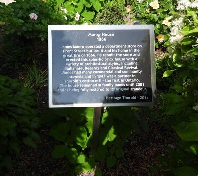
Munro House 1866
Photographed by Kevin Westell, June 14, 2025
1. Munro House 1866 Marker
Erected 2014 by Heritage Thorold.
Topics. This historical marker is listed in these topic lists: Architecture • Industry & Commerce. A significant historical year for this entry is 1866.
Location. 43° 7.456′ N, 79° 11.947′ W. Marker is in Thorold, Ontario, in Niagara Region. It is on Ormond Street South, on the right when traveling south. Touch for map. Marker is at or near this postal address: 5 Ormond Street S, Thorold ON L2V 1Y2, Canada. Touch for directions.

Regionally, this marker is on Ontario’s Golden Horseshoe and in Niagara Canada. It is also in Central Canada. Globally, it is in North America, on the
this page online
Other nearby markers. At least 8 other markers are within walking distance of this marker: Carnegie Library 1912 (within shouting distance of this marker); St. Andrew's Presbyterian Church 1883 (within shouting distance of this marker); a different marker also named St. Andrew's Presbyterian Church 1883 (within shouting distance of this marker); Quebec Bank (about 120 meters away, measured in a direct line); The Quebec Bank 1875 (about 120 meters away); Schwaller Block (about 120 meters away); Carr-Millar McMillan Block c. 1868 (about 150 meters away); L.G. Lorriman School (about 150 meters away). Touch for a list and map of all markers in Thorold.
Photographed by Kevin Westell, June 14, 2025
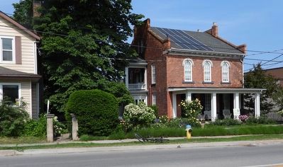
2. Munro House 1866 - Marker in context
The marker is close to the road side-walk, but concealed between two bushes.
Credits. This page was last revised on June 15, 2025. It was originally submitted on June 14, 2025, by Kevin Westell of St. Catharines, Ontario. This page has been viewed 92 times since then and 14 times this year. Photos: 1, 2. submitted on June 14, 2025, by Kevin Westell of St. Catharines, Ontario. • Andrew Ruppenstein was the editor who published this page.
