
Northeast Edmonton in Edmonton Metropolitan Region, Alberta — Canada’s Prairie Region (North America)
Coal Mines of Beverly
1899/1900 - 1925 and 1928 - 1934

Photographed by Tim Woerle
1. Coal Mines of Beverly Marker
Humberstone Coal Mine
Mine No. 43. North half. Sec 7-53-23-W4, west of river and part of River Lot 40. Entrance along northeast bank of North Saskatchewan (30th Street), north of 111th Avenue and south of 115th Avenue. Recorded production of 980,837 tons. Recovery: 47.5 per cent. Thickness of coal mined: five feet to 7 feet 6 inches.
In 1899, William and Beata Humberstone bought a half section, east of 34th Street and south of 118th Avenue, where they launched the Humberstone Coal Company. William and Beata established a farm on the land to house and grow food for the mine workers and livestock. Eventually, the farm comprised over 200 acres of tilled land. It was the beginning of the settlement that became Beverly.
The original mine entrance was a horizontal shaft, called a drift, located on the riverbank south of the present-day Clover Bar Bridge. In 1900, the mine had a capacity of 10 tons of coal daily. About 1910, a new shaft was dug and a spur track was laid to connect the Humberstone Mine to the Grand Trunk Pacific Railroad. In the late 1910s, the Humberstone Mine had 200 employees, with a monthly payroll of $25,000.
The mine originally used the room and pillar mining method. Miners dug, using a pick and shovel, leaving
this page online
William's health failed in 1915 and Beata took control over the mine's operations. She leased the mine and its equipment from her husband, becoming owner and operator. Beata reorganized the company, utilizing new technology such as the Sullivan Puncher Machine to increase productivity. By 1918, the mine was the best equipped in the Clover Bar field, with a capacity of 1,000 tons per day. William Humberstone died in April of 1922.
The company reorganized in 1923 as Humberstone Mines Limited and 3,000 shares were sold at $10 each. In 1925, there was a fire at the mine. The damage and the depleted coal reserves closed the mine. It reopened in 1928 but closed in 1934 due to the depression. The carts and
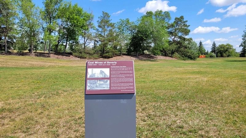
Photographed by Tim Woerle, June 15, 2025
2. Coal Mines of Beverly Marker
Erected by Olde Towne Beverly Historical Society.
Topics. This historical marker is listed in this topic list: Industry & Commerce. A significant historical year for this entry is 1899.
Location. 53° 33.895′ N, 113° 23.226′ W. Marker is in Edmonton, Alberta, in Edmonton Metropolitan Region. It is in Northeast Edmonton. It is at the intersection of 30 Street Northwest and 30 Street and 111 Avenue, on the right when traveling north on 30 Street Northwest. The marker is on the western edge of Rundle Park. Touch for map. Marker is in this post office area: Edmonton AB T5W 1V9, Canada. Touch for directions.

Regionally, this marker is in the Prairies. Globally, it is in North America, the Western Hemisphere, the Western World, and the Anglosphere. Historically, it finds itself in what was once a British colony and also Rupert’s Land.
Other nearby markers. At least 8 other markers are within 10 kilometers of this marker, measured as the crow flies: St. Luke's Anglican Church (approx. 5.9 kilometers away); Low Level Bridge (approx. 7.2 kilometers away); Creation of the Province of Alberta / Création de la province d'Alberta (approx. 8.5 kilometers away); John Rowand (approx. 8.7 kilometers away); Strathcona Fire Hall Number 1 (approx. 8.8 kilometers away); Fire Hall No. 6 (approx. 8.8 kilometers away); Strathcona Public Library (approx. 8.8 kilometers away); The High Level Bridge (approx. 8.8 kilometers away). Touch for a list and map of all markers in Edmonton.
Credits. This page was last revised on December 21, 2025. It was originally submitted on June 15, 2025, by Tim Woerle of Edmonton, Alberta. This page has been viewed 143 times since then and 37 times this year. Photos: 1, 2. submitted on June 15, 2025, by Tim Woerle of Edmonton, Alberta. • Andrew Ruppenstein was the editor who published this page.
