Near South Lake Tahoe in El Dorado County, California — The American West (Pacific Coastal)
Vikingsholm – A Scandinavian Castle
Photographed by Syd Whittle, August 14, 2010
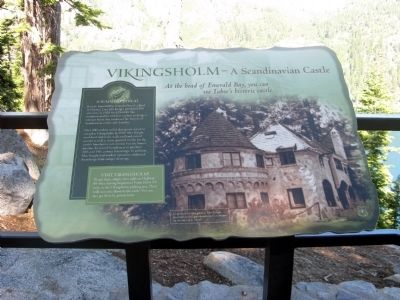
1. Vikingsholm – A Scandinavian Castle Marker
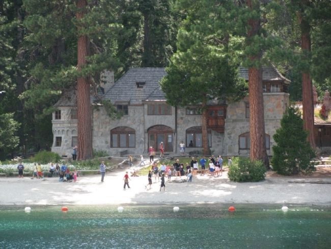
Because Emerald Bay reminded her of a fjord in Norway, Lora J.M. Knight purchased 200 acres here in 1928 for $250,000. She commissioned her architect nephew to design a summer home that combined the features of Scandinavian castles and churches.
Over 200 workers toiled during one season to complete Vikingsholm in 1929. Mrs. Knight used local timber for walls and hand-carved accents as well as stone quarried nearby for the castle’s foundation and exterior. For the home’s interior, she toured Scandinavia to purchase 18th and 19th century furnishings. In addition, Mrs. Knight had workers reproduce additional furnishings from antique drawings.
[Inset:]
Visit Vikingsholm
To get there, simply turn right on Highway 89 when leaving Inspiration Point. Drive 1.1 miles to the Vikingsholm parking area. Then walk one mile down to the castle. You can also get there by private boat.
Topics and series. This historical marker is listed in these topic lists: Architecture • Forts and Castles. In addition, it is included in the Norwegian-Americans series list. A significant historical year for this entry is 1928.
Location. 38° 56.805′ N, 120° 5.908′ W.
this page online

Regionally, this marker is in California’s Sierra Nevada and in the Lake Tahoe Basin. It is also in the American Mountain West. Globally, it is in North America, on the Ring of Fire, on the Pacific Rim, in the Western Hemisphere, in the Western World, and in the Anglosphere. Historically, it finds itself in what was once New Spain and also Mexico’s Alta California.
Other nearby markers. At least 8 other markers are within 3 miles of this marker, measured as the crow flies: Tahoe By Car (a few steps from this marker); Fannette Island (a few steps from this marker); Enjoy the View from Inspiration Point (a few steps from this marker); The Hermit of Emerald Bay (a few steps from this marker); Da ow a ga – Lake Tahoe (within shouting distance of this marker); The Old Veteran (approx. 2.6 miles away); Lucky's Legacy
Photographed by Syd Whittle, August 14, 2010
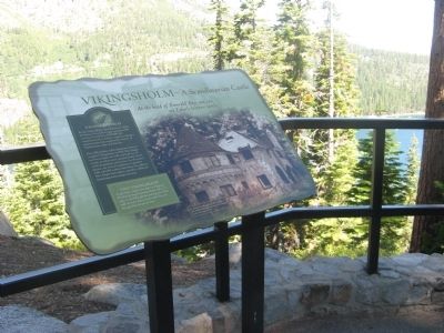
2. Vikingsholm – A Scandinavian Castle Marker
Also see . . . Vikingsholm. Vikingsholm website with history, photos and additional information. (Submitted on September 1, 2010.)
Photographed by Syd Whittle
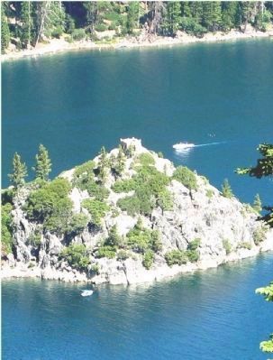
3. Mrs. Knight's Teahouse on Fannette Island
The small stone structure at the top of the mountain.
Photographed by Denise Boose, August 7, 2009
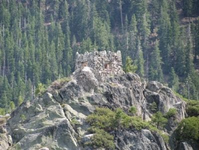
4. Mrs. Knight's Teahouse on Fannette Island
As viewed from the Tahoe Queen Tour Cruise
Photographed by Denise Boose, August 7, 2009
5. Vikingsholm – A Scandinavian Castle
Viewed from the Tahoe Queen Tour Cruise
Credits. This page was last revised on June 27, 2025. It was originally submitted on September 1, 2010, by Syd Whittle of Mesa, Arizona. This page has been viewed 1,689 times since then and 40 times this year. Last updated on June 15, 2025, by Connor Olson of Menomonee Falls, Wisconsin. Photos: 1, 2. submitted on September 1, 2010, by Syd Whittle of Mesa, Arizona. 3. submitted on August 30, 2010, by Syd Whittle of Mesa, Arizona. 4, 5. submitted on May 20, 2012, by Denise Boose of Tehachapi, California. • Devry Becker Jones was the editor who published this page.
