Near McHenry in Garrett County, Maryland — The American Northeast (Mid-Atlantic)
Meshach Browning surveys a mountain sunset

Photographed by Bradley Owen, June 12, 2025
1. Meshach Browning surveys a mountain sunset Marker
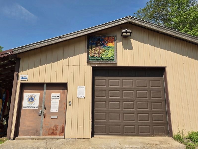
Reclaimed plastic bottlecap mosaic by community members, Sept 2020
This mosaic was created by community members with bottlecaps collected by the Town of Oakland's Clean and Green Team. The Team worked with local businesses to collect these bottlecaps which they used to create a mosaic in a public space in the town. The Town and Team generously donated the leftovers for this project.
Community members who were present at the unveiling of another work of Meshach Browning art then used these bottlecaps for the creation of this mosaic.
Erected 2024 by Meshach Browning History Center, Town of Oakland, Maryland and Deep Creek Lake Lions Club.
Topics. This historical marker is listed in this topic list: Arts, Letters, Music. A significant historical month for this entry is September 2020.
Location. 39° 34.414′ N, 79° 20.186′ W. Marker is near McHenry, Maryland, in Garrett County. It can be reached from Bumble Bee Road 1.3 miles north of Mosser Road, on the left when traveling north. Marker is located at the end of the entrance road in Lions Club Park on the east side of the Meshach Browning History Center building. Touch for map.
this page online

Regionally, this marker is in Western Maryland. It is also in the American Mid-Atlantic, in Appalachia, and specifically in Northern Appalachia. Globally, it is in North America, the Western Hemisphere, the Western World, and the Anglosphere. Historically, it finds itself in what was once one of the original Thirteen Colonies.
Other nearby markers. At least 8 other markers are within walking distance of this marker: Meshach Browning Trail System (here, next to this marker); Life in Western Maryland during the Pioneer Era (here, next to this marker); Mary Browning and her Tree of Life (here, next to this marker); Portrait of Meshach Browning (a few steps from this marker); Mary Browning (a few steps from this marker); Meshach Browning (a few steps from this marker); Meshach Browning pursued by family of bears (within shouting distance of this marker); Meshach Browning and his dogs (within shouting distance of this marker). Touch for a list and map of all markers in McHenry.
Photographed by Bradley Owen, June 12, 2025
2. Meshach Browning surveys a mountain sunset Marker
The marker is located at the left of the garage door and the artwork is above it.

Photographed by Bradley Owen, June 12, 2025
3. Meshach Browning surveys a mountain sunset
Credits. This page was last revised on June 19, 2025. It was originally submitted on June 18, 2025, by Bradley Owen of Morgantown, West Virginia. This page has been viewed 112 times since then and 15 times this year. Photos: 1, 2, 3. submitted on June 18, 2025, by Bradley Owen of Morgantown, West Virginia.
