Near McHenry in Garrett County, Maryland — The American Northeast (Mid-Atlantic)
Trading
Photographed by Bradley Owen, June 12, 2025
1. Trading Marker
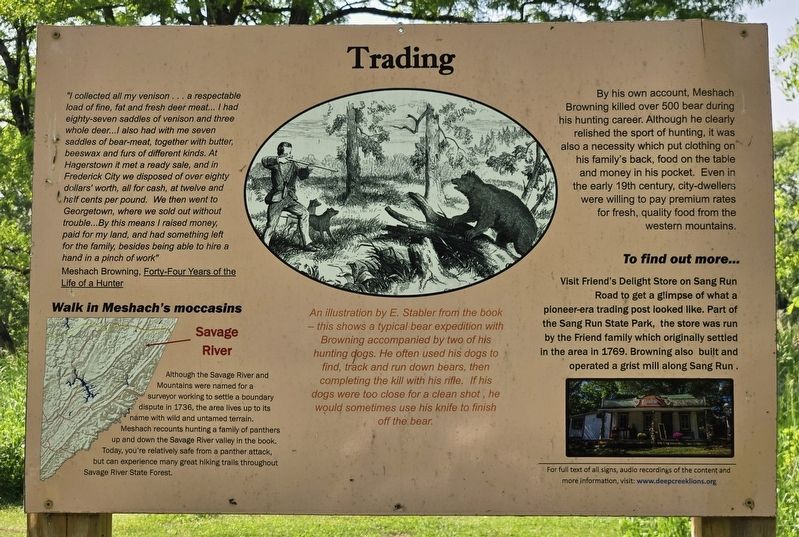
"I collected all my venison … a respectable load of fine, fat and fresh deer meat… I had eighty-seven saddles of venison and three whole deer…I also had with me seven saddles of bear-meat, together with butter, beeswax and furs of different kinds. At Hagerstown it met a ready sale, and in Frederick City we disposed of over eighty dollars' worth, all for cash, at twelve and half cents per pound. We then went to Georgetown, where we sold out without trouble…By this means I raised money, paid for my land, and had something left for the family, besides being able to hire a hand in a pinch of work"
Meshach Browning, Forty-Four Years of the Life of a Hunter
Walk in Meshach's moccasins
Although the Savage River and Mountains were named for a surveyor working to settle a boundary dispute in 1736, the area lives up to its name with wild and untamed terrain. Meshach recounts hunting a family of panthers up and down the Savage River valley in the book. Today, you're relatively safe from a panther attack, but can experience many great hiking trails throughout Savage River State Forest.
An illustration by E. Stabler from
this page online
By his own account, Meshach Browning killed over 500 bear during his hunting career. Although he clearly relished the sport of hunting, it was also a necessity which put clothing on his family's back, food on the table and money in his pocket. Even in the early 19th century, city-dwellers were willing to pay premium rates for fresh, quality food from the western mountains.
To find out more…
Visit Friend's Delight Store on Sang Run Road to get a glimpse of what a pioneer-era trading post looked like. Part of the Sang Run State Park, the store was run by the Friend family which originally settled in the area in 1769. Browning also built and operated a grist mill along Sang Run.
Erected 2018 by Meshach Browning History Center.
Topics. This historical marker is listed in these topic lists: Industry & Commerce • Political Subdivisions

Photographed by Bradley Owen, June 12, 2025
2. Trading Marker
Location. 39° 34.409′ N, 79° 20.217′ W. Marker is near McHenry, Maryland, in Garrett County. It can be reached from Bumble Bee Road 1.3 miles north of Mosser Road, on the left when traveling north. Marker is located at the trailhead for the Meshach Browning Trails which is at the end of the entrance road to Lions Club Park. Touch for map. Marker is at or near this postal address: 1249 Bumble Bee Road, Mc Henry MD 21541, United States of America. Touch for directions.

Regionally, this marker is in Western Maryland. It is also in the American Mid-Atlantic, in Appalachia, and specifically in Northern Appalachia. Globally, it is in North America, the Western Hemisphere, the Western World, and the Anglosphere. Historically, it finds itself in what was once one of the original Thirteen Colonies.
Other nearby markers. At least 8 other markers are within walking distance of this marker: Meshach Browning takes aim at a buck (a few steps from this marker); Meshach Browning and his dogs (a few steps from this marker); Meshach Browning pursued by family of bears (a few steps from this marker); Meshach Browning (within shouting distance of this marker); Mary Browning (within shouting distance of this marker); Portrait of Meshach Browning (within shouting distance of this marker); Mary Browning and her Tree of Life (within shouting distance of this marker); Life in Western Maryland during the Pioneer Era (within shouting distance of this marker). Touch for a list and map of all markers in McHenry.
Credits. This page was last revised on June 25, 2025. It was originally submitted on June 18, 2025, by Bradley Owen of Morgantown, West Virginia. This page has been viewed 90 times since then and 22 times this year. Photos: 1, 2. submitted on June 19, 2025, by Bradley Owen of Morgantown, West Virginia.
