
Apalachicola in Franklin County, Florida — The American South (South Atlantic)
Riverside Café/People’s Ice Company
| — | Apalachicola Historic Walking Tour | — |
Photographed by Brandon D Cross, June 17, 2025
1. Riverside Café/People’s Ice Company Marker
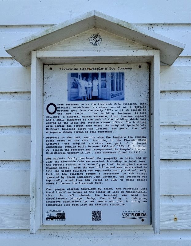
Previous to the café, records show the People's Ice Company plant stood on the site. According to the Florida State Archives, the original structure was part of a larger commercial complex built between 1903 and 1909. S.E. Rice, Jr. leased the property and incorporated the People's Ice and Cold Storage Company in 1907. That business closed in 1913.
The Nichols family purchased the property in 1914, and by 1920 the Riverside Café was erected. According to local lore, the current structure is actually part of the original wooden Chapman School. When the new brick school was constructed
this page online
When people stopped traveling by train, the Riverside Café found itself no longer at the center of life in Apalachicola. After the café closed, the building was used for miscellaneous storage. Today, the building is undergoing extensive renovations by new owners who plan to bring new commercial life back into the historic structure.
Erected by Apalachicola Main Street and VisitFlorida.
Topics. This historical marker is listed in these topic lists: Industry & Commerce • Railroads & Streetcars. A significant historical year for this entry is 1903.
Location. 29° 43.804′ N, 84° 59.138′ W. Marker is in Apalachicola, Florida, in Franklin County. It is at the intersection of Water Street and Avenue G, on the left when traveling east on Water Street. Touch for map. Marker is at or near this postal address: 280 Water St, Apalachicola FL 32320, United States of America.

Photographed by Brandon D Cross, June 17, 2025
2. Riverside Café/People’s Ice Company Marker

Regionally, this marker is on the Florida Panhandle. It is also in the American South, specifically in the Deep South, and on the Gulf Coast. Globally, it is in the North Atlantic Region, North America, a Gulf of Mexico state, the Western Hemisphere, the Western World, and the Anglosphere. Historically, it finds itself in what was once New Spain, the territory of the Mississippian Culture, one of the Confederate States of America, and the Antebellum South.
Other nearby markers. At least 8 other markers are within walking distance of this marker: The Raney House (about 600 feet away, measured in a direct line); Apalachicola City Hall Warehouse (about 700 feet away); Apalachicola During the Civil War (about 800 feet away); The Sponge Exchange (approx. 0.2 miles away); Apalachicola’s Cotton Era (approx. 0.2 miles away); When the River Was King! (approx. 0.2 miles away); Apalachicola’s Sponge Industry (approx. 0.2 miles away); J.E. Grady & Co. (approx. 0.2 miles away). Touch for a list and map of all markers in Apalachicola.
Also see . . . Walking Tour - Apalachicola Site of Interest.
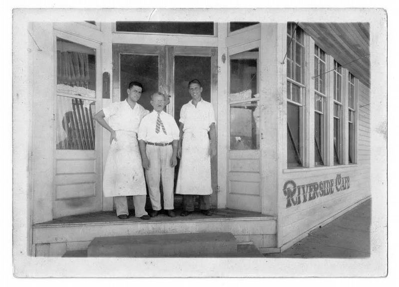
Photo Courtesy Florida Archives
3. Riverside Café
Credits. This page was last revised on June 22, 2026. It was originally submitted on June 18, 2025, by Brandon D Cross of Flagler Beach, Florida. This page has been viewed 119 times since then and 25 times this year. Photos: 1, 2, 3. submitted on June 18, 2025, by Brandon D Cross of Flagler Beach, Florida. • Bernard Fisher was the editor who published this page.
