Northeast South Bend in St. Joseph County, Indiana — The American Midwest (Great Lakes)
Jewish Cemetery Site
Photographed by Rosanne Kroen, September 30, 2007
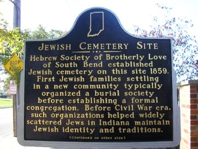
1. Jewish Cemetery Site Marker
Hebrew Society of Brotherly Love of South Bend established Jewish cemetery on this site 1859. First Jewish families settling in a new community typically organized a burial society before establishing a formal congregation. Before Civil War era, such organizations helped widely scattered Jews in Indiana maintain Jewish identity and traditions.
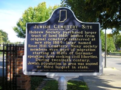
Hebrew Society purchased larger tract of land 1883: bodies from original cemetery reinterred at new site 1884: later named Rose Hill cemetery. Many society members were part of migration starting in 1820s of German-speaking Jews seeking civil liberties. During twentieth century Jewish population in area was second or third largest in state.
Erected 2002 by Indiana Historical Bureau, Michiana Jewish Historical Society. (Marker Number 71.2002.1.)
Topics and series. This historical marker is listed in these topic lists: Cemeteries & Burial Sites • Religion & Religious Structures • Settlements & Settlers. In addition, it is included in the Indiana Historical Bureau Markers series list. A significant historical year for this entry is 1859.
Location. 41° 41.046′ N, 86° 14.666′ W.
this page online

Regionally, this marker is in Northern Indiana. It is also in the American Midwest and in the Corn Belt. Globally, it is in North America, the Western Hemisphere, the Western World, and the Anglosphere. Historically, it finds itself in what was once the territory of the Mississippian Culture and also the Northwest Territory.
Other nearby markers. At least 8 other markers are within walking distance of this marker: Powell House (approx. 0.3 miles away); United States Constitution Bicentennial (approx. 0.3 miles away); On This Site South Bend Was Founded (approx. half a mile away); History of the 1906 Studebaker Electric Fountain (approx. half a mile away); Special Olympics Island (approx. 0.6 miles away); First Post Office of South Bend (approx. 0.6
Photographed by Rosanne Kroen
2. Jewish Cemetery Site Marker
Also see . . . IHB Annotations. The Indiana Historical Bureau (IHB) provides annotations for the text of this marker on their website. (Submitted on February 6, 2013, by Duane Hall of Abilene, Texas.)
Additional keywords. Jewish
Photographed by Rosanne Kroen
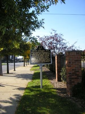
3. Jewish Cemetery Site Marker
Credits. This page was last revised on February 23, 2026. It was originally submitted on October 1, 2007, by Rosanne Kroen of South Bend, Indiana. This page has been viewed 1,689 times since then and 32 times this year. Photos: 1, 2, 3. submitted on October 1, 2007, by Rosanne Kroen of South Bend, Indiana. • J. J. Prats was the editor who published this page.
