
Montrose in La Crescenta-Montrose in Los Angeles County, California — The American West (Pacific Coastal)
Theodore Pickens & Benjamin Briggs
Photographed by Craig Baker, June 16, 2025
1. Pickens & Briggs Marker
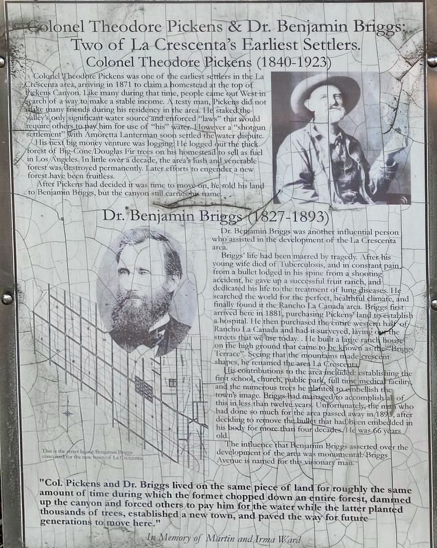
Colonel Theodore Pickens & Dr. Benjamin Briggs:
Two of La Crescenta's Earliest Settlers.
Colonel Theodore Pickens (1840-1923)
Colonel Theodore Pickens was one of the earliest settlers in the La Crescenta area, arriving in 1871 to claim a homestead at the top of Pickens Canyon. Like many during that time, people came out West in search of a way to make a stable income. A testy man, Pickens did not make many friends during his residency in the area. He staked the valley's only significant water source and enforced "laws" that would require others to pay him for use of "his" water. However, a "shotgun settlement" with Amoretta Lanterman soon settled the water dispute.
His next big money venture was logging. He logged out the thick forest of Big-Cone Douglas Fir trees on his homestead to sell as fuel in Los Angeles. In little over a decade, the area's lush and venerable forest was destroyed permanently. Later efforts to engender a new forest have been fruitless.
After Pickens had decided it was time to move on, he sold his land to Benjamin Briggs, but the canyon still carries his name.
this page online
Dr. Benjamin Briggs (1827-1893)
Dr. Benjamin Briggs was another influential person who assisted in the development of the La Crescenta area.
Briggs' life had been marred by tragedy. After his young wife died of Tuberculosis, and in constant pain from a bullet lodged in his spine from a shooting accident, he gave up a successful fruit ranch, and dedicated his life to the treatment of lung diseases. He searched the world for the perfect, healthful climate, and finally found it the Rancho La Canada area. Briggs first arrived here in 1881, purchasing Pickens’ land to establish a hospital. He then purchased the entire western half of Rancho La Canada and had it surveyed, laying out the streets that we use today. He built a large ranch house on the high ground that came to be known as the "Briggs Terrace". Seeing that the mountains made crescent shapes, he renamed the area La Crescenta.
His contributions to the area included: establishing the first school, church, public park, full time medical facility, and the numerous trees he planted to embellish the town's image. Briggs had managed to
Photographed by Craig Baker, June 16, 2025
2. Two Natural Beauties Marker
The influence that Benjamin Briggs asserted over the development of the area was monumental. Briggs Avenue is named for this visionary man.
"Col. Pickens and Dr. Briggs lived on the same piece of land for roughly the same amount of time during which the former chopped down an entire forest, dammed up the canyon and forced others to pay him for the water while the latter planted thousands of trees, established a new town, and paved the way for future generations to move here."
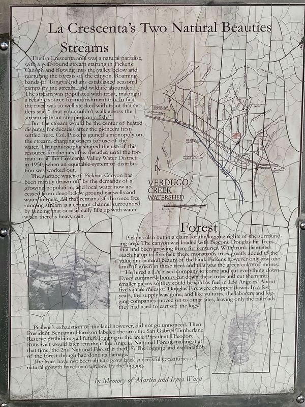
La Crescenta's Two Natural Beauties
Streams
The La Crescenta area was a natural paradise, with a year-round stream starting in Pickens Canyon and flowing into the valley below and nurturing the forests of the canyon. Roaming bands of Tongva Indians established seasonal camps by the stream, and wildlife abounded. The stream was populated with trout, making it a
Photographed by Craig Baker, June 16, 2025
3. Pickens & Briggs Markers
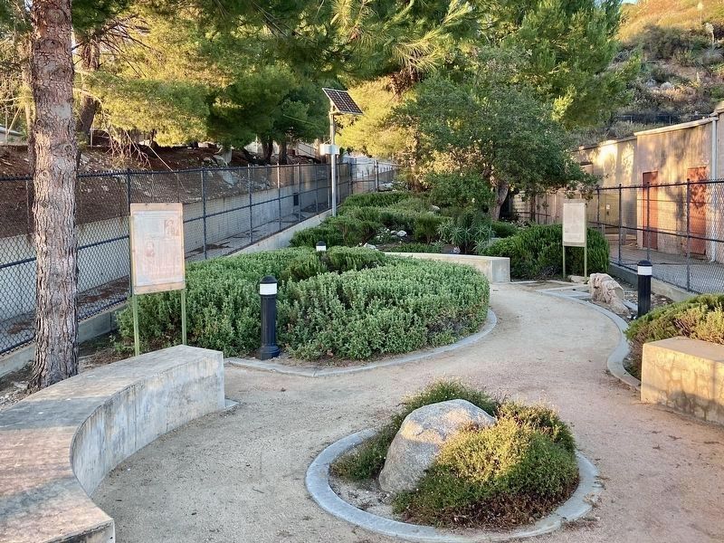
Pickens Canyon Channel is at left.
But the stream would be the center of heated disputes for decades after the pioneers first settled here. Col. Pickens gained a monopoly on the stream, charging others for use of the water. That philosophy shaped the use of this resource for the next few decades, until the formation of the Crescenta Valley Water District in 1950, when an equitable system of distribution was worked out.
The surface water of Pickens Canyon has been mostly drawn off by the demands of a growing population, and local water now accessed from deep below ground via wells and water tunnels. All that remains of the once free running stream is a cement channel surrounded by fencing that occasionally fills up with water when there is heavy rain.
Forest
Pickens also put in a claim for the logging rights of the surrounding area. The canyon was loaded with Big Cone Douglas Fir Trees that had been growing there for centuries. With trunk diameters reaching
Photographed by Craig Baker, June 16, 2025
4. Pickens Canyon Park
He hired a LA based company to come and cut everything down. Every summer laborers cut down these trees and cut them into smaller pieces so they could be sold as fuel in Los Angeles. About five square miles of Douglas Firs were chopped down. In a few years, the supply was gone, and like vultures, the laborers and logging companies moved on to other sites, leaving only the railroads they had used to cart off the logs.
Pickens's exhaustion of the land however did not go unnoticed. Then President Benjamin Harrison labeled the area the San Gabriel Timberland Reserve prohibiting all future logging in the area. President Theodore Roosevelt would later rename it the Angeles National Forest, making it at that time the 2nd National Forest in the US. The logging and exploitation of the forest though had done its damage.
The trees have not been able to grow back successfully; centuries of natural growth have been undone by the logging.
In Memory of Martin and Irma Ward
Erected 2008 by an Eagle Scout project.
Topics. This historical marker is listed in this topic list: Settlements & Settlers. A significant historical year for this entry is 1871.
Location. 34° 13.147′ N, 118° 13.866′ W. Marker is in La Crescenta-Montrose, California, in Los Angeles County. It is in Montrose. It is on Foothill Boulevard near Briggs Avenue, on the right when traveling west. Located in Pickens Canyon Park. Touch for map. Marker is at or near this postal address: 2391 Foothill Blvd, La Canada Flintridge CA 91011, United States of America. Touch for directions.

Regionally, this marker is in Greater Los Angeles and in the Transverse Ranges. It is also on the American Pacific Coast. Globally, it is in North America, on the Ring of Fire, in the Pacific Rim, in the Western Hemisphere, in the Western World, and in the Anglosphere. Historically, it finds itself in what was once New Spain and also Mexico’s Alta California.
Other nearby markers. At least 8 other markers are within walking distance of this marker: St. Luke’s of the Mountains (approx. ¼ mile away); The Great Flood of 1934 (approx. 0.4 miles away); The Bell of La Crescenta Elementary School (approx. half a mile away); Bonetto House (approx. 0.6 miles away); Paul McCarton (approx. 0.7 miles away); Montrose Shopping Park Association (approx. 0.9 miles away); Montrose Shopping Park Redevelopment (approx. 0.9 miles away); Hollywood Location (approx. 0.9 miles away). Touch for a list and map of all markers in La Crescenta-Montrose.
Credits. This page was last revised on June 19, 2025. It was originally submitted on June 19, 2025, by Craig Baker of Sylmar, California. This page has been viewed 340 times since then and 93 times this year. Photos: 1, 2, 3, 4. submitted on June 19, 2025, by Craig Baker of Sylmar, California.
