Fort Totten in Queens in Queens County, New York — The American Northeast (Mid-Atlantic)
422 Weaver Ave.
Constructed in 1909

Original use: Commanding Officer's Quarters
Current use: Northeast Queens Parks Headquarters
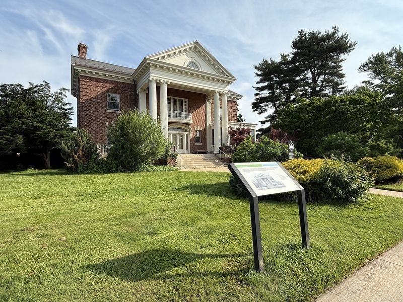
Nicknamed the Commandant's House, Building 422 was given a striking location at the northern end of the Parade Ground, which provided the resident commander with the perfect panorama of the field to review mustering soldiers. It displays imposing Neo-Georgian features with a bowed balcony and Tuscan columns to emphasize its importance. The enclosed porch on the east side was built following a fire in 1926 that also severely damaged the interior of the building.
[Caption:]
Prior to Building 422's completion, the commanding officer and his family lived in a farmhouse on the grounds that was owned by the Willet family before the land was sold to the U.S. government.
Erected by NYC Parks.
Topics and series. This historical marker is listed in these topic lists: Architecture • Forts and Castles. In addition, it is included in the NYC Parks series list. A significant historical year for this entry is 1926.
Location. 40° 47.567′ N, 73° 46.601′ W. Marker is in Queens, New York, in Queens County. It is in Fort Totten. It
this page online

Regionally, this marker is in New York City and on Long Island. It is also in the American Northeast, in the Mid-Atlantic, and on the Eastern Seaboard. Globally, it is in the North Atlantic Region, North America, the Western Hemisphere, the Western World, and the Anglosphere. Historically, it finds itself in what was once New Netherland and also one of the original Thirteen Colonies.
Other nearby markers. At least 8 other markers are within walking distance of this marker: Fort Totten (within shouting distance of this marker); 208 Totten Ave. (about 300 feet away, measured in a direct line); Parade Ground (about 400 feet away); 638 Totten Ave. (about 400 feet away); 207 Totten Ave. (about 400 feet away); 322 Story Ave. (about 700 feet away); Thorne-Wilkins Cemetery (about 800 feet away); New York City Fire Department September 11 Memorial (approx. 0.2 miles away). Touch for a list and map of all markers

Credits. This page was last revised on June 19, 2025. It was originally submitted on June 19, 2025, by Devry Becker Jones of Washington, District of Columbia. This page has been viewed 111 times since then and 29 times this year. Photos: 1, 2, 3. submitted on June 19, 2025, by Devry Becker Jones of Washington, District of Columbia.
