Jerseyville in Jersey County, Illinois — The American Midwest (Great Lakes)
The National
Stroll Through History
| — | Historic City Center | — |
Photographed by Jason Voigt, June 16, 2025
1. The National Marker
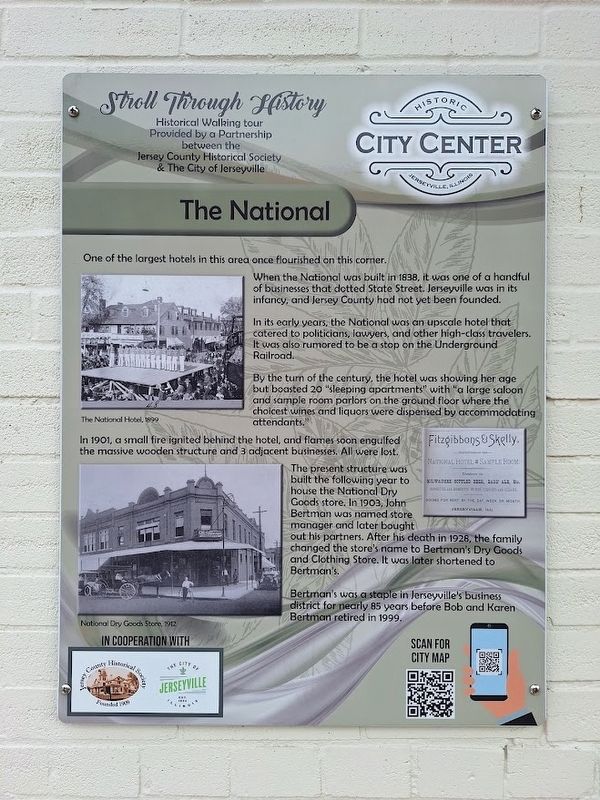
One of the largest hotels in this area once flourished on this corner.
When the National was built in 1838, it was one of a handful of businesses that dotted State Street. Jerseyville was in its infancy, and Jersey County had not yet been founded.
In its early years, the National was an upscale hotel that catered to politicians, lawyers, and other high-class travelers. It was also rumored to be a stop on the Underground Railroad.
By the turn of the century, the hotel was showing her age but boasted 20 "sleeping apartments" with "a large saloon and sample room parlors on the ground floor where the choicest wines and liquors were dispensed by accommodating attendants."
In 1901, a small fire ignited behind the hotel, and flames soon engulfed the massive wooden structure and 3 adjacent businesses. All were lost.
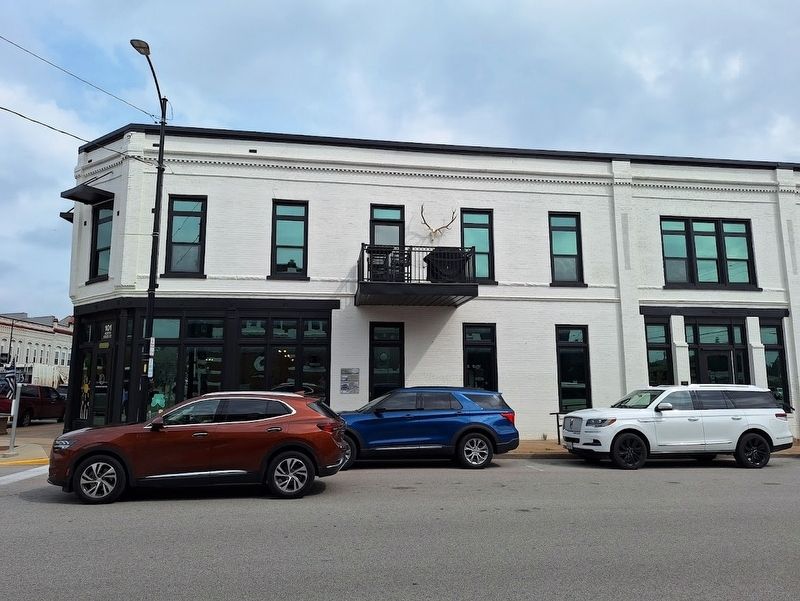
The present structure was built the following year to house the National Dry Goods store. In 1903, John Bertman was named store manager and later bought out his partners. After his death in 1928, the family changed the store's name to Bertman's Dry Goods and Clothing Store. It was later shortened
this page online
Bertman's was a staple in Jerseyville's business district for nearly 85 years before Bob and Karen Bertman retired in 1999.
Erected by the City of Jerseyville and Jersey County Historical Society.
Topics. This historical marker is listed in this topic list: Industry & Commerce. A significant historical year for this entry is 1838.
Location. 39° 7.176′ N, 90° 19.633′ W. Marker is in Jerseyville, Illinois, in Jersey County. It is on East Pearl Street (County Route 21) near North State Street (U.S. 67), on the right when traveling west. Touch for map. Marker is at or near this postal address: 101 N State St, Jerseyville IL 62052, United States of America. Touch for directions.

Regionally, this marker is in the Illinois River Valley. It is also in the American Midwest, in the Corn Belt, and in the Great River Road Region. Globally, it is in North America, the Western Hemisphere, the Western World, and the Anglosphere. Historically, it finds itself in what was once the territory of the Mississippian Culture and also the Northwest Territory.
Other nearby markers. At least 8 other markers are within walking
Photographed by Jason Voigt, June 16, 2025
2. The National Marker
Regarding The National. QR-code on the marker is a dead link.
Credits. This page was last revised on June 19, 2025. It was originally submitted on June 19, 2025, by Jason Voigt of Glen Carbon, Illinois. This page has been viewed 108 times since then and 27 times this year. Photos: 1, 2. submitted on June 19, 2025, by Jason Voigt of Glen Carbon, Illinois.
